9 April 2021
Oxley Highway: multiple landslides in New South Wales, Australia
Posted by Dave Petley
Oxley Highway: multiple landslides in New South Wales, Australia
The Oxley Highway is a rural road orientated east-west in New South Wales, Australia. To the west is the town of Nevertire, to the east it terminates at Port Macquarie on the Tasman Sea coast.
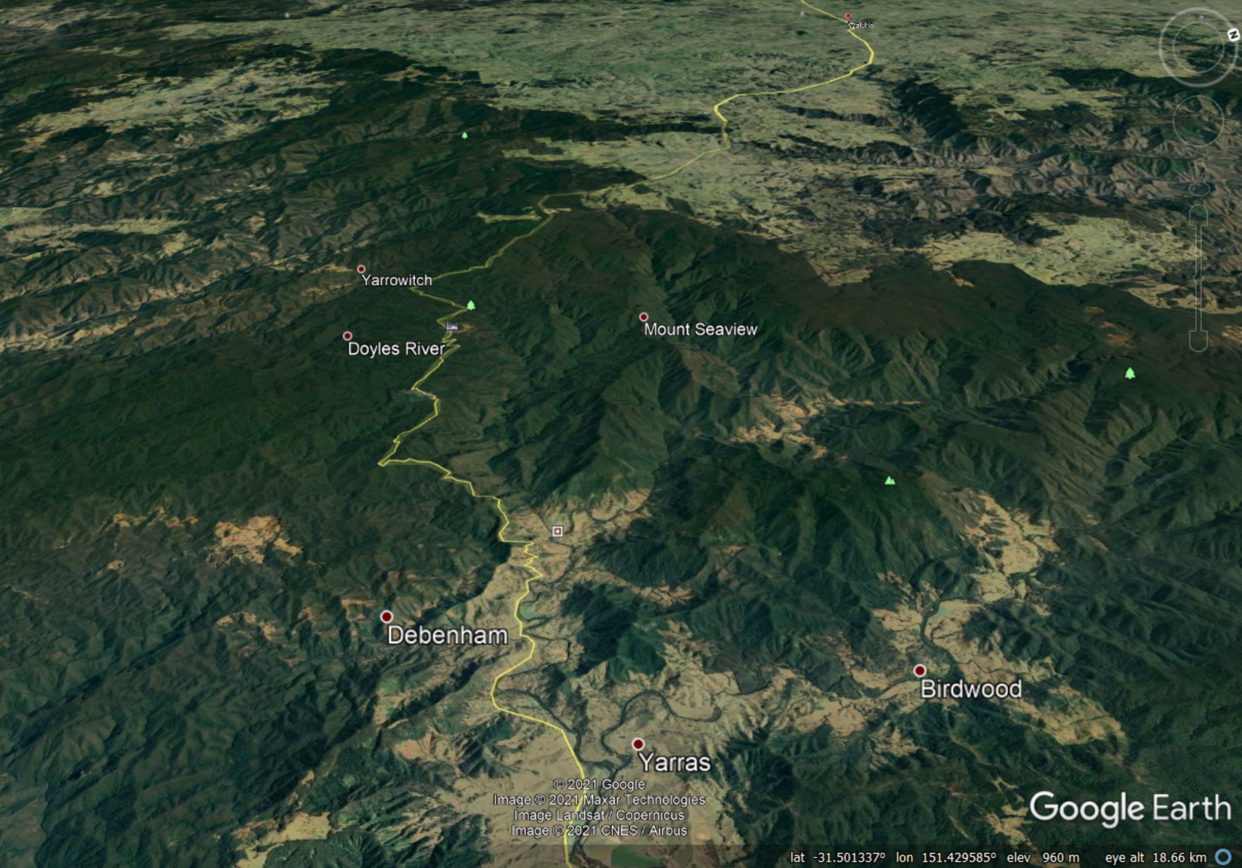
Heavy rainfall in March triggered multiple landslides along the Oxley Highway in a section between Yarras and Walcha. This is the landscape of the section in question:-

Google Earth image showing the landscape along the Oxley Highway between Yarras and Walcha (just visible in the distance) in New South Wales, Australia
.
There is a good helicopter reconnaissance video showing the magnitude of the damage caused by landslides to the highway, posted to Youtube:-
.
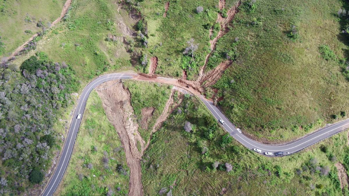
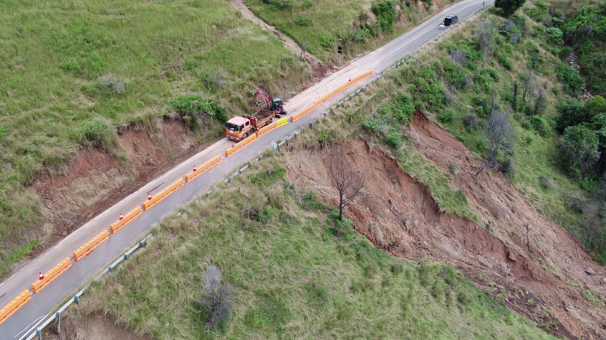
The level of damage is also clear in some of the images released by Transport for NSW:-

Landslide damage along the Oxley Highway. Image from Transport for NSW.
.

A landslide on the Oxley Highway. Image from Transport for NSW.
.
There are more than 70 landslide sites along the road. Transport for NSW has estimated that it will at least two months before the road can reopen with a limited service, and several more months at least before the problems are fully mitigated. As the two images directly above show, some of the landslides are both large and located below the level of the road bench. Remediating these sites will be a substantial and expensive challenge.
Meanwhile, also in Australia, 7 Daily News tweeted a video yesterday of a coastal landslide in Queensland:
Another sinkhole has opened up at Inskip Point, stripping chunks of sand away from the beach. It appeared after the recent deluge near where vehicles are loaded onto the barges to go to Fraser Island. Vid: Wayne Kerr. https://t.co/dSgFbiE9NM #7NEWS pic.twitter.com/7zmXEc5dhk
— 7NEWS Sunshine Coast (@7NewsSC) April 8, 2021
.
I have posted about these retrogressive landslides at Inskip Point previously. This is another example of a Retrogressive Breach Failure, not a sinkhole.


 Dave Petley is the Vice-Chancellor of the University of Hull in the United Kingdom. His blog provides commentary and analysis of landslide events occurring worldwide, including the landslides themselves, latest research, and conferences and meetings.
Another story on the Inskip point landslide, this time actually called a landslide. https://www.abc.net.au/news/2021-04-09/qld-inskip-point-another-landslip/100056978
I note that these damp sand blocks are toppling into the water and assume that this is a function of “sapping” from below the water level as liquefied sand flows away from the active face into the center of the failure?
I wonder if anyone will map the floor of the flooded German mine pit where a similar event occurred recently. It would be useful to see what becomes of non-granular slide material like that. Do the blocks remain intact or break up into a chaotic mass riding along on a master slide plane? Trees standing in the runout zone of that failure suggest that at least some blocks remained intact.
Do we know much about the soil properties here? Did the slopes fail due to loss of capillary tension following the rain? Were the cut slopes too steep?