11 April 2021
Culluchaca: a large landslide on 7 April 2021 in Peru
Posted by Dave Petley
Culluchaca: a large landslide on 7 April 2021 in Peru
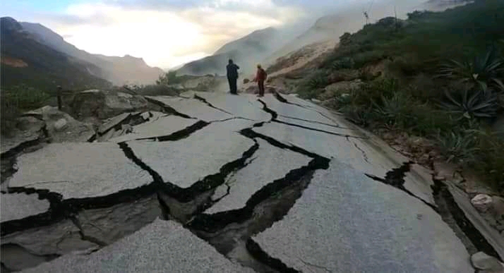
On 7 April 2021 a large failure occurred close to the village of Culluchaca in Huari province of the Áncash region of Peru. The landslide did not claim any lives but caused serious damage to about 1 km of National Road 14a:-

The aftermath of the landslide close to Culluchaca in Peru. Still from a video posted to Youtube.
.
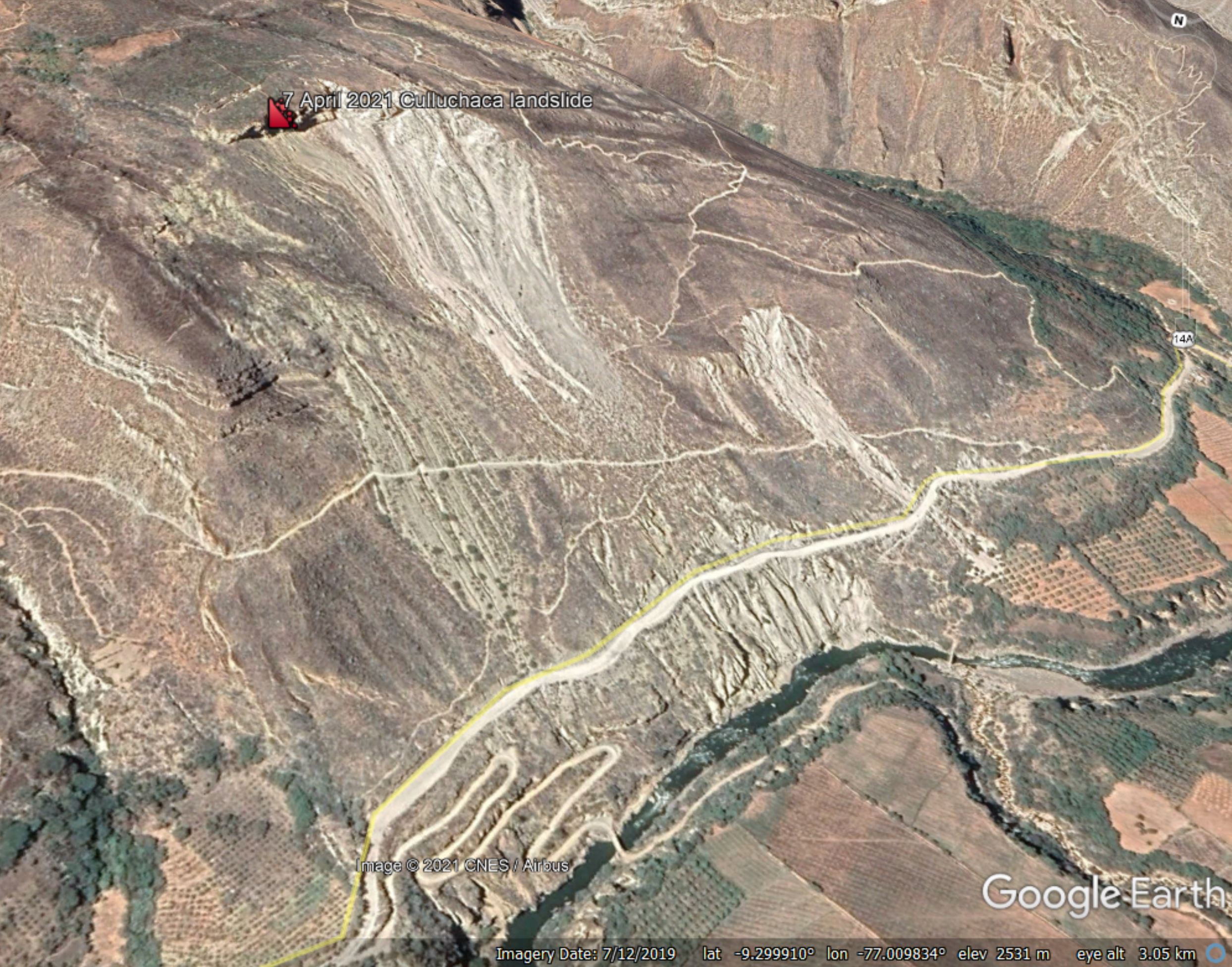
The location of the landslide appears to be -9.301534° -77.008174°. This is a Google Earth oblique view of the site:

Google Earth view of the site of the landslide close to Culluchaca in Peru.
.
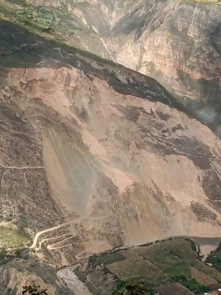
The image shows an existing large failure at this site. Note also the very clear tension cracks located above the existing crest of the landslide. I suspect that a large block delineated by these cracks has failed. The image below shows the aftermath of the landslide:-

The aftermath of the landslide close to Culluchaca in Peru. Image from Áncash Noticias.
.
Note the very extensive scale of the landslide in the image above. It is clear that a large volume has failed.
According to a news report in Áncash Noticias (in Spanish), the population of the village of Culluchaca have had to be evacuated because of the risk. In addition the landslide has disrupted the electricity network supply the districts of Huacachi, Anra, Uco, Rapayán, Paucas and Huacchis in the province of Huari, and some parts of the province of Antonio Raimondi and Huamalies.
There is a video that captures some of the failure and the aftermath on Youtube:-
.
Clearly reinstatement of the road will be important, but this will not be possible until the landslide has stabilised again. It will not be a straightforward problem to solve. Fortunately the images above suggest that the river is probably not blocked by the landslide, at present at least.


 Dave Petley is the Vice-Chancellor of the University of Hull in the United Kingdom. His blog provides commentary and analysis of landslide events occurring worldwide, including the landslides themselves, latest research, and conferences and meetings.