8 March 2021
#VirtualFieldtrips: a supplementary educational tool in Covid-19 times
Posted by Shane Hanlon
By Niki Evelpidou
An integral part of the geosciences are field trips, where students have the opportunity to understand and apply what they have learned in the classroom. Field trips have always been a way for students and nature lovers to interact with the environment, stimulating their “appetite” for in situ learning and thinking about natural environment and generally geosciences. But suddenly…. Covid-19 happened and the physical educational activities froze! So, my team and I thought that a good solution would be to transfer the experience of field trips to home safety through computer screens! But how could such a thing happen? The answer is, through Virtual field trips. Having material from various study areas, the first virtual field trips began to be set up. Our “partner in crime” in this endeavour was the web platform of Google Earth Pro and ArcGIS StoryMaps powered by ESRI.
A virtual fieldwork can be useful in classes where students have the opportunity for a quick and realistic “visit” to a particular study area.
But let’s not take as granted the use of virtual field trips only as educational material for students in the period of covid-19. The triggering part of Virtual field trips is that it’s about a tool that may help to overcome educational difficulties such as poor weather, accessibility issues, economic difficulties, mobility impairments. Virtual field trips also give nature lovers the opportunity to explore unique environments and geological and geomorphological features of areas they may not have been able to visit until now.
At this point, allow me to introduce you our work in order to experience what are we talking about…
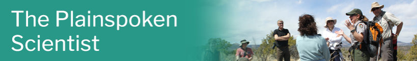
Virtual fieldtrip on the Quaternary evolution of Rhodes Isl. (Greece)
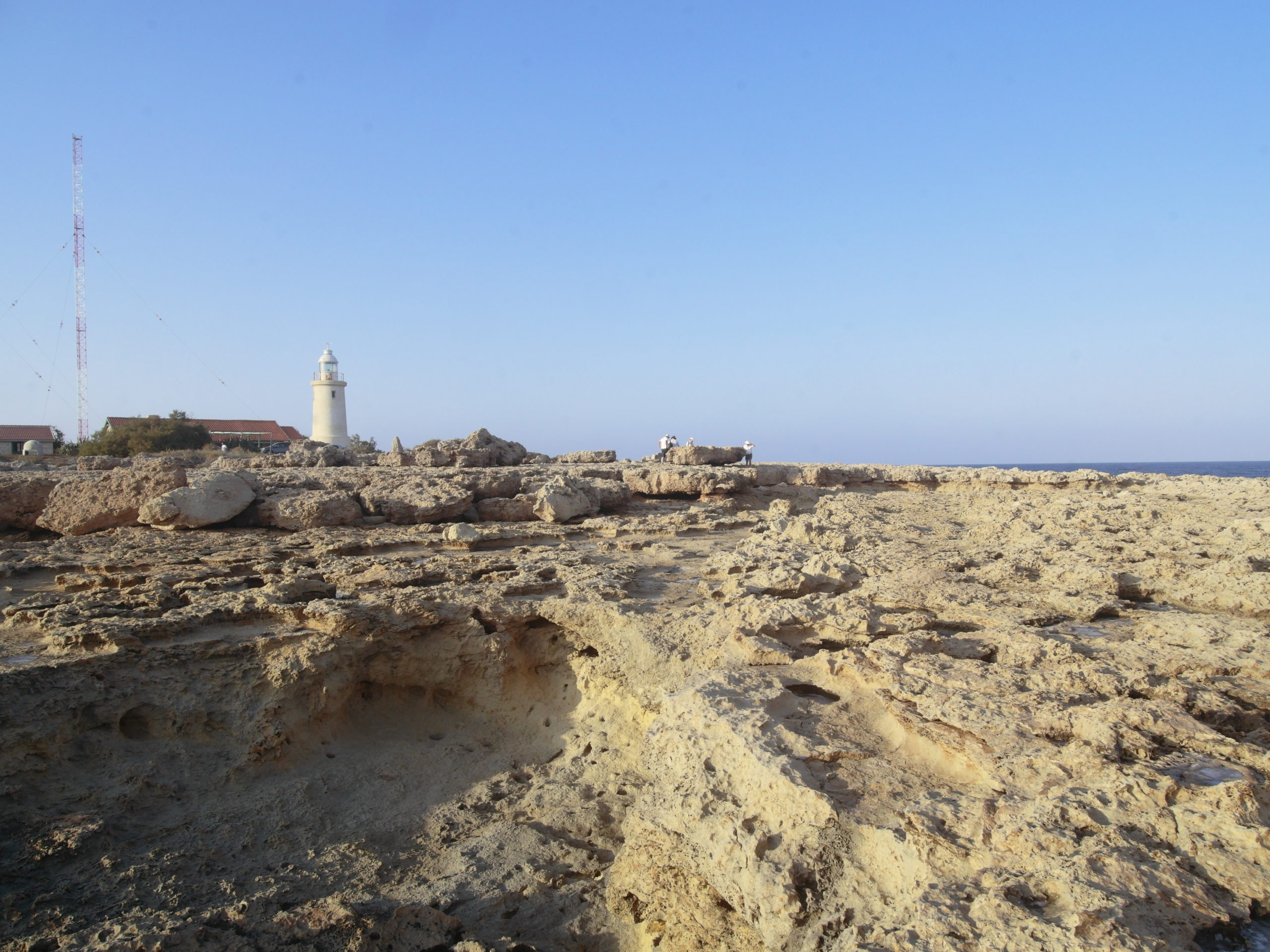
Our goal was to provide the audience the experience of getting a “closer look” on the unique coastal landscape of a tectonically active area and a better understanding on how tectonics and sea level changes shape the coastal landscape ,in an active subduction zone where the African plate is subducted under the Eurassian plate.
Cape Ladiko – Ripple tidal notches. Credit: Manolis Lykouropoulos
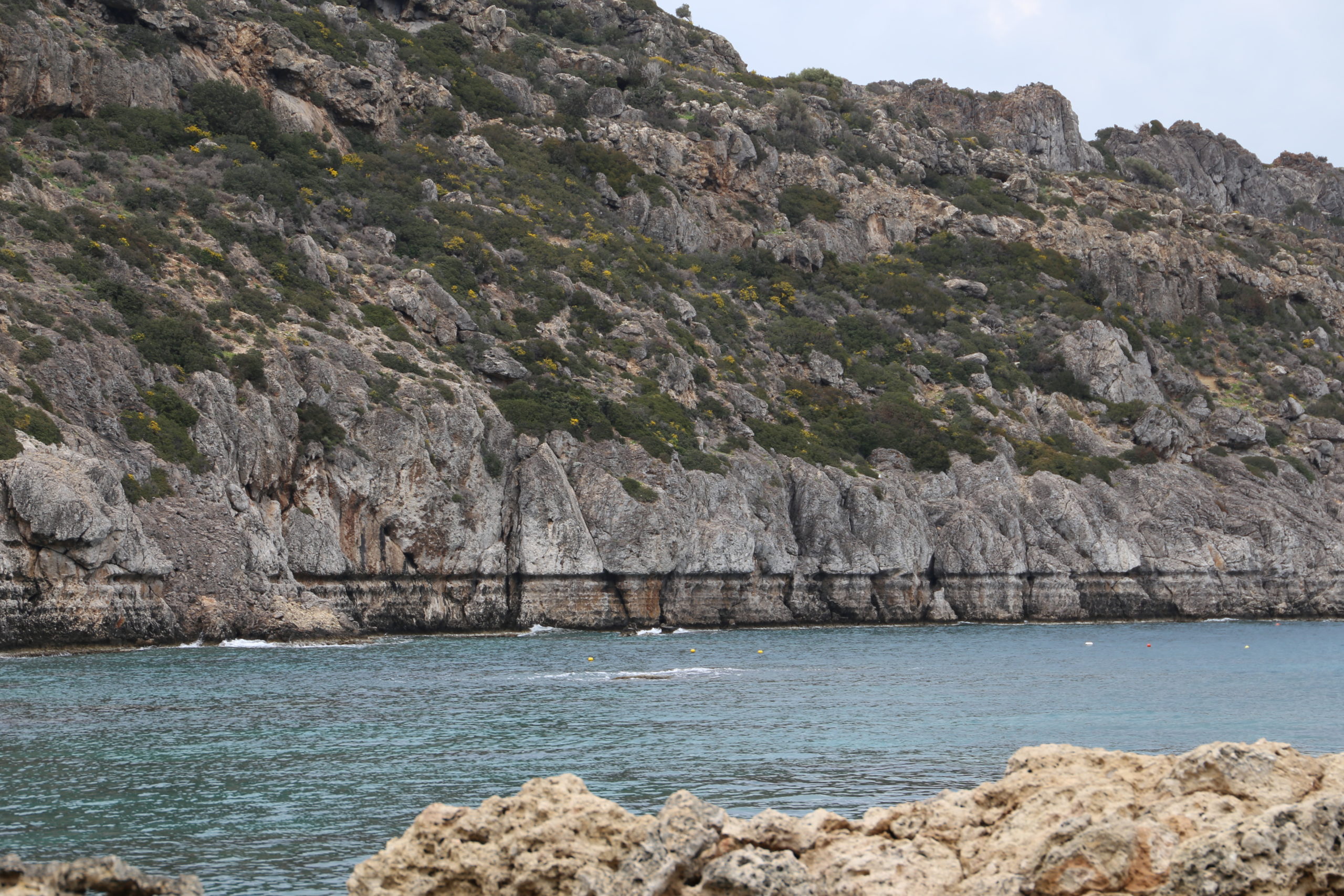
Quaternary Geoenvironment – Archaeogeomorphology (Naxos)
Palaeogeographical evolution of Naxos Isl. (Cyclades, Aegean Sea, Greece) depicting among other, ancient coastlines and ancient ports.
Agios Georgios-Tombolo. Credit: Manolis Lykouropoulos
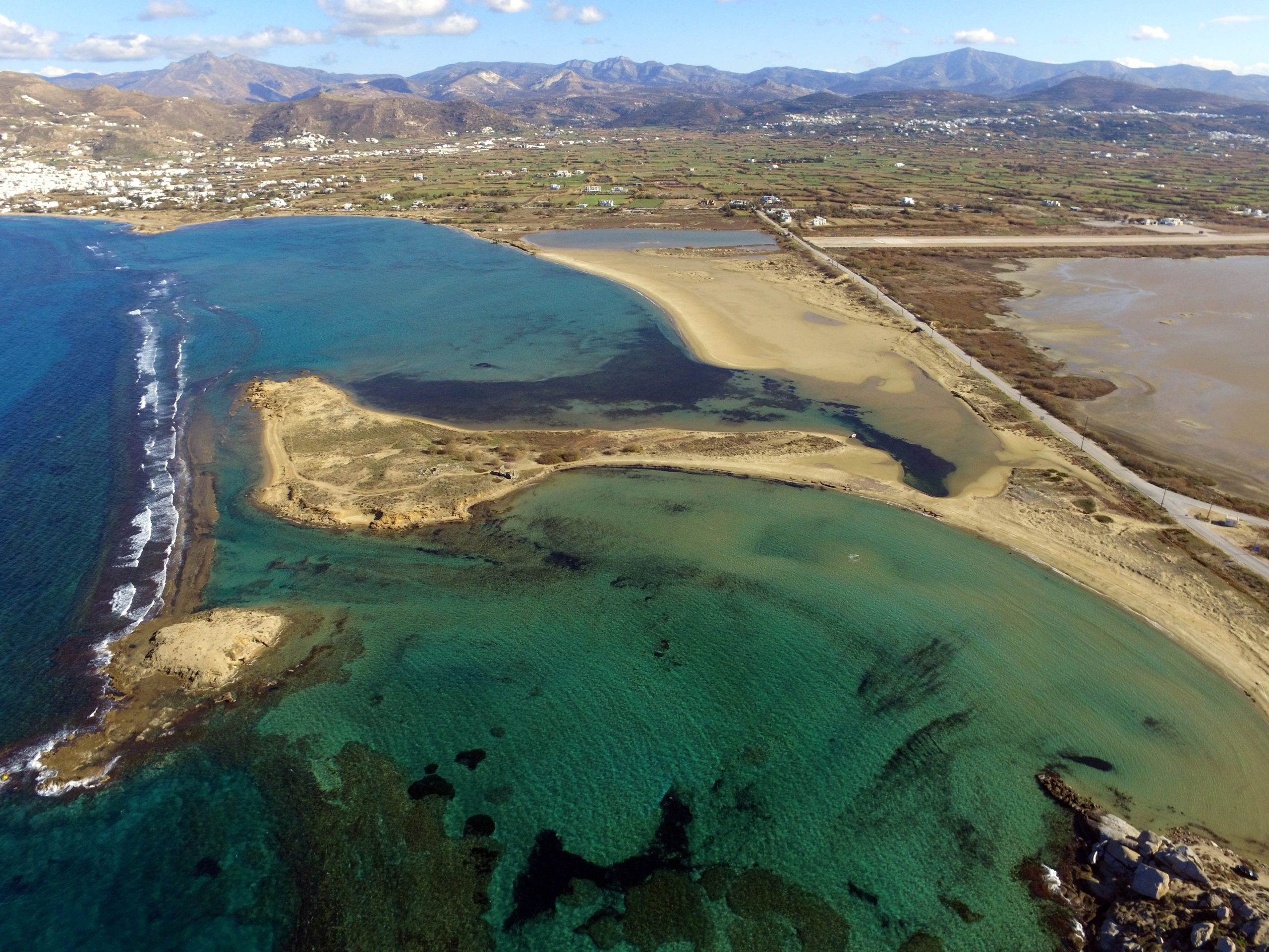
Corinth
Geomorphological, geoarchaeological and morphotectonic characteristics, indicate the active tectonic history of Corinth Gulf.
An ancient paved road – Diolkos. Credit: Manolis Lykouropoulos
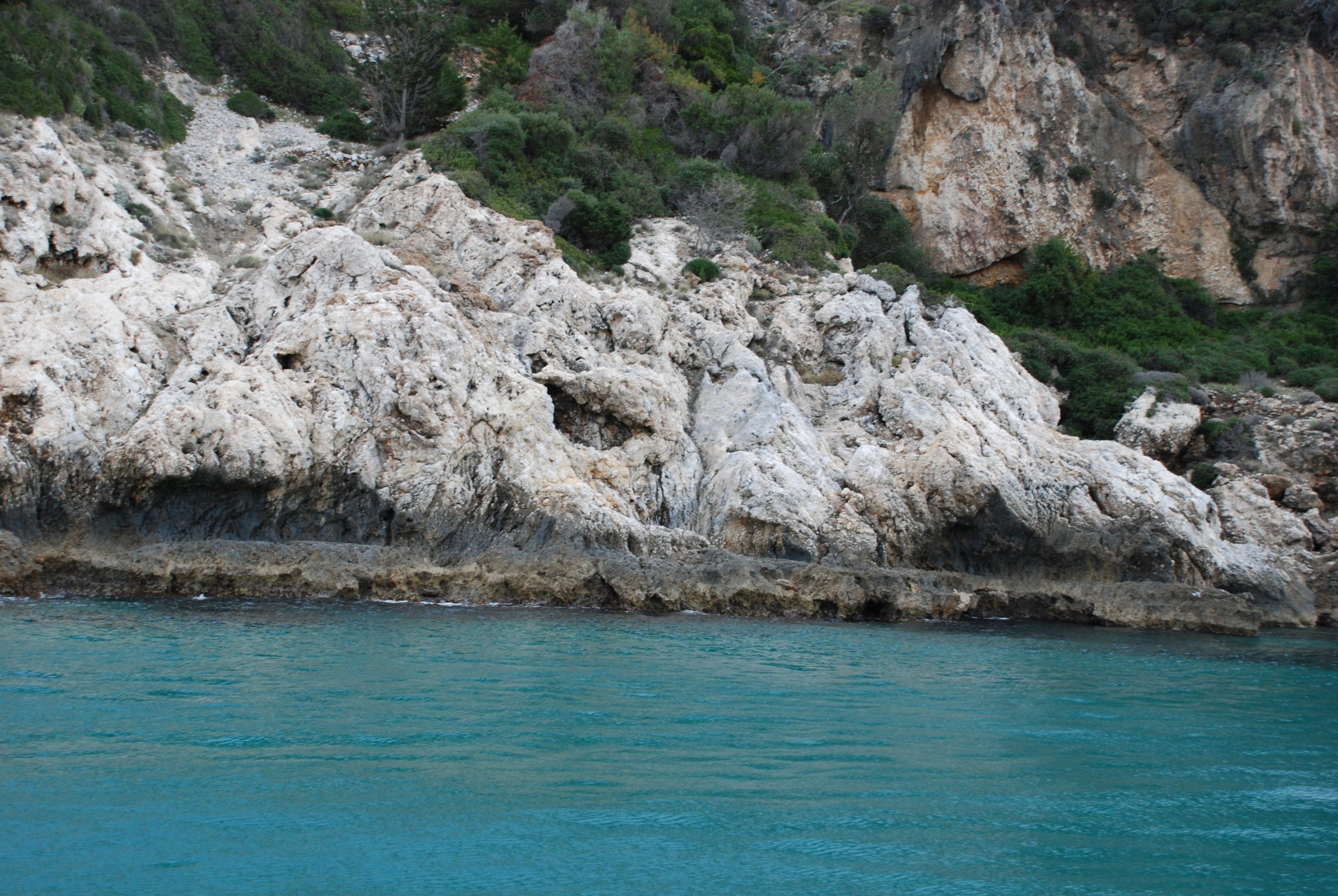
Palaeo ‐Tsunami events of Cyprus
Boulder deposits, which may be found in various locations in Cyprus, indicate seismic wave activity palaeo-tsunamis as described in archaeological and geological records.
Boulders deposits- Cape Greco. Credit: Manolis Lykouropoulos
30/10/2020 Earthquake, Samos Island, East Aegean
On October 30th 2020, the eastern Aegean Sea was shaken by a Mw=7.0 earthquake. The epicenter was located close to the northern coasts of Samos island. This tectonic event produced an uplift of the whole island as well as several infrastructure damages.
Samos- uplift of former palaeoshorelines. Credit: Niki Evelpidou
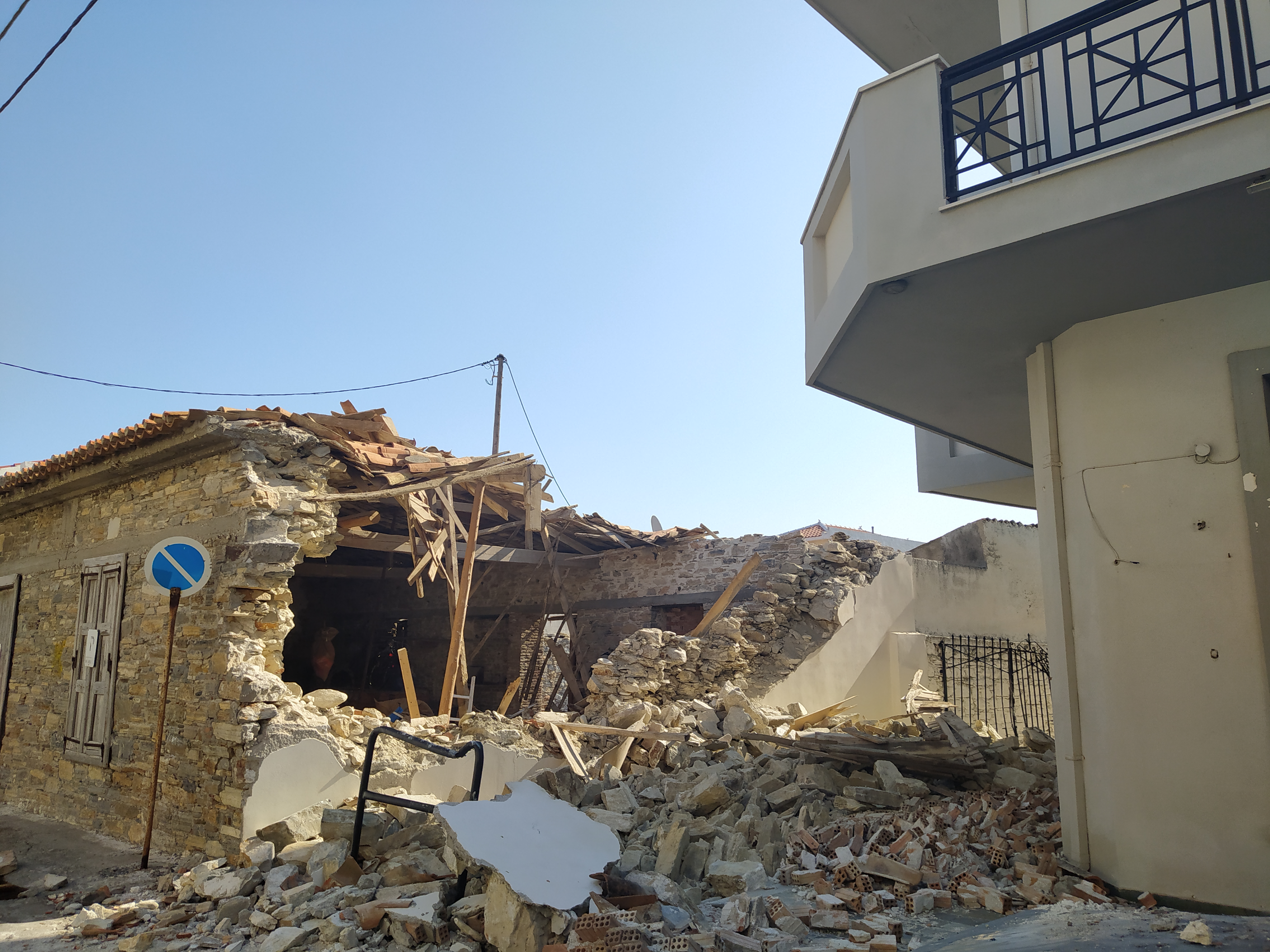
Samos- infrastructure damages. Credit: Anna Karkani
Our #VirtualFieldtrips can be found here
-Niki Evelpidou is Professor of Geomorphology and GIS at the Faculty of Geology and Geoenvironment of National and Kapodistrian University of Athens in Greece. Find her on Facebook and her web page.
 The Plainspoken Scientist is the science communication blog of AGU’s Sharing Science program. With this blog, we wish to showcase creative and effective science communication via multiple mediums and modes.