16 October 2012
An intriguing landslide from Bulgaria
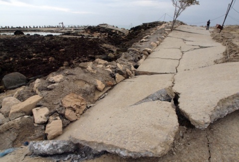
The Sofia News Agency carried a report and picture yesterday of a landslide on the coast near to Kranevo on the Black Sea in Bulgaria. The image is shown below:
The commentary in the article states:
“The strip covered by the landslide is about 2 km, while the fishermen village near the shoreline is the most affected. The road leading to the water is completely destroyed with some of the fishermen trailers buried by the land mass. Eight people have been temporarily blocked, but have already managed to leave. No one has been injured. The landslide was activated Sunday, bringing down huge land mass that inflicted serious damage. A 100-year-old lighthouse has been fully destroyed along with damages to several nearby vacation homes, and several stranded automobiles.”
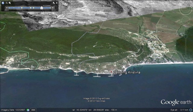
Wikipedia reports that there is a lighthouse 3 km south of Kranevo at Cape Ekrene. This implies that the stretch of coast affected is the one shown in the Google Earth image below, although it is not clear where the landslide is located within this area:
The landslide itself is quite interesting, even though the image does not show most of it. The Buildings and trees have been rotated to lean inland, suggesting a rotational landslide Note that the sea floor has also been pushed up out of the water by the same process.
Does anyone have any more information or images?
15 October 2012
An easy Monday morning – a fantastic cliff collapse video from New Zealand
Thanks to Lee Peterson for doing the leg work on this video. This is a rockfall that occurred at Nevis Bluff in New Zealand in September 2000:
12 October 2012
Safeland project reports
 The EU-funded Safeland Project has recently come to an end. This was a very large, multi-institution research programme designed to:
“develop generic quantitative risk assessment and management tools and strategies for landslides at local, regional, European and societal scales and establish the baseline for the risk associated with landslides in Europe, to improve our ability to forecast landslide hazard and detect hazard and risk zones”
The project website falls into the trap of so many such sites, focusing on a description of the project (which is actually rather mundane on the whole) rather than the findings of the research (which is definitely of interest more widely). However, hidden away in a corner, well hidden, is a fantastic resource. This is the reviews and reports that the project has generated, many of which are rather good. There are multiple documents there, including:
Guidelines: recommended models of landslide triggering processes and run-out to be used in QRA
Recommendations for run out models for use in landslide hazard and risk mapping
Overview of landslide hazard and risk assessment practices
Toolbox of landslide mitigation measures
In fact there are many resources and reports available if you go to the Work Packages pages and click-through.
These are really fantastic resources. I recommend in particular the Remote Sensing report, which is very impressive and useful. It seems a great shame that so few people are aware of what is available.
8 October 2012
Call for an investigation into the Tumbi Quarry landslide
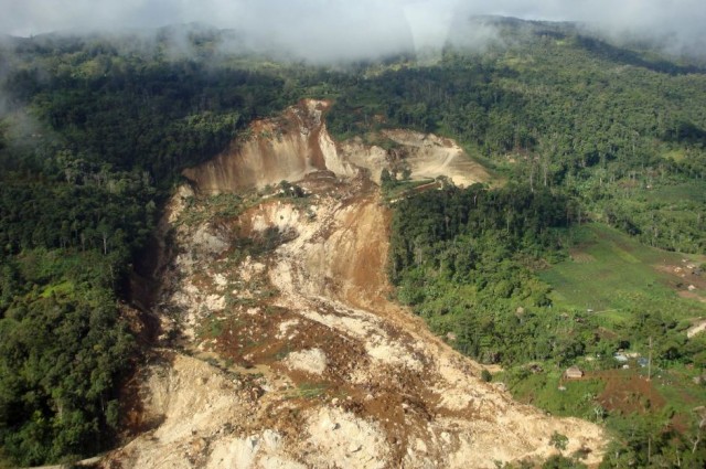 Earlier this year I featured on a number of occasions the Tumbi Quarry landslide in Papua New Guinea of 24th January 2012 (see here, here, here, here, here, here, here, here and here) . As a reminder, this was a large landslide at a quarry site in a remote area of Papua New Guinea that killed 60 people. At the time there was a controversy about the cause of the landslide, which happened in a quarry that was providing aggregate for a pipeline project run by Esso Highlands (EHL). My line from the very start was that this landslide needs to be properly investigated, even though a National Disaster Center (NDC ) report suggested that it was”caused by continuous heavy rainfall which weakened, or undermined, the existing topography and the limestone formation.”
A new article has appeared in Pacific Scoop, reporting that the International State Crime Initiative (ICSI) have released the result of an investigation into the landslide. This report, entitled The Forgotten Disaster, as available for download as a PDF. They report that “To date no inquiry has been held into the cause of the landslide”. The report quotes my posts on this blog in a number of places, but also goes on to detail allegations of neglect of the survivors,and threats and bribery of local people. Thus, the report calls for a form a Commission of Inquiry into the Tumbi Quarry landslide probing the following key issues:
- The cause(s) of the landslide
- The alleged failure if EHL to relocate the villages of Tumbi and Tumbiago prior to the landslide
- Allegations of collusion between the NDC and EHL
- The NDC’s alleged failure to provide adequate humanitarian assistance;
- The NDC’s alleged failure to properly manage the distribution of financial aid;
- Allegations that local landowners protesting the official landslide response were threatened by national government representatives;
- Allegations that protesting local landowners were offered undisclosed payments by EHL;
- The strength of environmental and safety oversight provided by regulatory agencies at PNG LNG sites.
It is a tragedy that this landslide has not been investigated in an open and transparent way.
5 October 2012
A fatal landslide in the area of the September 2012 Yunnan earthquake sequence
NB: this post first appeared on the new Earthquakes Without Frontiers blog, to which I also contribute.
In early September 2012 a series of small but shallow earthquakes affected Yunnan Province in China. The main events were two earthquakes on 7th September, an Mw=5.6 event at 03:19 UTC (11:19 local time) and a Mw=5.3 event at 04:16 UTC (12:16 local time). Although small these two earthquakes caused considerable damage in the epicentral area, with a reported 81 fatalities, 800 injuries and over 6500 houses destroyed. Direct economic costs are estimated to be over $500 million.
The worst affected area was Yiliang County. The chaotic scenes during the earthquake, and in the aftershock sequence, are well-captured by this amateur video that was recorded at the time:
http://www.youtube.com/watch?v=xFl4C4XWjxs
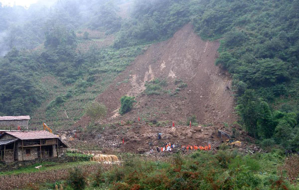
Unfortunately, it is a common facet of earthquakes in mountain areas that they leave a legacy of unstable slopes, many of which then collapse as landslides in the first heavy rainfall event. In Yiliang this appears to have happened yesterday, resulting in a genuine tragedy. In the town of Zhenhe, within Longhaixiang Township in Yiliang County a slope collapsed without warning yesterday morning, burying a primary school. In total 18 young children, who were in the school to take additional classes on the National Day holiday in order to make up for the schooling that they lost as a result of last month’s earthquakes, were killed. A local person also died.
Unfortunately, it is likely that further landslides will affect this area in the coming months or even years, meaning that careful hazard management will be essential.
NB: this post first appeared on the new Earthquakes Without Frontiers blog, to which I also contribute.
The Powerpoint slides from my RGS lecture on landslides and earthquakes last night are available online
Last night I gave the annual Royal Geographical Society lecture at Latymer Upper School in west London. The talk was a slightly modified version of my RGS talk in Hong Kong earlier this year (with a slightly different name – “The Hazards of Geography – Earthquakes and Landslides”). The slides are available below:
[authorSTREAM id= 1378304_634690114204727500 pl= player by= Nubiagroup]
4 October 2012
Historic mapping of the stream responsible for the erosion at Newburn
Last week I featured the extraordinary erosion event at Newburn in northeast England that was responsible for the removal of the foundations of an apartment block. Whilst the arguments about who is responsible for this event continue, it is interesting to take a closer look at the culvert collapsed. In the UK we have high quality maps dating back to the 1840s, produced by the Ordnance Survey. A friend of this blog has kindly used this data, provided through Digimap, to map the area through time (used with that person’s permission):
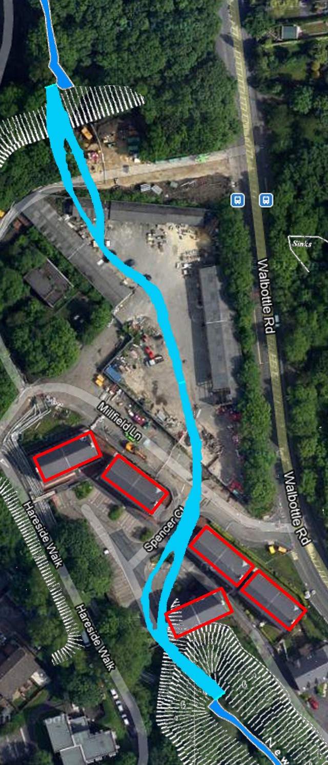
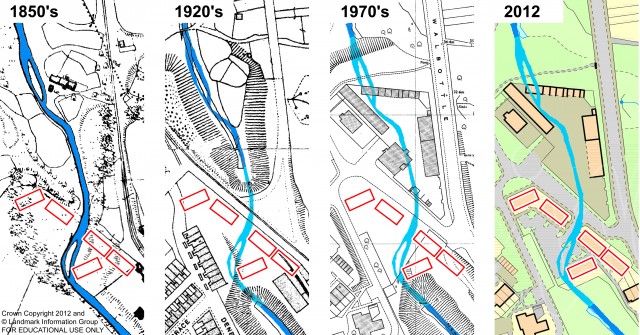 The left hand image shows the situation in the 1850s, when there was no culvert, and thus showing the original stream course. The red rectangles are the apartment block in Spencer Court, the estate that was affected by the erosion last week. You can see that the channel at that time ran through the area on which the undermined apartment block was located. By the 1920’s a part of the stream was in a culvert (the section is shaded in a lighter colour). By the 1970s the culvert had been extended and the land had been filled to allow the construction of buildings above. It is likely that the fill material was waste from the steel works, although this is not confirmed. The exact course of the culvert is of course not shown (it is likely that it was slightly to the west of the original stream, at least in the location of the undermined apartment block).
The following map shows the location of the original steam (using the 1970s map data) overlain on the recent Google Earth image:
3 October 2012
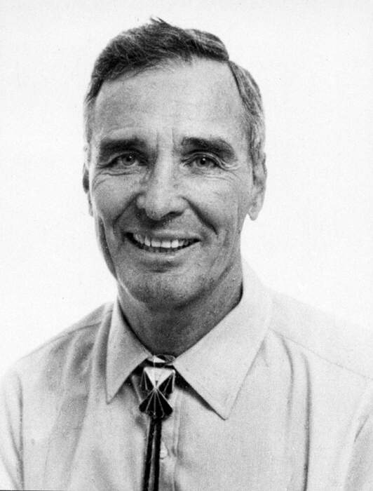
Landslide expert Earl Brabb has died
http://luirig.altervista.org/naturaitaliana/viewpics.php?title=Earl+E+Brabb,+Menlo+Park,+San+Mateo+County,+California+circa...
The renowned landslide scientist Earl Brabb died in hospital on 14th September after a brief illness. He was 83. There is a really nice obituary for him on the SFGate website. It includes this very lovely illustration of the pioneering spirit that he embodied:
Early in his career and immediately after joining the Geological Survey in 1960, Mr. Brabb spent several years fording rivers and flying by helicopter into the wilderness of eastern Alaska to develop maps of isolated rock formations of the tertiary era millions of years ago. On one flight, his helicopter crashed. When his food ran out, Mr. Brabb caught and cooked a marmot, a species of ground squirrel. He learned the biology of the animal’s scent glands “the hard way,” a longtime colleague recalled.
In 2000 theEGU awarded Earl with the Sergey Soloviev medal. This was the citation:
Earl Edward Brabb spent his entire 40-year career with the U.S.Geological Survey carrying out a variety of scientific investigations dealing with natural hazards across a number of disciplines including: landslide studies in the San Francisco Bay region, California, New Mexico and Central Italy; regional geological mapping and interpretation of geophysical data in complex geologic terrains in Alaska, California and New Mexico; evaluation of oil shale and petroleum potential in eastern Alaska; evaluation of ground water potential in San Francisco Bay region using geophysical methods; Paleozoic, Mesozoic and Cenozoic paleontology and stratigraphy; development of earthquake and landslide hazard maps using Geographic Information Systems; and mapping of San Andreas and Hayward fault systems in central California. He is the author or co-author of more than 170 papers, reports and maps.
Earl Brabb has degrees from Dartmouth College, the University of Michigan, and Stanford University. He is or has been a member of several American and International Organizations. For the past 6 years he has been a Geologist Emeritus and has worked as a volunteer for the U. S. Geological Survey in charge of preparing a digital geologic map of the San Francisco Bay region and a debris flow map of the United States. He lives in Palo Alto, California with his wife, Gisela.
Dr. Brabb is a scientific pioneer in several fields of geology and natural hazard assessment, including production of landslide inventory and susceptibility maps at various scales, and the use of Geographic Information Systems for the preparation of geological hazard maps. His analysis of economic costs associated with landslides in the United States, his encouragement of geologists who have produced similar information for other countries, and his reports on innovative techniques for making landslide maps have given him widespread and unique recognition in the international community.
Dr. Brabb is the founder of the International Landslide Research Group and the co-founder of the International Conference and Field Workshop on Landslides. He has received the Distinguished Service Citation from Italian National Research Council Research Institute for Hydrological Protection of Central Italy (1995), the highest awards of the U. S. Department of Interior (1983, 1994), and the Distinguished Practice Award from Engineering Geology Section, Geological Society of America (1988).
From a personal perspective, I started my opening keynote paper for the 2012 International Symposium on Landslides with the following words:
In 1989, in the forward to a volume that sought to document the global extent and economic significance of landslides, Earl Brabb of the United States Geological Survey observed that: “Landslides are ubiquitous – although this may seem self-evident, the principal obstacle to major progress in coping with them is that they are perceived to be a local problem. The fact is that they cross political, social and economic boundaries, killing people and destroying property; what’s more…landslides are largely predictable and preventable using existing technology. Recognizing landslides as a worldwide issue is a primary concern; but beyond that national and international leadership is needed to muster the resources, knowledge and skills for reducing landslide hazards”(Brabb 1989, VII).
It is a undeniably disappointing state of affairs that, 23 years after that statement was written, the message remains as fresh and as relevant as it was at the time.
It is probably true to say that in everything that he did Earl was ahead of his time. He is a sad loss.
2 October 2012
Three late monsoon landslides in Nepal
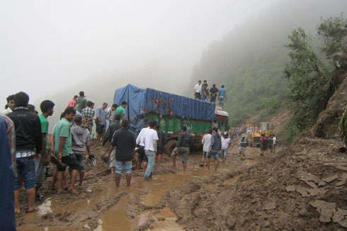
Although the summer monsoon season is drawing to a close in Nepal, three fatal landslides occurred yesterday, together claiming up to 20 lives. The first event occurred on the Mechi Highway between Harkate and Haspokhari in Ilam in eastern Nepal, when a landslide swept five vehicles from the road:
To date six bodies have been recovered, and a further eight are believed to be missing with little chance of survival. There were four survivors. Later in the day, two landslides occurred in Sankhuwasabha District in eastern Nepal. The first, at about 11 pm local time, buried a house in Jyamire Dhupu, killing three children. The second occurred at Dhupa in Barabesay, destroying 15 houses and claiming five lives from a single family. Two people were injured.
The landslide season in Nepal this year has been unusually quiet, reflecting the low rainfall levels across much of South Asia.
29 September 2012
Updates and videos from a couple of recent landslides
A couple of interesting landslide stories this week (updated with an extra video below):
1. The Route 14 landslide near Cedar Falls, Utah
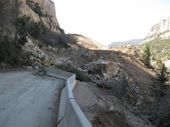
Thanks to Alexandre Mathieu for the heads up on this one. Back in October 2011, a huge landslide blocked State Route 14 near to Cedar Falls. Since then a huge project has been underway to reinstate the road. This was completed this week, when the road reopened. Remarkably, the restoration project has its own website:
This is a great resource for information about the landslide and the restoration programme, and surely is an example of best practice for such a project.
2. The Wang Shan landslide in Gansu, China
This ongoing slope failure was observed in action by the participants of a conference field trip earlier this week. Helen Reeves of the BGS has posted a brief summary and has put a video online on Youtube. The BGS also have a website about the landslide.
Geology for Global Development also have a video showing the landslide:
3. An intriguing video from the Yukon River:


 Dave Petley is the Vice-Chancellor of the University of Hull in the United Kingdom. His blog provides commentary and analysis of landslide events occurring worldwide, including the landslides themselves, latest research, and conferences and meetings.
Recent Comments