4 October 2012
Historic mapping of the stream responsible for the erosion at Newburn
Posted by Dave Petley
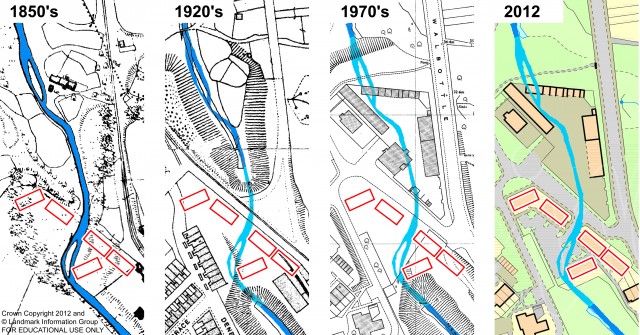
Last week I featured the extraordinary erosion event at Newburn in northeast England that was responsible for the removal of the foundations of an apartment block. Whilst the arguments about who is responsible for this event continue, it is interesting to take a closer look at the culvert collapsed. In the UK we have high quality maps dating back to the 1840s, produced by the Ordnance Survey. A friend of this blog has kindly used this data, provided through Digimap, to map the area through time (used with that person’s permission):
 The left hand image shows the situation in the 1850s, when there was no culvert, and thus showing the original stream course. The red rectangles are the apartment block in Spencer Court, the estate that was affected by the erosion last week. You can see that the channel at that time ran through the area on which the undermined apartment block was located. By the 1920’s a part of the stream was in a culvert (the section is shaded in a lighter colour). By the 1970s the culvert had been extended and the land had been filled to allow the construction of buildings above. It is likely that the fill material was waste from the steel works, although this is not confirmed. The exact course of the culvert is of course not shown (it is likely that it was slightly to the west of the original stream, at least in the location of the undermined apartment block).
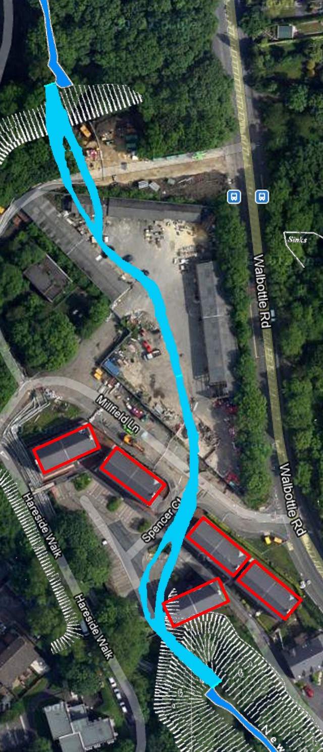
The following map shows the location of the original steam (using the 1970s map data) overlain on the recent Google Earth image:


 Dave Petley is the Vice-Chancellor of the University of Hull in the United Kingdom. His blog provides commentary and analysis of landslide events occurring worldwide, including the landslides themselves, latest research, and conferences and meetings.