
18 February 2020
Further information about the Tylorstown landslide
Posted by Dave Petley
Further information about the Tylorstown landslide
Yesterday more information emerged about the Tylorstown landslide in South Wales on Sunday 16 February, which was caught on video. Many thanks to the various comments and observations that I’ve received.
The most useful information comes in the form of a pair of oblique aerial images that were tweeted by the National Police Air Service South West Region, who overflew the landslide. This is one of the two images:-
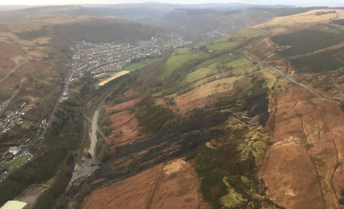
Oblique aerial photograph of the Tylorstown landslide in South Wales. Image tweeted by NPAS SW.
.
This image shows that the failure originated in the upper of the two spoil heaps. There can be little doubt that this is coal waste. The failure appears to have started as a rotational slip in the spoil, and a part of the rotated, back-tilted block is clearly visible. The lower part of the block has fragmented to form the flows that have reached and inundated the river.
These flows can be seen in more detail in the image below:-
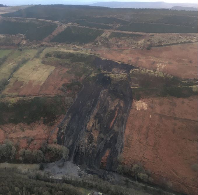
Oblique aerial photograph of the Tylorstown landslide in South Wales. Image tweeted by NPAS SW.
.
This second image shows that the displaced block has failed to generate the flows, and the amount of material in the watercourse. Interestingly, it also hints that there may be a further failure developing to the right of the slipped mass, although better imagery is needed to be clear.
Rotational failure that transitions into a flow is the classic failure mode for coal waste in South Wales – indeed the official tribunal found that this was the mechanism for the Aberfan landslide. This was the description of the landslide:-
“On 21st October 1966 there were a number of slipping movements of a rotational kind accompanied by settlements of the crest of the tip. These movements gave rise about 9-10 a.m. to a flow slide, the relatively dry material in the flow slide pouring down the mountainside and into the village. it was this flow slide which engulfed the school and houses in Moy Road.”
The waste pile is not shown on the 25 inch OS map that was published in 1919, but it is depicted on the 1956 map. Interestingly the early maps show a stream flowing through the site. It is not clear as to what happened to this stream when the waste was dumped.
 Dave Petley is the Vice-Chancellor of the University of Hull in the United Kingdom. His blog provides commentary and analysis of landslide events occurring worldwide, including the landslides themselves, latest research, and conferences and meetings.
Hi,
About the stream… I’ve been looking at google earth imagery… if you take a look at the 1945 image, there is a ramp a the bottom of the upper spoil heap… through decades it seem that a part of this ramp developped one or two small ponds (the black shape in the 2001 picture)… stream resurgence?
A number of houses in Blaenllechau rd.were flooded on Saturday night after the heavy rain. The water coming off the mountain above Blaenllechau rd. Was like a river flowing over the top of the ground. This road is the one on the photograph above the dramway slide at Tylorstown. The water on this mountain should run down culverts along the top side of the road, but who is responsible to keep them clear? They are mostly blocked by shale stone and this heavy rain is bringing more land more down. Worse lies ahead, I can’t see how you change the water courses!