20 February 2020
Hardin County: a dramatic landslide in Tennessee
Posted by Dave Petley
Hardin County: a dramatic landslide in Tennessee
On Saturday 15 February 2020 a dramatic landslide occurred in the Chalk Bluff area of Hardin County in Tennessee, USA. The landslide, which is located at 35.385, -88.284, destroyed rather beautiful two houses located at the top of a bluff. Fortunately no-one was harmed, although the houses are a total loss.
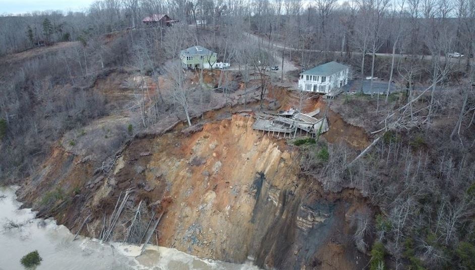
Fox 17 News has posted some imagery and a video of the landslide, including this image of the early part of the failure:-

The early phases of the landslide at Hardin County in Tennessee. Image via Fox 17 News.
.
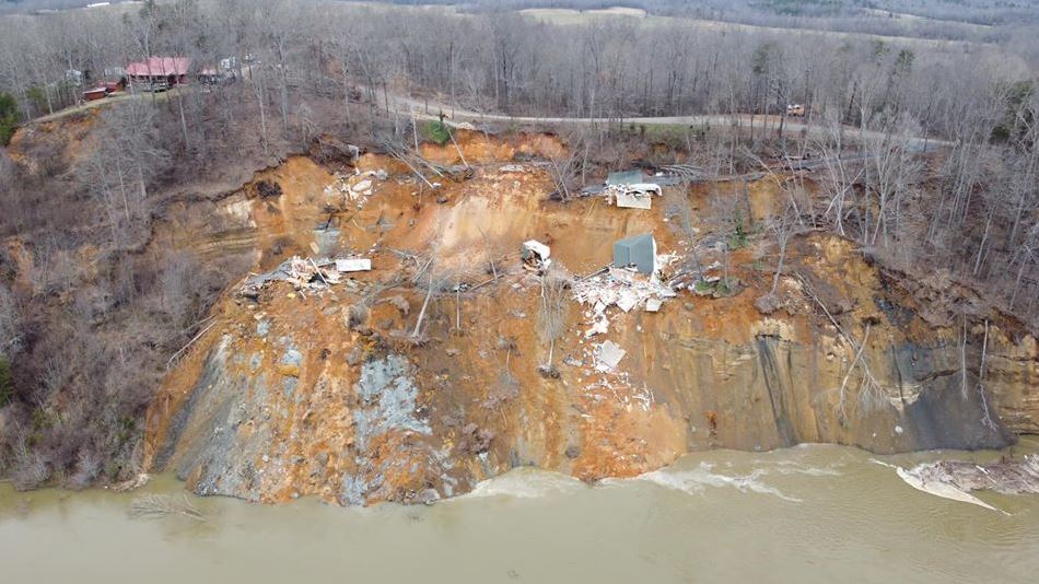
Whilst this image shows a later phase, when the slide had retrogressed significantly, causing the loss of the two properties:-

The later phases of the landslide at Hardin County in Tennessee. Image via Fox 17 News.
.
On Youtube, Knox County News have posted a video of the collapse of one of the two properties:-
.
Whist News4 WSMV Nashville has posted drone footage of the aftermath of the landslide:-
.
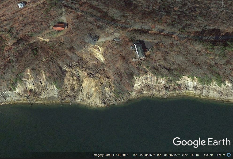
Google Earth imagery from November 2012 shows the site quite clearly, as the trees had no leaves:-

Google Earth imagery from November 2012 showing the site of the landslide at Hardin County in Tennessee.
.
This image appears to show that a smaller landslide has been active for some years, and that it had encroached close to one of the two houses that were lost. The collapse on 15 February appears to be a significant increase in the size of this landslide, driven by a prolonged period of heavy rainfall. As the site is located on the outside of a gentle bend in the river, enhanced erosion would be expected.
The Jackson Sun has some more detail about the landslide. One of the houses, which were built in the 1990s, has been unoccupied, but the other was in daily use. The occupiers were able to recover only a small amount of their possessions before the house was destroyed.


 Dave Petley is the Vice-Chancellor of the University of Hull in the United Kingdom. His blog provides commentary and analysis of landslide events occurring worldwide, including the landslides themselves, latest research, and conferences and meetings.
The landslide continues to progress: three quarters of the road is gone, in places.
https://www.foxnews.com/us/tennessee-river-landslide-morris-chapel-aftermath-hillside-crumble-road-home-hardin-county
Not positive about this, but that water may be backed up above its natural level by Kentucky Dam, farther north. Even though the velocity would be reduced, the higher water may have disrupted the natural “equilibrium” the bluffs had achieved prior to the 1930s when the dam was built, setting the stage for heavy rain to destabilize the slide mass. Whether or not the water is backed up by the dam, waves from 200 m long barge-towboat assemblies may also have had a role in gradually degrading the condition of the bluff at the water line. Not completely an “act of G_d.”
Find our planet interesting and want to learn more about its history and scientific discoveries? Check out CuriosityStream where you can kind non-fictional documentaries on any and every topic now. Use code: From Head To Curve
https://curiositystream.com/FromHeadToCurve