
22 December 2021
Another fatal jade mine landslide in Myanmar
Another fatal jade mine landslide in Myanmar
It is reported that yet another landslide affected the Hpakant area of Myanmar this morning. Whilst the picture is a little sketchy at the moment, the indications are that a jade mine landslide occurred at about 4 am. Indications are that between 70 and 100 people were swept into a lake. One body has been recovered and 25 people have been injured.
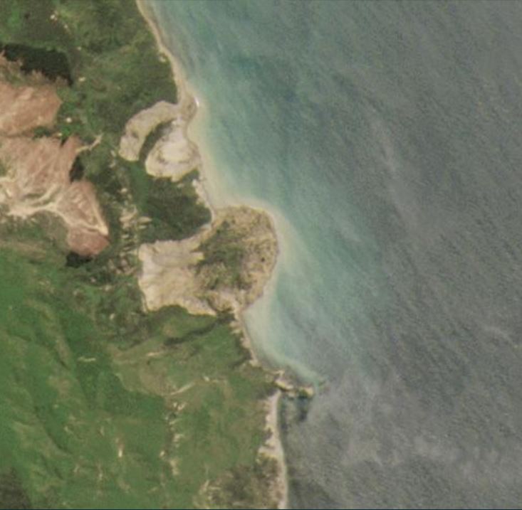
WION/AFP has the only image of the aftermath that I can find at the moment – unfortunately it doesn’t tell us a great deal:
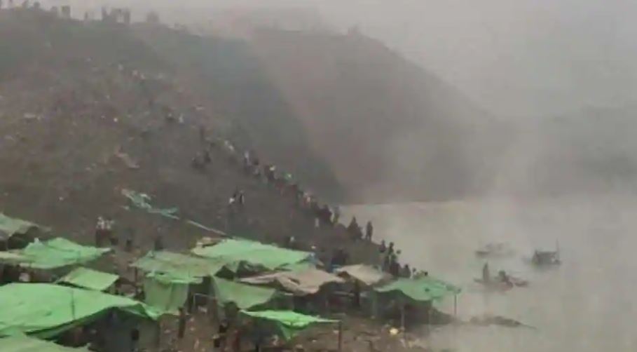
The aftermath of the jade mine landslide at Hpakant in Myanmar. Image by AFP via WION.
.
Over the years I have repeatedly written about the terrible history of jade mine landslides in the Hpkant area of Kachin State. In 2018 I produced a timeline of reported events, whilst last year another landslide killed at least 175 miners at Wai Khar mine at Sate Mu. At the weekend there was yet another landslide, with at least six people, and possibly as many as ten people, killed.
Much has been written about the causes of these dreadful events, but this is an area in which the landscape is being pillaged by large scale mining activities. The level of regulation is negligible, and the area is riven with dangerous slopes of both mine waste and bedrock. On top of this, the dire economic conditions in Myanmar have meant that a large number of people scavenge on the waste piles, trying to find jade to sell. They often mine at night, increasing the danger. Very often the collapse of the waste piles bury these people, or sweep them into the flooded pit bottom. Sometimes displacement waves from collapsing waste piles catch the miners by surprise.
All of this is avoidable with proper regulation, but there is little or no prospect of change in Myanmar.
It is estimated that 70-90% of the jade produced in the world comes from Myanmar. Jade is a beautiful rock, but please don’t ever buy jade from Myanmar.
21 December 2021
The movement of the San Isidro landslide in Peru, and a possible relationship with the 28 November 2021 Northern Peru earthquake?
The movement of the San Isidro landslide in Peru, and a possible relationship with the 28 November 2021 Northern Peru earthquake?
Yesterday I wrote about the failure of the San Isidro Landslide in La Peca, Peru on 12 December 2021, which has led to the relocation of about 250 people. Later in the day, Sotiris Valkaniotis tweeted satellite images of the site, derived from the European Space Agency Sentinel instruments, that both confirmed the location of the landslide and provided an indication of the movement of the slope. The Tweet should be visible below:
Copernicus #Sentinel2 satellite imagery captures the motion from an activated #landslide of 800+ meters length in San Isidro, Peru (Dec 12 2021). Left; total horizontal displacement as measured by optical image correlation (before & after imagery). 1/2 https://t.co/691BgrfwE2 pic.twitter.com/4NrHKpL6hW
— Sotiris Valkaniotis (@SotisValkan) December 20, 2021
.
This provisional analysis indicates that the landslide was about 800 m in length, with displacements exceeding 20 metres in places. The devastating impact on the village is clear, despite the low resolution of the imagery.
There is an interesting other dimension to this landslide. On 28 November 2021 the Amazonas region suffered an M=7.5 earthquake. The epicentre was about 215 km from the San Isidro landslide. Images posted to the La Peca Facebook page indicate that significant landsliding was triggered in the area by the earthquake.
https://www.facebook.com/Miqueridalapeca/posts/1876581976063557
.
Thus, it seems quite possible that the slope at San Isidro was weakened by the earthquake, and then failed in the first heavy rainfall event after the seismic event. This is a pattern that we have seen elsewhere.
Of course this is only speculation at this point, but it is an interesting angle to explore.
As an aside, the images in the Facebook page indicate that in at least one location the valley is blocked by a landslide, possibly in the area of Bagua Grande. I hope that this has been (or is being) addressed.
20 December 2021
The 12 December 2021 landslide at San Isidro in Peru
The 12 December 2021 landslide at San Isidro in Peru
On 12 December 2021 a large landslide affected the village of San Isidro in La Peca, Amazonas, Peru. The landslide, which was apparently triggered by heavy rainfall, destroyed more than 80 homes as well as building for the local health, initial and primary educational institutions and the town’s Catholic Church. About 250 people have been forced to relocate.
RT has a video on Youtube that provides a decent overview of the impact of the landslide:-
.
There are some good images of the landslide on the La Peca Facebook page, including this one:-
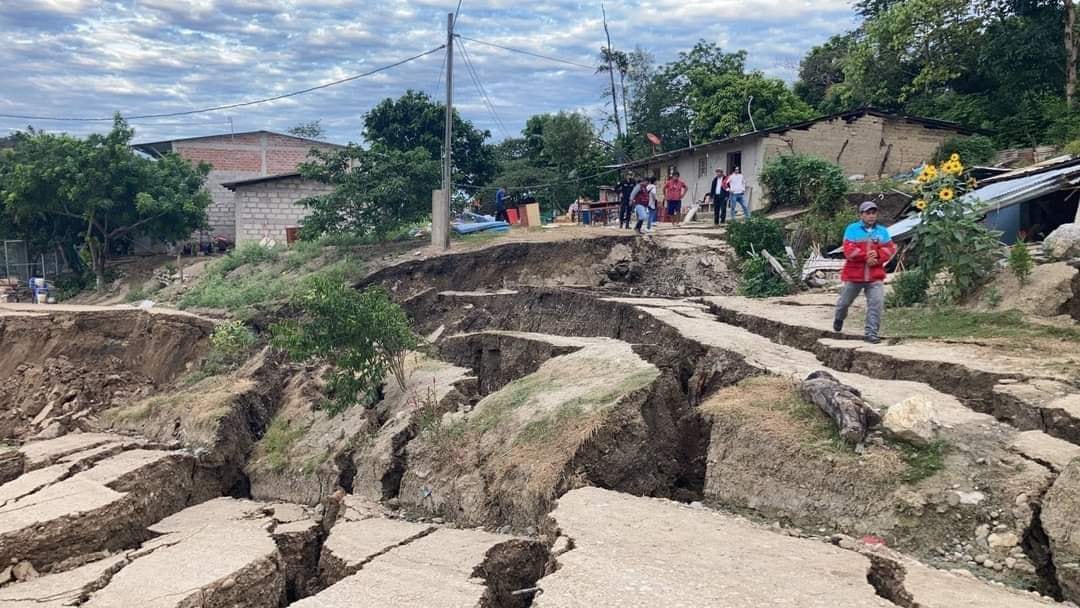
The aftermath of the San Isidro landslide in Amazonas, Peru. Image from Facebook.
.
Google Earth gives the location of San Isidro as below:-
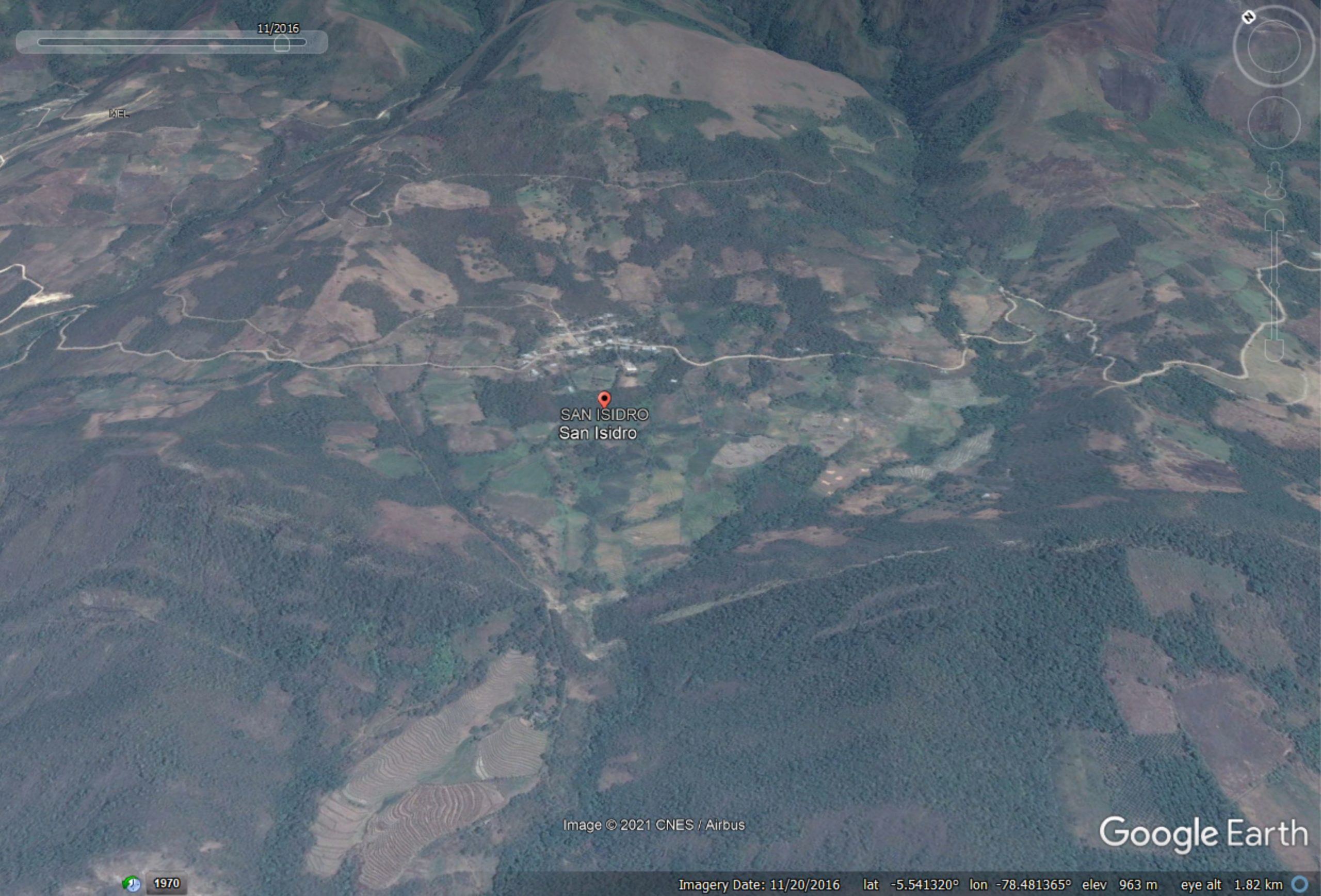
Google Earth image of the possible location of the landslide at San Isidro in Peru.
.
The configuration looks right, but I cannot be certain that this is correct place.
13 December 2021
The failure of retaining walls
The failure of retaining walls
Retaining walls are an essential part of modern construction. In general they perform remarkably well; occasionally they fail and find their way onto this blog. You should be able to find a list of examples here, and some posts have included videos and spectacular photographs, such as this:-
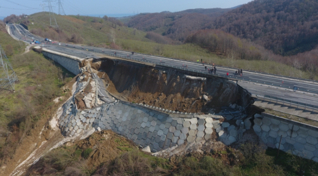
The highway slope failure at Düzce Zonguldak in Turkey on 26 March 2021. Image from Haber Golkoy.
.
Loyal reader George Haeh has very kindly highlighted a link to an interesting video that describes types of retaining walls and the mechanisms through which they may fail. The video should be embedded below:-
.
Whilst it is not technical, it is a good summary. An interesting aspect of the video is that it includes an interesting example of a retaining wall failure from New Jersey:-
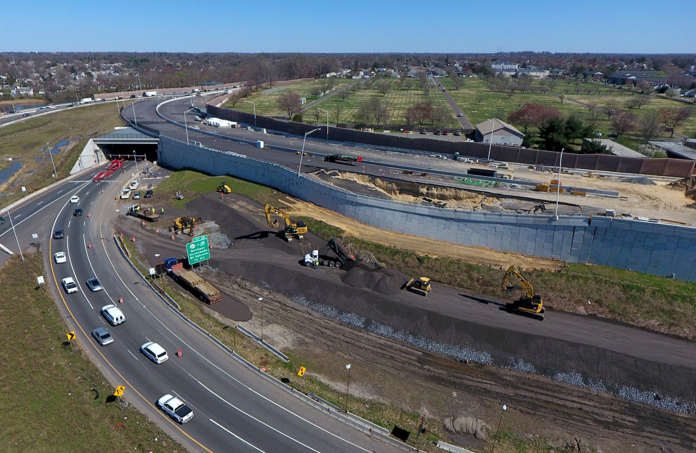
A retaining wall failure on I-295 in New Jersey in April 2021. Image from NJ.com.
.
This failure of a retaining wall has further delayed an already deeply troubled project (it was originally supposed to be completed in 2022, even before the failure this had been delayed until 2028. In this case an investigation has indicated that the problem may have been higher than anticipated groundwater levels that caused “a partial collapse of a column-supported embankment system”. It is interesting to note that in the image above it appears that mass was being added to the toe of the slope, which is sensible way to stabilise the slope temporarily.
One of the key failure modes for retaining walls is a slope failure that goes through material upon which the wall has been constructed. This is the idealised cross section of such a failure:-
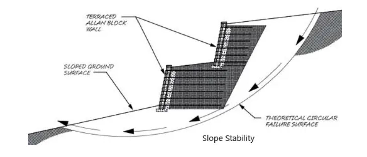
An idealised cross section of one key mode of failure of a retaining wall. Image from structuralguide.com.
.
Readers may spot some similarities between this cross section and the examples shown above. Way back in 2010 I highlighted another really interesting case study, at the Rivermist subdivision in San Antonio, Texas.
10 December 2021
The 11th Lumb Lecture at HKU: Bridging the Gap between Theoretical and Actual Slope Performance by H.N. Wong

The 11th Lumb Lecture at HKU: Bridging the Gap between Theoretical and Actual Slope Performance by H.N. Wong
Professor H.N Wong is the former head of the Geotechnical Engineering Office in Hong Kong, the agency charged with responsibility for slope management in the territory. Last Friday he delivered the 11th Lumb Lecture at Hong Kong University, entitled “Bridging the Gap between Theoretical and Actual Slope Performance”.
The lecture is held every two years in memory of Professor Peter Lumb, who for 32 years was an academic in the Department of Civil Engineering, The University of Hong Kong. He was a towering figure in geotechnical engineering in Hong Kong, and indeed globally, and much of the success in managing slopes in Hong Kong is built upon his work and that of his students.
In his lecture, H.N. Wong drew upon multiple examples from Hong Kong. He highlighted the uncomfortable fact that the failure rate for engineered slopes is much higher than that of other engineered structures. H.N. notes that one of the issues is that there is a large gap between theoretical and actual slope performance. The lecture explores ways to both understand this issue and to address it.
The full synopsis is below.
The lecture has been posted online and can be viewed for free. I thoroughly recommend it.
Synopsis: Bridging the Gap between Theoretical and Actual Slope Performance by H.N. Wong
Unlike other types of modern-day engineering structures, slopes that are engineered according to sound geoscience theories and meeting state-of-the-art standards still suffer from an appreciable chance of failure. This unsettling fact was not previously evident to the geotechnical community at large. It was also unfamiliar to the local practitioners during the formative years in the first one to two
decades of implementing the system for mandating the application of geotechnology in Hong Kong’s slope engineering. Despite this, the notable improvement in slope safety made at the time has rendered Hong Kong internationally reputable as a model of slope engineering in an urbanized setting. Yet, as time went by when more engineered slopes had been formed and their actual performance tested under heavy rains, the bitter lesson was learnt of the gap between theoretical and actual slope stability. The systematic landslide investigations and related technical development studies launched by the GEO since the mid-1990s has provided comprehensive findings on failures of engineered slopes and important insights into the causes. This has brought about enhanced understanding of the need and impetus for further improving the relevant slope engineering practices. While the experience and knowledge have emerged primarily from Hong Kong, it is relevant to urban slope engineering and landslide risk management elsewhere.
This Lecture aims to show, with reference to the available data and selected case histories, the extent and causes of the disparity between the theoretical and actual slope performance in Hong Kong. In this context, the key improvement measures adopted over the years with some degree of success in bridging the gap will be explained. This will illustrate the importance of robust geotechnical design and holistic landslide risk management. Cautioning against complacency particularly in the wake of the new challenges that may arise from climate change, the Lecturer will also discuss issues yet to be addressed and some possible solutions.
7 December 2021
An update on the Mira Mar landslide in Albany, Australia
An update on the Mira Mar landslide in Albany, Australia
In October I wrote about an ongoing landslide that is causing very significant problems for the residents of a neighbourhood in the Mira Mar suburb of the city of Albany in the southern part of Australia. At this spot a slow moving landslide has progressively destroyed or damaged a number of houses. The event remains contentious, with claims and counter-claims as to whether the cause is high levels of rainfall or the leakage of a water main. The slope has been moving since at least 2013, but it dramatically accelerated in the winter of this year. On 30 July a water main ruptured.
Last week a geotechnical report was released by a consultant, CMW Geosciences, commissioned by the Great Southern Development Corporation. This has been placed online. This is not a detailed site investigation, but it is instead primarily a desk study. However, this site has been extensively studied in recent years, and there is a movement monitoring record for the last few weeks, so the study usefully summarises the state of play.
Perhaps strangely, the report contains neither an interpreted plan view of the landslide nor an interpreted cross-section. I would be interested to know why this is not present. At the back of the report there are photographs of the landslide, including these images of surface damage:-
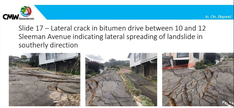
Ground deformation in the Mira Mar landslide in Albany, Australia. Image from a geotechnical report by CMW Geosciences.
.
The report concludes that the landslide is complex, active and extending in size. It also notes that groundwater is likely to be the cause of the landslide, but it is clear that it is not possible to determine whether the source was rainfall or leakage. The report recommends that dewatering of the landslide is enhanced. In the short term the report recommends that two houses (10 and 12 Sleeman Avenue – see image below) are demolished – the damage to the houses means that they are unsafe and demolition would provide access for investigation and remediation. Finally the report recommends a more detailed investigation, using Lidar to understand the topography and morphology of the slope, and boreholes to understand the subsurface geometry, materials and pore water pressures. All of these recommendations seem reasonable.
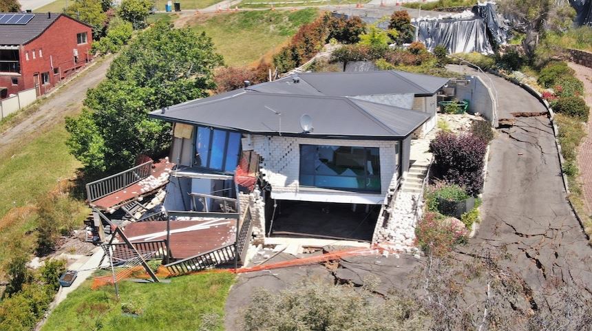
Damage to a house caused by the Mira Mar landslide. Image from ABC Great Southern: Tom Edwards
.
The Minister for Regional Government has provided a response to the report that indicates that a further three properties will be evacuated, that AUS$150,000 will be made available for further investigations and that dewatering will be supported. It is probably true to say that the response has not been welcomed by those affected by the landslide.
This event is a nightmare for the residents of the properties on the landslide, and for those living around it. The report is correct in noting that the long term solution will need to address the stability of the whole landslide system, not individual properties. This is entirely possible from an engineering perspective, but it will be complex and expensive, and will require a long period of investigation, planning and construction.
30 November 2021
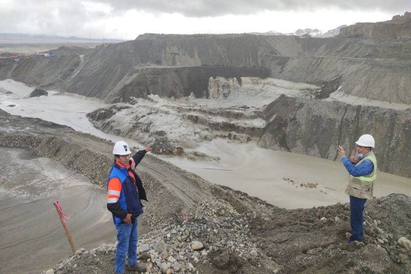
Ananea: a significant mine waste failure in Peru
Ananea: a significant mine waste failure in Peru
On 26 November 2021 a significant landslide occurred in mine waste near to the town on Ananea in Peru. I will say from the start that I am finding it extremely difficult to piece this event together as there is a wide range of conflicting information and images. I am unsure as to whether this was a single event or a series of related failures, and I am unsure as to the level of damage. Unfortunately at present there is no good satellite imagery.
I would welcome any insight that anyone can provide.
I’ll try to set out what I do know. The official COEN-INDICI (Centro de Operaciones de Emergencia Nacional) Twitter site confirms that an event occurred on that date:-
#COENInforma
El 26/11 se produjo un #Deslizamiento que causó daños a viviendas y carretera en el distrito Ananea, provincia San Antonio de Putina (Puno). Autoridades locales evacuaron a las personas afectadas y coordinan su reubicación. (1/2) pic.twitter.com/gEqFENttIr— COEN – INDECI (@COENPeru) November 29, 2021
.
The translation is: On 11/26 there was a #landslide that caused damage to homes and roads in the Ananea district, San Antonio de Putina province (Puno). Local authorities evacuated the affected people and are coordinating their relocation.
The photograph shows the aftermath of a large landslide. There is also a set of images on the Sin Fronteras website, with a set of photographs. The text says:
ANANEA. IN THE CHAOS! THE OVERFLOW OF THE MINING TAILINGS FROM A SEDIMENTATION POOL HAS LEFT THE ANANEA DISTRICT, IN THE SAN ANTONIO DE PUTINA PROVINCE, WITH THE STREETS FLOODED WITH MUD AND IMPASSABLE, SO THE RESIDENTS ASK THAT IT BE DECLARED IN EMERGENCY.
The overflow occurred yesterday at 8:30 in the morning, apparently from one of the sedimentation ponds of the San Antonio mining cooperative, located on the Q’oñiunu hill.
The collapse of the highly toxic material would have occurred due to the alleged negligence in the management and control of the mining waste pools; irresponsible work of some cooperatives.
It also includes some images, but I cannot figure out how they all fit together:-
An image of the aftermath of the landslide at Ananea in Peru. Image from Sin Fronteras.
.
The image above is consistent with that tweeted by COEN. However, another image appears to show a different site altogether:-
An image of the aftermath of the landslide at Ananea in Peru. Image from Sin Fronteras.
.
There are also some videos of a flood event circulating, such as this one on Tic Toc, and this one on Twitter:
Desastre ambiental en mina de #LaRinconada en #Ananea #Puno. Dirá algo la Primera Ministro o su chamba es solo destruir valor bursátil de empresas mineras formales.
Esta es la minería que Contaminación, esta es la minería que apoya #Castillo #Cerron #Vasquez y #Mendoza pic.twitter.com/QnQOk5cQKF— Lucho Romero (@luroel) November 29, 2021
But again I am unsure as to whether this is the same event.
Can anyone shed any more light on this event, or set of events?
26 November 2021
Breaking Ground – a podcast on climate change and slope behaviour

Breaking Ground – a podcast episode on climate change and slope behaviour
Breaking Ground is a podcast run by Ground Engineering magazine. Hosted by Steve Hadley (Chair of the Federation of Piling Specialists and Managing Director of Central Piling), it features people from across the ground engineering profession.
Last week I recorded an episode with Steve, which I found to be really interesting and fun. That episode is now online on audible and is freely available. Steve and I discuss a wide range of issues about slopes and slope behaviour, with a central focus on climate change.
I hope you enjoy it.
23 November 2021
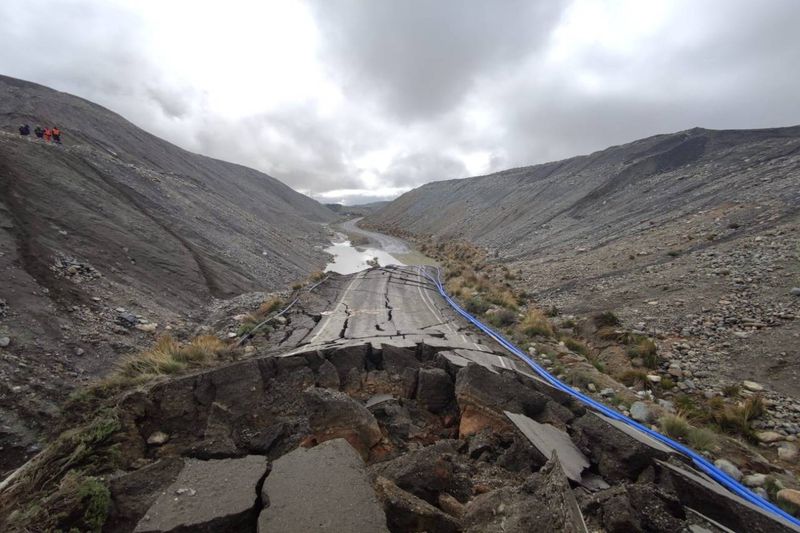
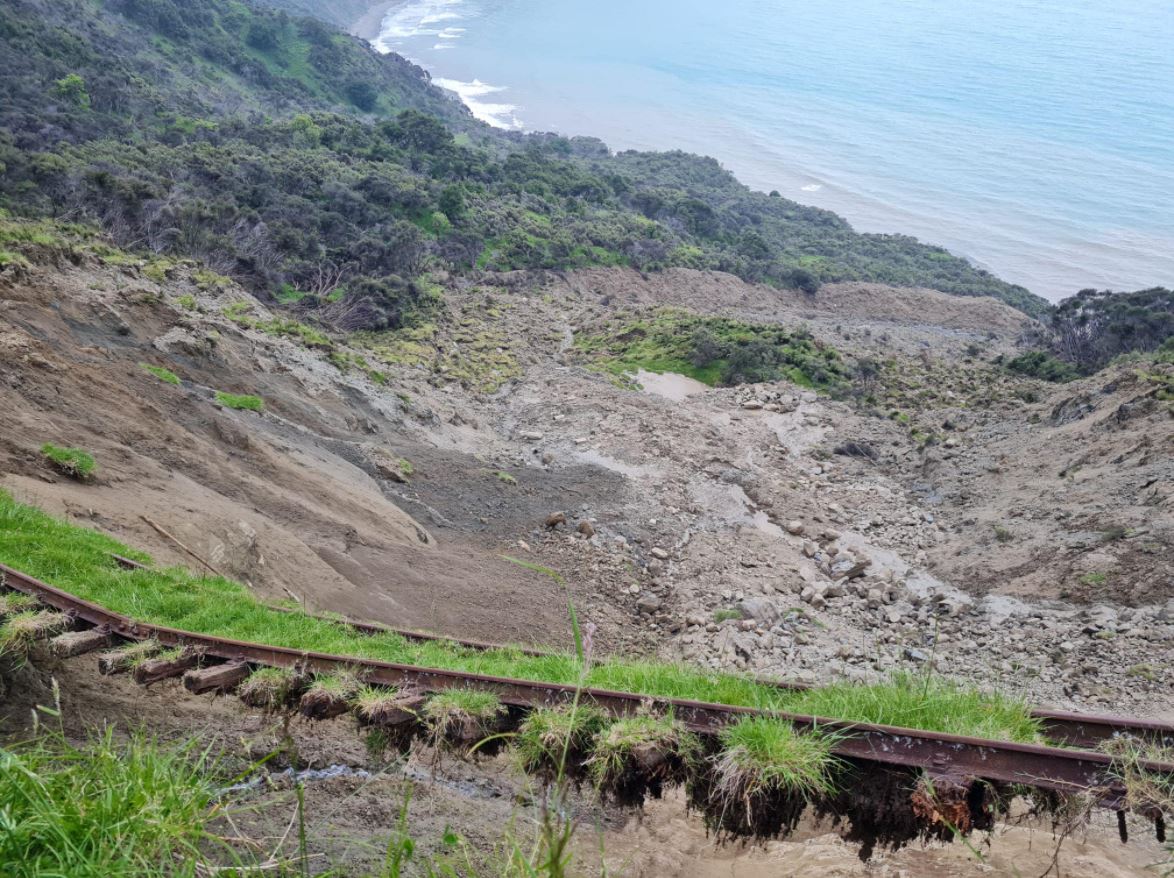
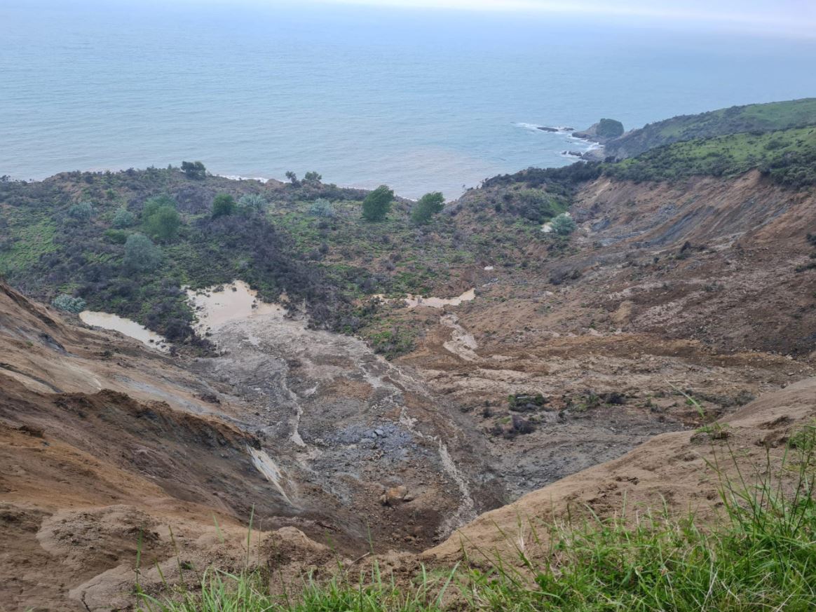
Large landslides at Beach Loop near Whareongaonga in New Zealand
A large landslide at Beach Loop near Whareongaonga in New Zealand
Heavy rainfall earlier this month caused extensive flooding and landsliding in the Gisborne area of New Zealand. Three large landslides were triggered on the coast in the Beach Loop area to the south of Whareongaonga, about 30 km from Gisborne.
The Gisborne Herald has some images of the failures, including this one, which gives a sense of the scale:-
A Beach Loop landslide 30 km south of Gisborne in New Zealand. Image from the Gisborne Herald, posted to Facebook by Liam Clayton.
.
But there is an even larger one a little further along the coast:
The largest landslide at Beach Loop, 30 km south of Gisborne in New Zealand. Image from the Gisborne Herald, posted to Facebook by Liam Clayton.
.
The railway line in the images is the Wairoa to Gisborne line, which was mothballed after a storm in 2012. There is controversy as to whether the line should reopen – Kiwirail has argued that the economic cost is too high for the value that the line brings. I would imagine that these landslides will be a further blow to those who argue for reinstatement. It is interesting to note that the failures appear to have rear scarps along the alignment of the railway.
Planet Labs has captured good imagery of the landslides:-
Satellite imagery of the aftermath of the landslides at Beach Loop in New Zealand. Image copyright Planet Labs, used with permission.
.
The largest failure appears to be a slump, whilst the smallest of the three (the most northerly) is more of a rapid earthflow, I think. I am unsure as to the middle one. The alignment of the railway is also visible.
Although this is a rural area, the Gisborne Herald reports that a number of sacred sites for the indigenous population of New Zealand have also been lost.
.
Reference and acknowledgement
Planet Team (2021). Planet Application Program Interface: In Space for Life on Earth. San Francisco, CA. https://www.planet.com/
Thanks to loyal reader Dr Murry Cave for highlighting these events to me.
22 November 2021
The British Columbia landslides and floods – new images of the impacts
The British Columbia landslides and floods – new images of the impacts
Over the last few days new sets of images have been posted online of the enormous impact of the landslides that affected parts of British Columbia a week ago, caused by an exceptional rainfall event. The most comprehensive images that I have seen were posted to Twitter by Brent Ward (@GeoBrentatlarge) from Simon Fraser University, resulting from a helicopter flight that he took with my former PhD student Sergio Sepulveda, also of SFU. The Twitter thread is is below:
Friday Sergio Sepulveda and I examined landslides along some of the highway corridors. We are both at SFU @SFUEarthScience and @CNHR_SFU. We were focused on getting photogrammetry of landslides and evaluating initiation zones. This thread is mainly about landslides. 1/n pic.twitter.com/FUj85rm9Qm
— Brent Ward 🇺🇦 (@GeoBrentatlarge) November 21, 2021
.
Meanwhile, Jeremy Venditti (@VendittiLab), also from SFU, has posted some images of the terrible impacts at Tank Hill on Highway 1:-
Many have seen the mess at #TankHill that closed #Highway1. Few have seen the source area. No point source, just too much water on hydrophobic soils, burnt by the Lytton fires. A flood turned to a landslide. A classic natural hazard cascade. #BCStorm #BCLandslides #BCfloods pic.twitter.com/5evy7841xT
— Jeremy Venditti (@VendittiLab) November 21, 2021
.
Meanwhile, BC Transportation has compiled a gallery of images including over 100 photographs and seven videos of the impacts of the extreme rainfall. This for example is an image from Tank Hill:
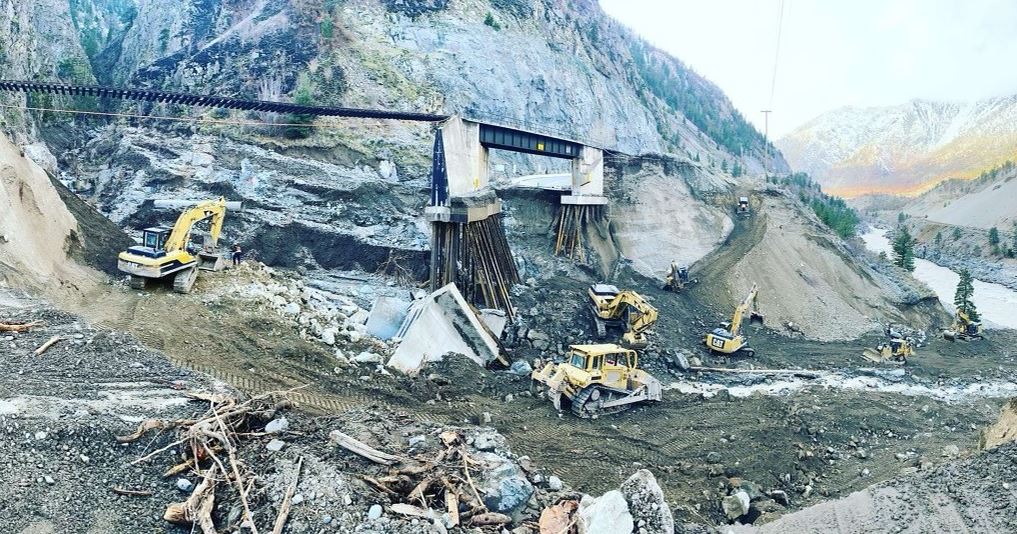
The aftermath of the debris flow / flood at Tank Hill in British Columbia. Image posted to Flickr by BC Transportation.
.
The human cost of the disaster has slowly increased as the recovery operation has continued. At least four people are now known to have died in the landslides, with one more person missing. The three new confirmed fatalities occurred in the Duffy Lake area.
The Mining Journal has an interesting article focusing on the impact of the events on the extractive industries in the area, most notably the rail links that are the primary route for moving the ore to the coast. There is also damage to pipelines used to transport crude oil and other hydrocarbon products, leaving fuel shortages in some areas. Another potential impact that is causing concern is the fisheries industry, with concerns that the large volumes of water and sediment may have damaged wild salmon spawning grounds.
Unfortunately further heavy rainfall is forecast in the area. This is not expected to be an extreme event, but with the ground already saturated the impacts might be greater than would be expected normally.
 Dave Petley is the Vice-Chancellor of the University of Hull in the United Kingdom. His blog provides commentary and analysis of landslide events occurring worldwide, including the landslides themselves, latest research, and conferences and meetings.
Recent Comments