14 September 2022
The Jagersfontein tailings dam accident: the aftermath
Posted by Dave Petley
The Jagersfontein tailings dam accident: the aftermath
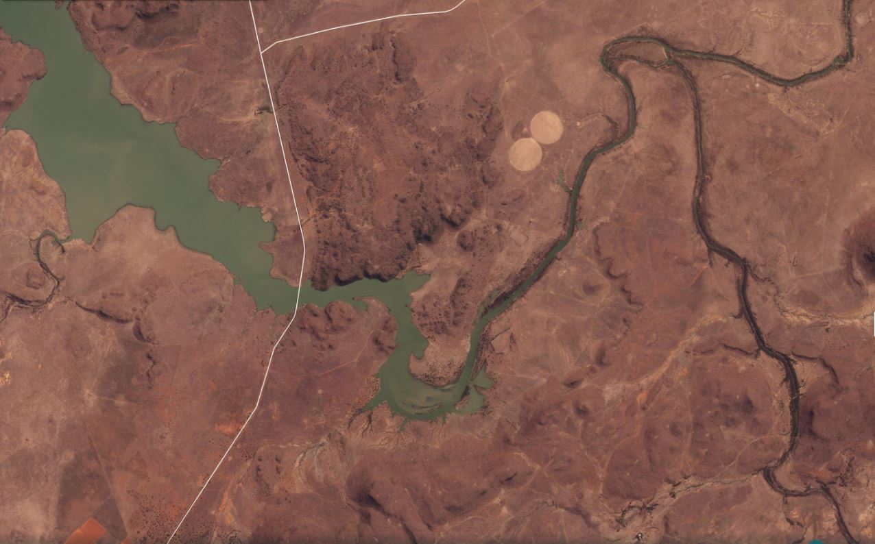
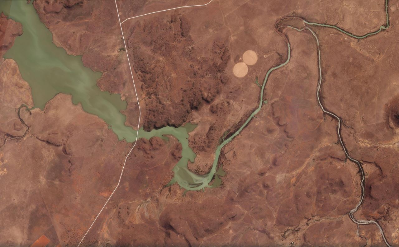
Inevitably, there is considerable discussion about the Jagersfontein tailings dam failure as the impacts become more clear. The slimes released into the channel have travelled downstream to the reservoir behind the Kalkfontein Dam. The Planet Labs images below show the reservoir on 8 September 2022, before the slimes reached the lake, and 12 September 2022, afterwards. The impacts of the pollution event are clear:-

Satellite image of the Kalkfontein Reservoir, collected on 8 September 2022, before the Jagersfontein tailings dam accident. Image copyright Planet Labs, used with permission.
.

Satellite image of the Kalkfontein Reservoir, collected on 12 September 2022, before the Jagersfontein tailings dam accident. Image copyright Planet Labs, used with permission.
.
Inevitably, there is a great deal of interest in what happened at the Jagersfontein tailings dam site of the in the period leading up to the failure. One key question is whether the facility fell between regulatory stools because it was a reprocessing centre rather than an active mine. It appears from the satellite imagery and from Google Earth that old spoil heaps were being “mined”, with the waste being stored in a greatly expanded tailings storage facility. Operations were suspended at least once, reportedly because of concerns about regulatory compliance.
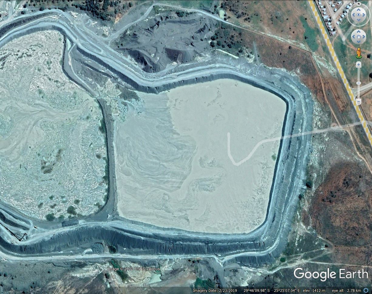
Of particular focus will be the walls on the southern edge of the facility. This is a Google Earth image from February 2019:-

Google Earth image of the Jagersfontein tailings dam from February 2019. Note the walls of dam on the southeastern side.
.
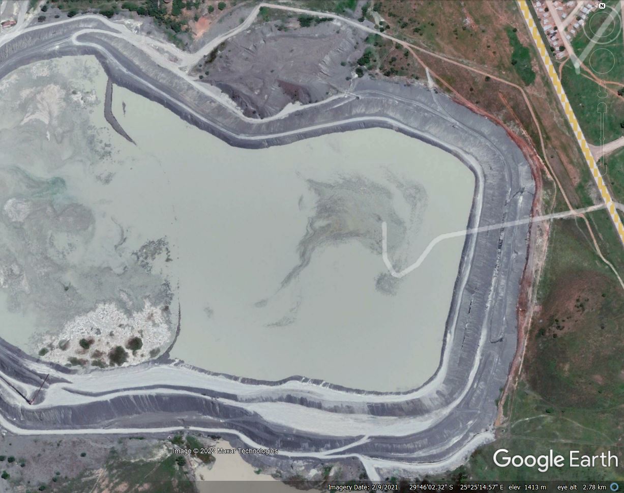
This is the same view from February 2021:-

Google Earth image of the Jagersfontein tailings dam from February 2021. Note the buttressed walls of dam on the southereastern side.
.
It is very clear that the wall of the tailings dam on the southeast corner was greatly thickened over the two year period. This was not matched on the east side, for example. This appears on first inspection to have been what might be described as buttressing on the downstream side. No explanation has been provided as yet as to why this occurred, but it is interesting to note that the failure occurred on the southeast wall of the facility.
Reports indicate that there are 400 more tailings facilities in South Africa. In 2020, 52 of these were classified as being “active high risk tailings dams “. I hope that attention will now be paid to ensuring that these are safe.
The weather forecast for Jagersfontien indicates that rain is anticipated on 19 September. Urgent attention is needed to ensure that further mobility of the tailings both in the facility and in the surrounding area is prevented.
.
Reference and acknowledgement
Planet Team (2022). Planet Application Program Interface: In Space for Life on Earth. San Francisco, CA. https://www.planet.com/


 Dave Petley is the Vice-Chancellor of the University of Hull in the United Kingdom. His blog provides commentary and analysis of landslide events occurring worldwide, including the landslides themselves, latest research, and conferences and meetings.
Thanks for posting this. Good video showing tailings liquefaction following dam failures include:
Mount Polley – https://www.youtube.com/watch?v=M1YgX2jXnpA (video time 11:30 to 14:10); and
Fundão – https://www.youtube.com/watch?v=WN2Djiun5b0.
We discuss the mechanism for liquefaction of silty, sandy soil in:
https://www.researchgate.net/publication/353844000_Channel-amphitheatre_landforms_resulting_from_liquefaction_flowslides_during_rapid_drawdown_of_glacial_Lake_Fraser_British_Columbia_Canada.
Good Day…been involved fighting corruption agains JDP on Jft sin 2009 when the minerals where awarded to the Jagersfontein community trust It225/09 from DMR Welkom…where in court 2013 just for the legal team been offered money to walk away .
.today 22th off Sep I am back in HI Court…can you please provide us with the higt off the slurry dam wall…got in my possession a Alex Ford report that JDP could only work 20 months into dam and by that time build 2 extra cover up dams to the south and old slurry dam must not exceed 20m…currently to my info it’s 70m