13 September 2022
Analysing the aerial and satellite imagery of the Jagersfontein tailings dam disaster
Posted by Dave Petley
Analysing the aerial and satellite imagery of the Jagersfontein tailings dam disaster
The impacts of the catastrophic tailings dam failure at Jagersfontein are slowly becoming apparent. The plume of slimes has devastated a large area and ruined many lives. Yesterday, aerial footage emerged of the site of the disaster, illustrating the scale of the clean up operation that will be needed:-
.
From about 52 seconds this video shows the tailings facility itself, including the breach:-
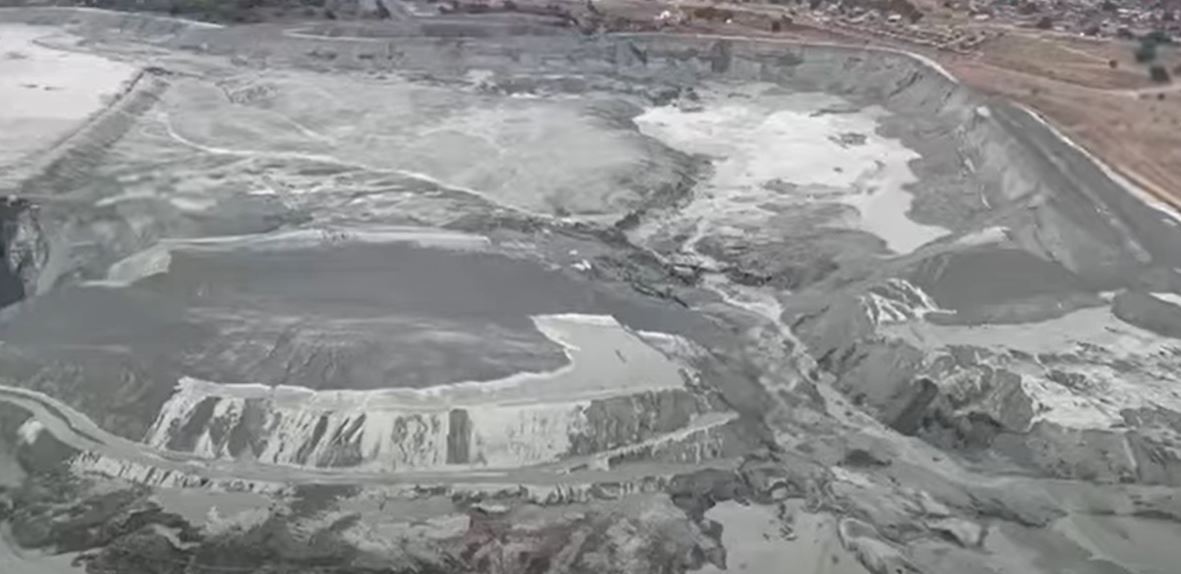
An aerial image of the site of the Jagersfontein tailings dam failure. Still from a video posted to Youtube by News24.
.
The image shows that the slimes in the eastern half of the facility have mobilised and escaped, but those on the western side appear to have been mostly retained by an internal structure. Ensuring that these do not mobilise must be a very high priority.
The breach itself is heavily eroded, meaning that it is difficult to determine whether the failure was caused by overtopping, piping or slope instability. On both side of the breach, fresh slimes are coating the walls of the tailings dam, illustrating the high mobility of the mine waste. Note the width of the walls of the tailings dam here – much greater than in other parts of the facility. I wonder why?
Whilst the main breach is clear, there are several other locations where there appears to have been substantial erosion of the dam walls. The image below shows these:-
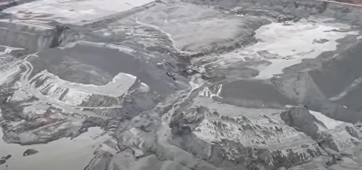
An aerial image of the site of the Jagersfontein tailings dam failure, showing other areas of erosion. Still from a video posted to Youtube by News24.
.
One of these is to the west of the main breach, on the left side of the image above. This appears to threaten the stability of the remaining tailings and needs very urgent attention. There are two more to the east side (on the right side of the image). I am unsure as to how these will have formed. Did the tailings develop waves within the pond that overtopped at other locations? The investigation will need to understand these features.
Meanwhile, on the other side of the Jagersfontein tailings facility, another slope failure has occurred:-
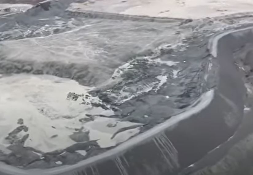
An aerial image of the site of the Jagersfontein tailing dam failure, showing a possible drawdown failure on the opposite side of the facility. Still from a video posted to Youtube by News24.
.
This appears to me to be a slump in the dam walls, possibly associated with the drawdown of the tailings. This will have left transient high pore water pressures in the dam wall, allowing failure to develop.
This is all captured rather nicely in Planet Labs latest imagery from the site, collected on 12 September:-
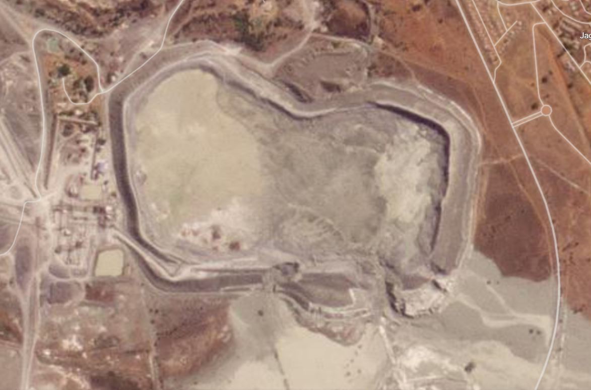
Satellite image showing the aftermath of the 11 September 2022 Jagersfontein tailings dam failure in South Africa. This image shows the tailings facility itself, including the multiple locations in which the walls have been compromised. Image copyright Planet Labs, used with permission.
.
The main breach is clear in the lower centre right of the image, but the other locations of substantial erosion, and the drawdown failure, can also be seen. As noted above, this image highlights the very urgent need to ensure that no further release of tailings occurs.
Yesterday I noted that the slimes had managed to reach the main channel, but it was unclear as to how mobile they had become. The Planet Labs satellite image below answers the question:-
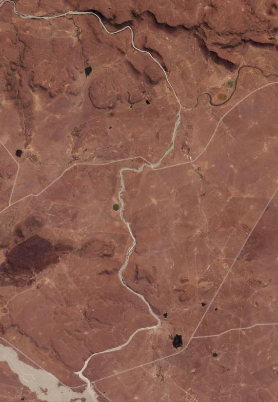
Satellite image showing the aftermath of the 11 September 2022 Jagersfontein tailings dam failure in South Africa. This image shows the slimes in the channel heading north from the mine site. Image copyright Planet Labs, used with permission.
.
It is clear that the tailings have travelled down the main channel, extending many kilometres from the main site. Another priorty now must be to ensure that the slimes being retaining by the small dam at the bottom of this image do not mobilise again.
Finally, it now appears that the ownership of this facility changed earlier this year, and that at the time of failure it was owned by Jagersfontein Developments, part of the Dubai-based Stargems Group. Reuters reports that the approach has been to reprocess the tailings to recover diamonds that have been accidentally dumped. It also reports that operations were stopped in 2020 due to high water levels, but that they resumed in 2021.
.
Reference and acknowledgement
Planet Team (2022). Planet Application Program Interface: In Space for Life on Earth. San Francisco, CA. https://www.planet.com/


 Dave Petley is the Vice-Chancellor of the University of Hull in the United Kingdom. His blog provides commentary and analysis of landslide events occurring worldwide, including the landslides themselves, latest research, and conferences and meetings.
On the partial failures of other parts of the dam, my guess would be that the rapid removal of buttressing support of the interior of the tailings dam, possibly combined with sudden steepening of the water table surface (which creates horizontal hydrostatic forces), might have caused this. The latter factor would be similar to slope instability related to reservoir drawdown.
The western part of the facility is it forms part of the original tailings dam built prior to 1970 when the diamond mine closed, and hence why it appears unaffected (look at Google Image from 2005/2009). The eastern part appears to have suffered one or two failures moving the wall downstream (wall benches seem offset). The failure zone is coincident with where the previous tailings dam walls terminated. Tailings once mobilised, liquefied – causing a breach similar to that seen at Mount Polley failure. The walls appear poorly maintained/built and I suspect that there was not much control over the rate of rise, pond size or in fact how they managed both water and tailings. There will be some discussion as to whether this tailings dam is still covered by Sth African legislation as it is no longer a mine.