
30 May 2022
Whitehorse escarpment, Yukon: a landslide caught on a monitoring camera
Posted by Dave Petley
Whitehorse escarpment, Yukon: a landslide caught on a monitoring camera
The Whitehorse escarpment is a c.50 m high steep slope close to the city of Whitehorse in the Yukon, Canada. It is formed from glaciolacustrine sediments, consisting mainly of silts, gravels and clay. Since the 1940s at least this slope has been subject to significant landslides – indeed there is a detailed report from 1959 that details landslides in the vicinity of Whitehorse airport, with a series of events recorded in 1948 for example. The landslides primarily occur in the spring and early summer months during the melting period, when water permeates through the coarser grained materials to the clay layers, where it pools and exits the slope, inducing failure.
A month ago, on 30 April 2022, a large failure developed on Robert Service Way close to downtown Whitehorse. This landslide, with an estimated volume of 3-4,000 cubic metres, caused some disruption but no loss of life. CBC has a rather nice image of the aftermath:-
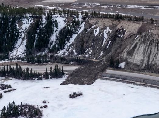
The 30 April 2022 landslide on Whitehorse escarpment. Image by Vincent Bonnay/Radio-Canada, via CBC.
.
Further potentially unstable locations have been identified, most notably near to Jeckell St. and 6th Avenue. This is the site on Google Earth:-
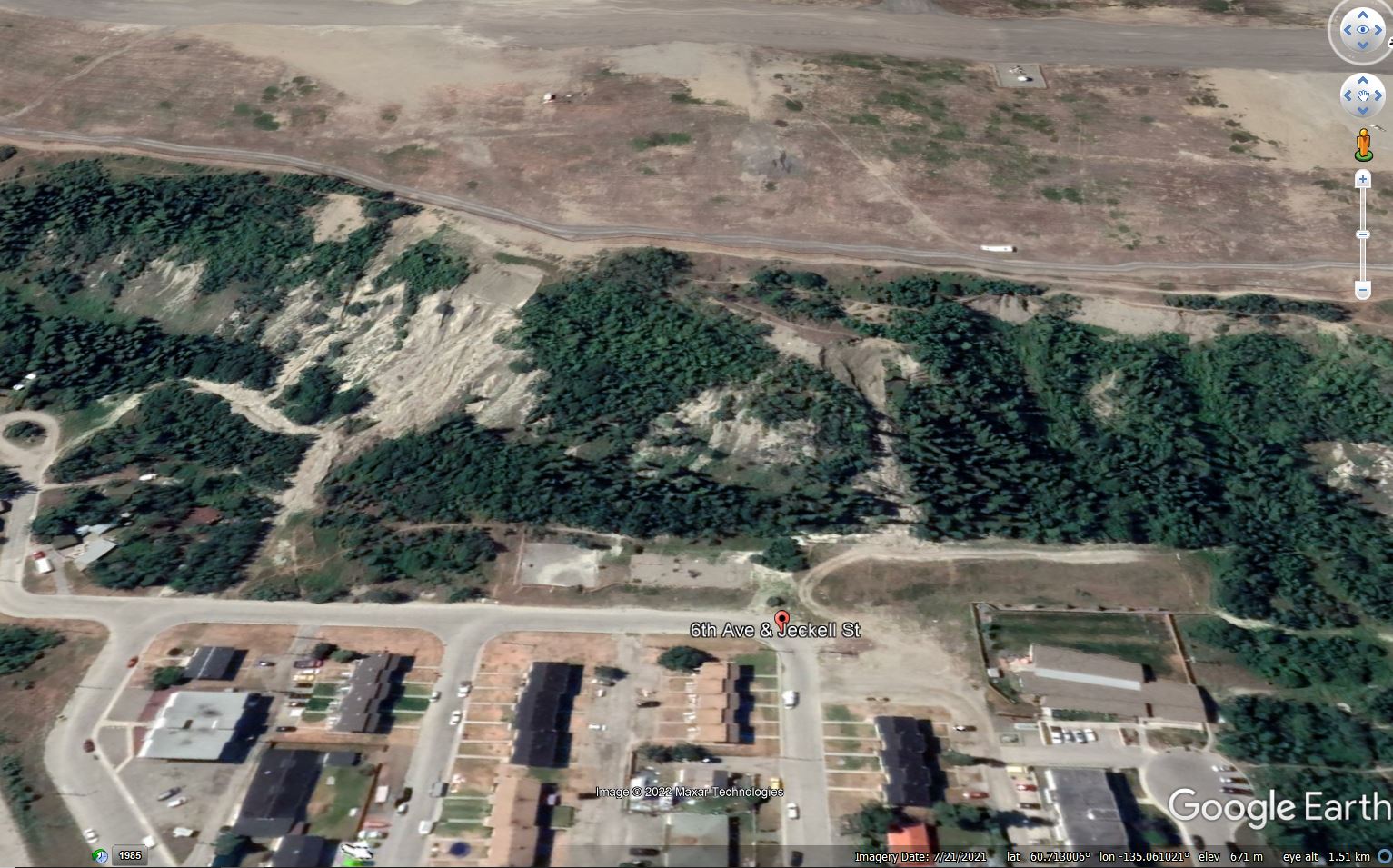
The site of the 28 May 2022 landslide on the Whitehorse escarpment in the the Yukon, from Google Earth.
.
The location is 60.712, -135.055. Late last week, Panya Lipovsky and Jeff Bond of the Yiukon Geological Survey positioned a monitoring camera at this site. Less than 24 hours later the slope failed. The landslide was captured on a brilliant video that they have have shared via the YGS Facebook page. You should be able to see the landslide video in this tweet from the City of Whitehorse:-
https://twitter.com/city_whitehorse/status/1530717484139126786
.
The aftermath of the landslide was captured in a photograph by a local resident, Amy Smarch:-
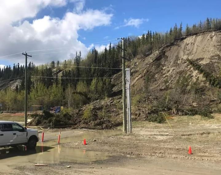
The aftermath of the 28 May 2022 landslide on the Whitehorse escarpment. Image by Amy Smarch via CBC.
.
Note that the childrens’ playground had been roped off prior to the failure.
The video is a really good illustration of the complex flow patterns in landslides of this type. The generation of quite large amounts of dust shows that parts of the landslide were quite dry, but it is interesting to see the water flowing out of the toe of the landslide as the movement came to a stop.
The entire escarpment is being monitored, and parts of the foot of the slope have been fenced off. There city has stated that there is no risk to public or private properties.
.
Acknowledgement
Thanks to loyal reader Tor Bejnar for highlighting this event, which was reported in the Arctic Sea Ice Forum.
 Dave Petley is the Vice-Chancellor of the University of Hull in the United Kingdom. His blog provides commentary and analysis of landslide events occurring worldwide, including the landslides themselves, latest research, and conferences and meetings.
A surprisingly quiet slide for it’s suddenness and scale, with only the trees cracking as an indication of disturbance.
Another landslide …
https://www.cbc.ca/news/canada/north/whitehorse-landslide-4th-near-first-one-1.6473085?fbclid=IwAR1wOwVExnj9GfSx2LMkYJflO893LHc6xh8ZlpTj70NSs5NHzH1u6LVkE_Q
I would just MOVE that playground forever. Not a good location at all. With more spring rain and such saturated slopes seems more slides are inevitable. Thankfully no one got hurt. I kept wonder how did anyone take that video from the landslide start zone without almost going over the brink themselves. Take care.
I spent some time working on this site after the landslides, inspecting the slopes on a daily basis to observe any new movement. All the landslides appear to have been triggered by groundwater seepage in thin sand layers interbedded with silt. Many more landslides could occur.
For the landslide that covered the road and ran out over the river, a sheet pile wall was installed to provide a basin to capture any future sliding masses.