
14 April 2022
Three very large landslides triggered by Tropical Storm Megi / Agaton
Posted by Dave Petley
Three very large landslides triggered by Tropical Storm Megi / Agaton
Over the last two days more information has started to emerge about the landslides triggered by Tropical Storm Megi / Agaton, which caused mayhem on the island of Leyte in the Philippines on 11 April 2022. The latest news on casualties is that at least 123 people were killed, the majority in landslides, but more remain missing.
Earlier this week I highlighted a major landslide at the village of Kantagnos in Baybay. The Inquirer has now published an image that provides a detailed view of this site:-
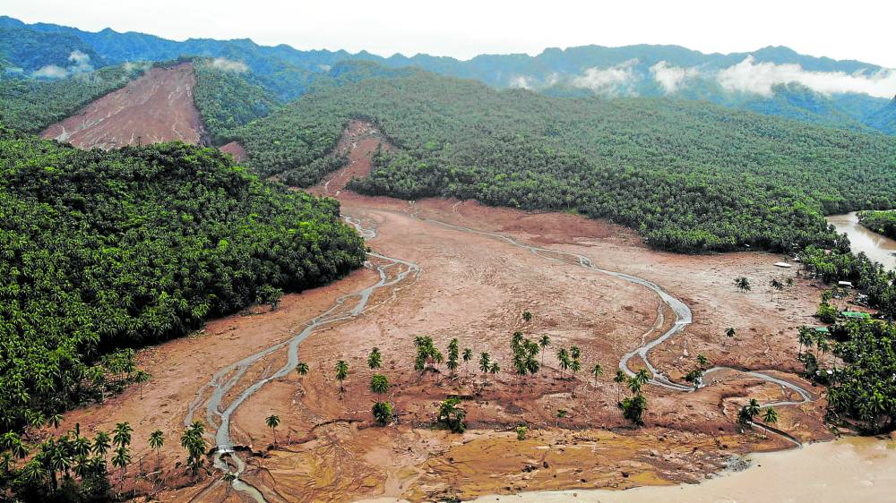
The aftermath of the landslide at Kantagnos village in Baybay City, Leyte, Philippines, triggered by Tropical Storm Megi. Image from Inquirer.net.
.
This is a very large failure in deeply weathered materials. The source appears to be a shallow slide on a steep, forested hillslope, but note that there are at least two other sources, albeit substantially smaller. The landslide has spread considerably to affect a very large swathe of land. The small number of standing trees might suggest that it was a comparatively shallow flow, but to a human or a weak structure it would have been devastating. Note the houses on the margin of the landslide on the right side of the image.
A second major event occurred in the village of Pilar in Abuyog. Here at least 29 people are known to have died, but as many as 177 more are reported to be missing. This total is likely to reduce, but it is clear that the landslide here has been devastating.
I can find few images of this landslide online, but Youtube has a drone video of the site:-
.
I have taken this image from the video, providing a decent impression of the failure:-
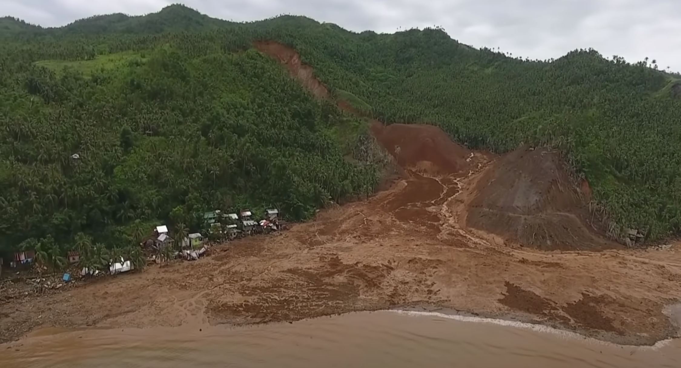
The devastating landslide at Pilar, triggered by Tropical Storm Megi. Image from Youtube drone video.
.
This appears to be a deeper seated landslide that has transitioned into a flow. Note the stripping of the vegetation on the slope on the right side of the image, which suggests to me that this was a high runout speed event. I also wonder if this event generated a displacement wave.
There are some videos online of secondary failures at this site, such as this one:-
.
The power of even this smaller landslide is appalling.
A third example occurred at the village of Bunga, also in Baybay. This landslide was also fatal – at least 17 people were killed here. The Jakarta Post has an image of this landslide:-
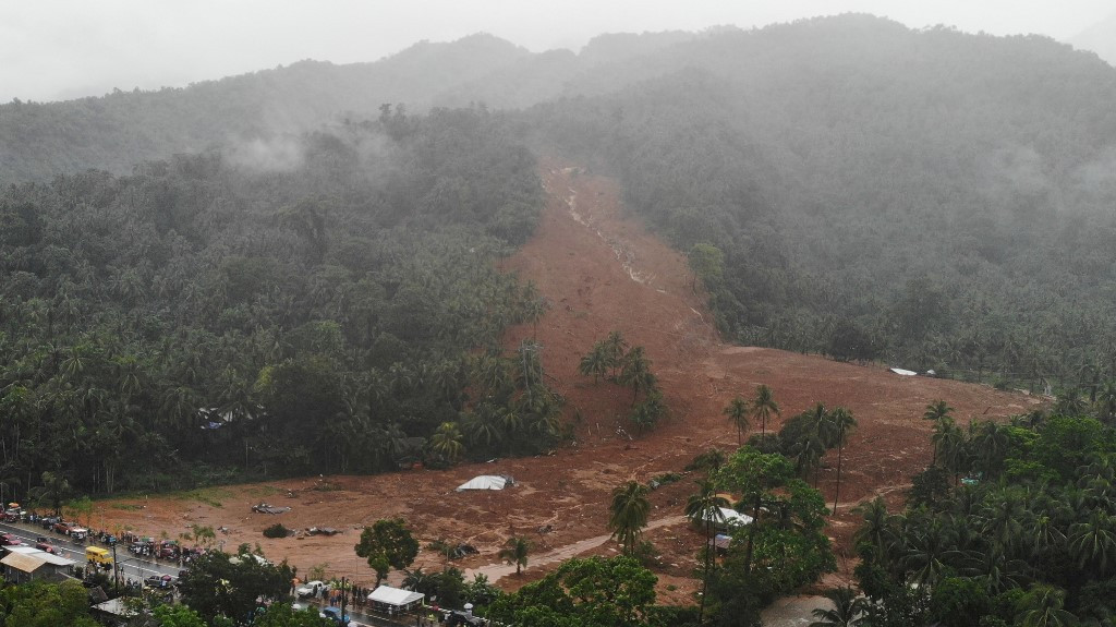
The landslide at Bunga in Leyte, triggered by Tropical Storm Megi. Image from AFP/Bobbie Alota via the Jakarta Post.
This landslide is broadly similar to the one at Kantagnos, although on a smaller scale.
I have been trying to track down the locations of these three landslides. At the moment, I believe that the following at correct:
Kantagnos in Baybay: 10.677, 124.853
Pilar in Abuyog: 10.714, 125.048
Bunga in Baybay: 10.773, 124.785
The impact of these landslides, and there are reports of many other events as well, is very serious. Tropical cuclones often cause landslides in the Philippines, but not in April.
 Dave Petley is the Vice-Chancellor of the University of Hull in the United Kingdom. His blog provides commentary and analysis of landslide events occurring worldwide, including the landslides themselves, latest research, and conferences and meetings.
This is a first for me. Even houses off to the side down the coast were damaged or destroyed by the initial wave.
What a terrible event. So sorry for the people. I am curious why the slide started where it did , and if the cleared are connecting to this above the town is also prone in the future.. The role of land disturbance was not discussed but is implied by the first image. Not a good situation. There may be mitigation measures they can take to try to prevent the slides from creeping larger and extending above the remaining town but it will be difficult. Tracking heavy rain and timing vacations may be the best way unfortunately. If the subsequent waves were as large as what the rescue group encountered, this event could well ripple further with more major rain events. The worst situation would be if the slope above the town failed – so I would be scanning for cracks and trying to ensure drainage is away from that area. Best of luck to these people and many others living on a precarious balance between natural processes, human development, and climate change impacts on precipitation intensity. There are measures that can be done to better ensure their safety or advise a safer place long term to live and farm.