
19 April 2022
Planet image of the Kantagnos village landslide in the Philippines
Posted by Dave Petley
Planet image of the Kantagnos village landslide in the Philippines
My friends at Planet have very kindly acquired a high resolution satellite image of the Kantagnos landslide in the Philippines, which occurred during Tropical Storm Megi / Agaton on 11 April 2022. This image, which shows most of the the landslide, was captured on 17 April 2022 at 22:15 UT. This is the image:-
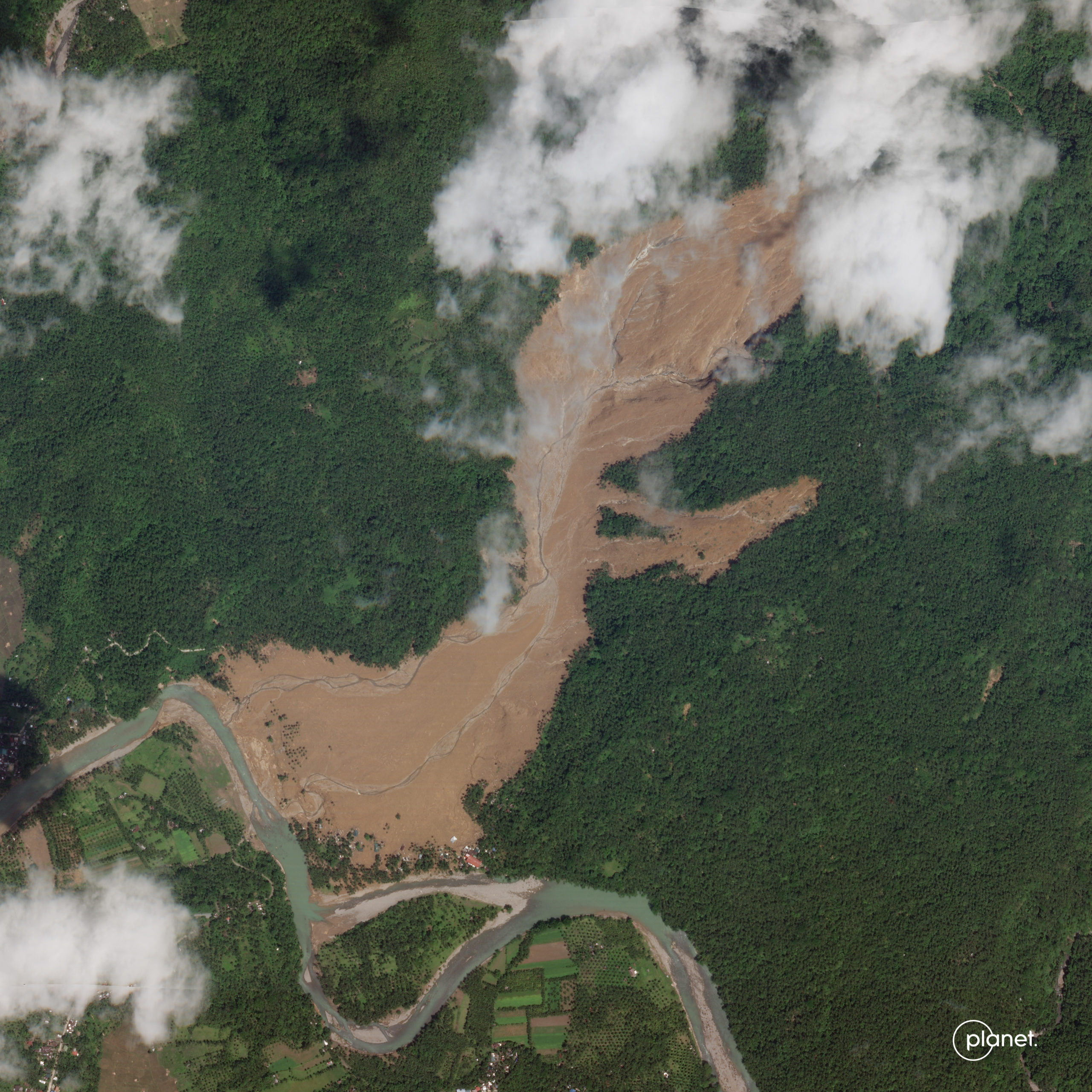
High resolution satellite image of the Kantagnos village landslide in the Philippines. Image copyright Planet, used with permission.
.
The main source of the landslide is in the cloud to the northeast of the image. As I noted previously, there is another substantial source that is visible. The flow has passed through a comparatively narrow gap and then spread. Note that there is very little evidence of landslide debris, implying a very mobile, fluid flow that has been removed by the river, which of course would have been in flood at the time of the failure.
For comparison, this is a Google Earth image of the same site ( I have included the location for reference), dated 20 April 2019:-
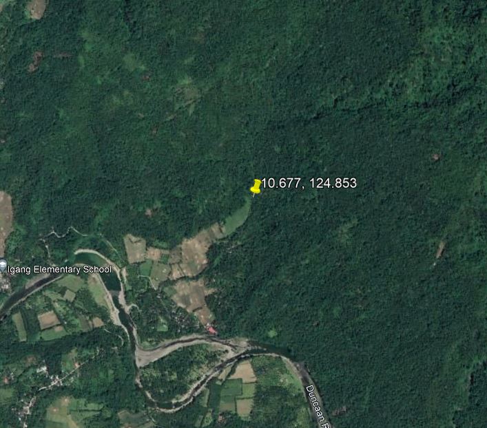
Google Earth image of the site of the Kantagnos village landslide in the Philippines.
.
The latest NDRRMC report lists 50 known fatalities at Kantagnos, with 93 people listed as missing. The total death toll from Tropical Storm Megi is now 175 people, with a further 110 people missing. The vast majority of the deaths occurred in landslides. Remarkably, an 11 year old boy survived the Kantagnos village in a refrigerator, but tragically his parents and a sibling were killed.
The impact of the landslide can be made clear by examining the inhabited area near to the river. This is the site in 2019:-
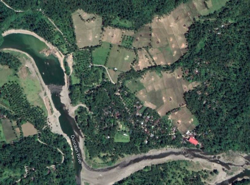
Google Earth image of the toe of the site of the Kantagnos village landslide in the Philippines.
.
And this is the site from the Planet image:-
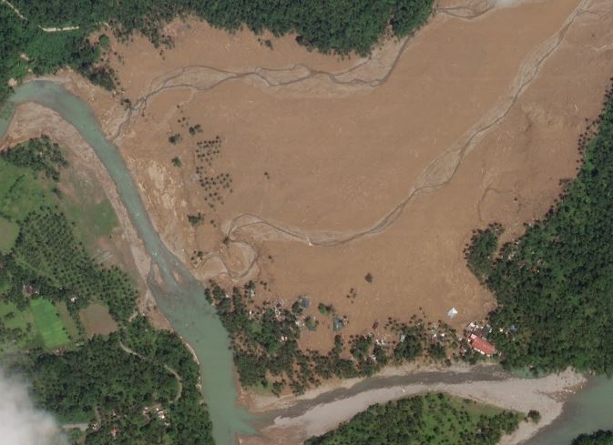
High resolution satellite image of the Kantagnos village landslide in the Philippines. Image copyright Planet, used with permission.
.
Hope fully, below you will see a slide comparison of the two images:-
.
It is clear that multiple houses have been destroyed in the landslide, as well as a substantial area of agricultural land.
.
Acknowledgement
Planet Team (2022). Planet Application Program Interface: In Space for Life on Earth. San Francisco, CA. https://www.planet.com/
Many thanks in particular to Rob Simmon of Planet for providing the image. Simply amazing.
 Dave Petley is the Vice-Chancellor of the University of Hull in the United Kingdom. His blog provides commentary and analysis of landslide events occurring worldwide, including the landslides themselves, latest research, and conferences and meetings.
….reminiscent of #OSO2014 incident in USA. …. where not to have village, resident, or #habitation.