16 July 2018
High resolution satellite imagery of the Japan landslide disaster
Posted by Dave Petley
High resolution satellite imagery of the Japan landslide disaster
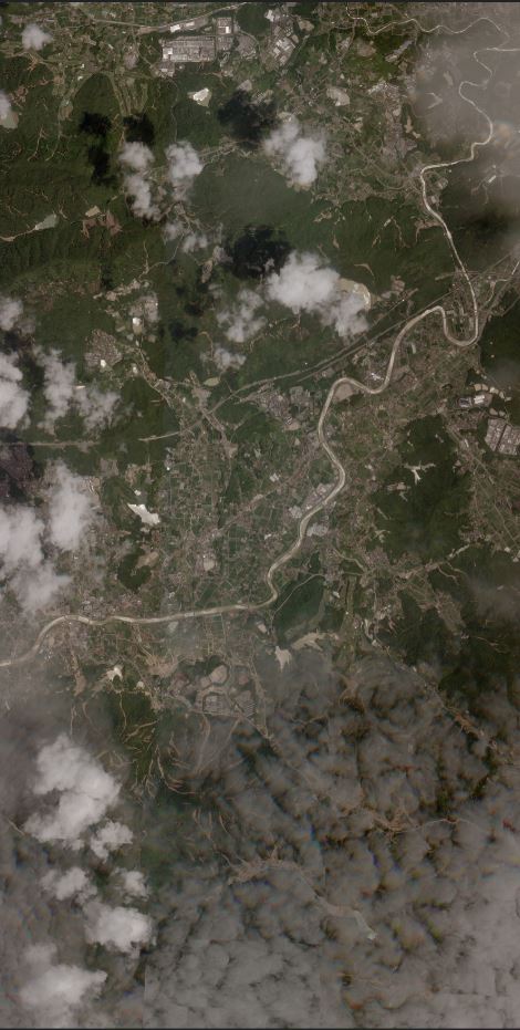
Planet Labs have now been able to collect some high resolution satellite imagery of the aftermath of the landslide and flood disaster that struck across Japan over the last few days. This is a SkySat image, which has a resolution of 0.8 metres per pixel. The image shows the area around Kure in the Hiroshima area, which was badly affected by the rains. This is the full image:-

Planet Labs SkySat image of Kure, Japan showing the aftermath of the Japan landslide disaster. Image courtesy of Planet Labs, used with permission.
.
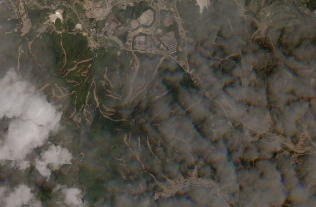
Whilst there was a little bit of light cloud when the image was collected, the extremely large number of landslides is clear. This is a part of the southern portion of the image:-

A portion of the Planet Labs SkySat image of Kure, Japan showing the aftermath of the Japan landslide disaster. Image courtesy of Planet Labs, used with permission.
.
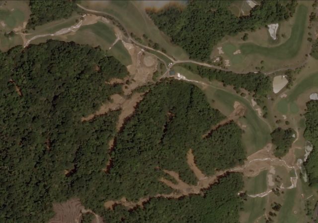
It is clear that there are dozens of landslides, mostly consisting of shallow slips that have transitioned into channelised debris flows, in the imagery. The nature of these landslides is perhaps best illustrated by this set, in the northeast of the image:-

Detail of a portion of the Planet Labs SkySat image of Kure, Japan showing the aftermath of the Japan landslide disaster. Image courtesy of Planet Labs, used with permission.
.
Here it is clear that the landslides started as small slips in the hilly, forested portion of the slopes. The debris has entered the channels and then entrained channel material. In many cases the same channel has seen slips from multiple slope portions. The debris has run out onto the golf course, where deposition of the mobile mass has occurred.
Of course it also serves to illustrate the extraordinary quality of satellite imagery that is now available. Many thanks to Robert Simmon at Planet Labs for his help with obtaining the imagery.
Reference
Planet Team (2018). Planet Application Program Interface: In Space for Life on Earth. San Francisco, CA. https://api.planet.com


 Dave Petley is the Vice-Chancellor of the University of Hull in the United Kingdom. His blog provides commentary and analysis of landslide events occurring worldwide, including the landslides themselves, latest research, and conferences and meetings.