27 June 2013
New high resolution images of Kedarnath – the cause of the debris flow disaster is now clear
Posted by Dave Petley
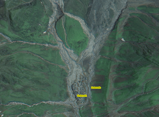
The Indian National Remote Sensing Centre has released a new set of images of the Kedarnath area, collected using the RISAT-1 instrument. These are very high quality images that allow a proper analysis of the events that caused the disaster. These can be viewed in their excellent GIS system, Bhuvan. In a post two days ago I suggested that the disaster might have been caused by two different events, first a landslide induced debris from that came from the area of the glacier to the northeast; second a glacial-related flow that came from the glacier to the northeast. In this post I am going to take a look at each of these. However, I’ll start with an image of the town itself. Note that all of the images shown here are taken from the Bhuvan system. This is the town, showing the flows that have come from the north:
The very high level of damage to the town is clearly evident. Also clear is the two flows:
- To the north-east, a flow that has come down the margin of the glacier (the large dark grey mass at the top of the image) and then spread out to hit the town.
- To the north-west, a flow that has come from the other glacier to strike the town. Note that much of this flow has passed to the west of the town, but it is also clear that a portion struck it directly.
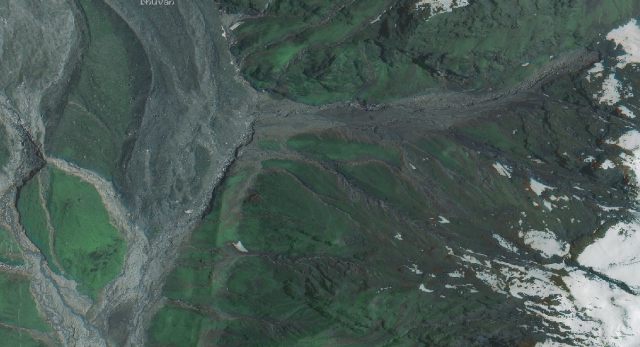
My interpretation is the that the flow from the northwest occurred after the one from the north-east, based on the juxtaposition of the sediments. I’ll now take a look at the source of the flow to the northeast. Upstream the area looks like this:
What is clear from this high resolution image is that the debris flow here was initiated by a landslide high on the hillside, which then ran down the slope entraining debris en route. At the slope toe it was channelized by the glacier into a narrow gully. It is clear that the flow eroded out a large amount of material is this area. Upon exiting the channel it spread out across the flood plain before striking the town. Rough parameters from Google Earth suggest a height difference from the crown of the landslide to the channel below of about 500 metres, and a length of about 1200 metres. The scar width is about 75 m, I think, so this is a large landslide. The area downslope of the failure was already a zone of active erosion, so the likelihood of entrainment was very high.
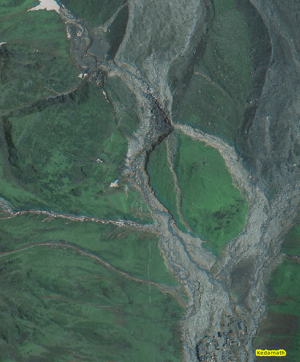
The second event, which came from the glacial area to the northwest, is very different. This was the area of greatest uncertainty, but the images tell us exactly what happened. This is the source area of the debris flow:
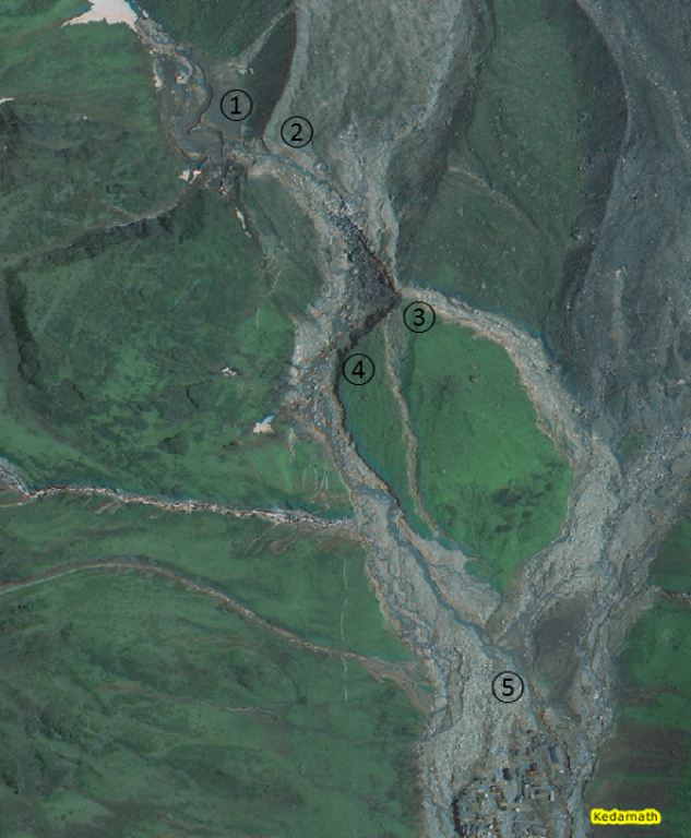
The key area here is the source zone, so I’ve enlarged and annotated this below:
This is my interpretation of what happened in this case – the bullet numbers refer to the numbers on the image above:
- In this area fresh, muddy sediment can be seen. This suggest to me that the moraine had created a blocked basin in this area, allowing water to build up in a pool.
- Eventually this pool overtopped the moraine barrier – the site of the breach can be seen at 2. Once overtopping of the barrier occurred, it catastrophically breached. This generated a very rapid release of the impounded water.
- The flow was so large that it over-topped the moraine on the other side of the glacial area, such that three flows were formed. One went southwest to join the valley from the earlier debris flow before swinging to the south to strike the town. This exploited an existing channel. The second was a much smaller flow that reoccupied an palaeo-channel. The volume of water and sediment that entered this channel was small, but note that it appears to have entrained debris en route (the channel widens downslope).
- Most of the debris flow traveled south down the main channel. The flow must have been huge as there is very substantial erosion in the area of 4. This is the source of many of the boulders now seen in the town. The flow traveled southwards, eventually starting to spread and deposit sediments before striking the town.
- Thus, it is clear that Kedarnath was struck by an earlier from from the northeast, then a later flow from the northwest. The latter was highly efficient, in part because of the earlier events and in part because the flow struck the town from two directions simultaneously.
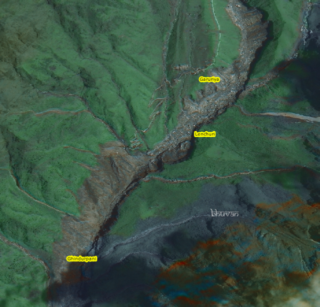
It is also worth noting what happened below Kedarnath. Downstream of the town, the flow was contained within the channel. As a result there was massive erosion of the riverbanks, as seen in the image below:
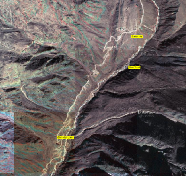
Compare this with the image (also from Bhuvan) from before the disaster:
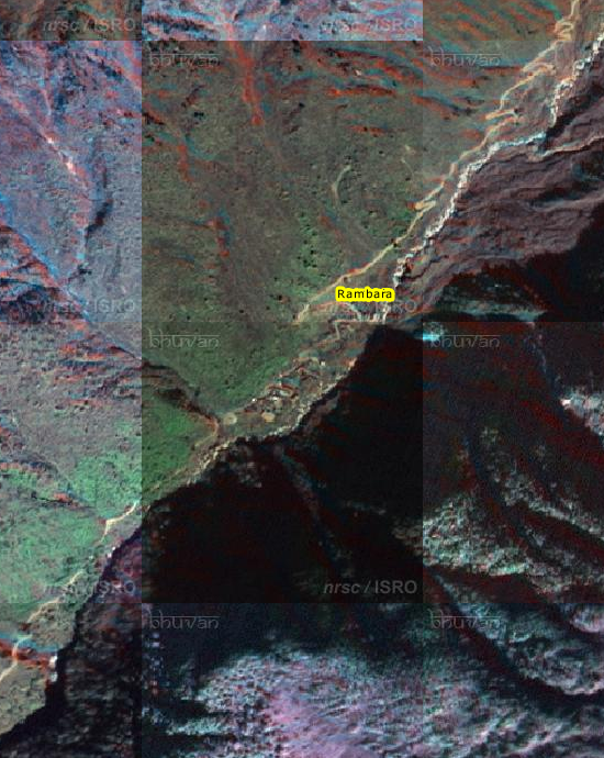
Although the focus has been on Kedarnath, downstream some of the smaller villages have been utterly destroyed by this event. This is the village of Rambara before the debris flow:
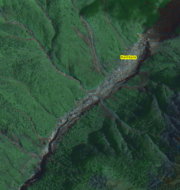
And this is how it looked afterwards:
..
There is nothing left of the village.


 Dave Petley is the Vice-Chancellor of the University of Hull in the United Kingdom. His blog provides commentary and analysis of landslide events occurring worldwide, including the landslides themselves, latest research, and conferences and meetings.
In addition to the extraordinary rains, I saw several comments at different youtube videos from people who live in the area stating their belief that deforestation contributed to the landslides. Do you detect any evidence of that in the photos? Do you think it had a role?
A couple of questions.
1. In (1) above, could the moraine be bounding a lake? Could it be an existing lake that filled to the brim because of a cloudburst directly above it? There indeed is a lake in the area, called Gandhi Sarovar / Chorabarital, and its position (as seen in Google Earth) seems roughly to correspond to the moraine.
2. I trekked to the temple just a couple weeks before the disaster. The damage downstream, especially to the village of Rambara, is understood. The village is almost level with the river at this point. But I am amazed by the damage to the mountain slope further down the trekking route (picture 5 from top or 4 from below). Can a river flooding 100 to 200 feet lower down in the valley cause such a wide swathe of mountainside landmass to slip? Or did this happen independently of the flood, maybe because of the heavy rain in the area?