18 July 2023
A mudflow on the banks of Loch Broom in northern Scotland
Posted by Dave Petley
A mudflow on the banks of Loch Broom in northern Scotland
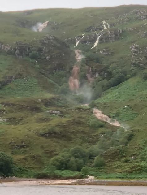
Heavy rainfall in northern Scotland has triggered an interesting mudflow on the banks of Loch Broom of Wester Ross in northern Scotland, near to Ullapool. The landslide was captured by a crew member from Shearwater Cruises , a local tourist boat operator. Two videos have been posted to Facebook. Unfortunately, WordPress won’t allow me to embed them, but the image below is a still from one of the clips:

The mudflow at Loch Broom in northern Scotland. Still from a video posted to Facebook by Noel Hawkins.
.
The Ross-shire Journal has a brief article about the landslide, but it adds little. The landslide appears to be in the vicinity of [57.880, -5.166], near to Alltnaharrie.
Hopefully the British Geological Survey will seek to track this one down, so more information should be available in due course. This is a favourite area of Scotland, so I’ll need to find the time to make a trip up there.


 Dave Petley is the Vice-Chancellor of the University of Hull in the United Kingdom. His blog provides commentary and analysis of landslide events occurring worldwide, including the landslides themselves, latest research, and conferences and meetings.
From the You-tube videos it actually looks like 2 different (adjacent) flows?
Intereresting but I think this is just a ‘muddy river’ rather than a mudflow. It certianly would not be classified as a ‘mud’ flow as the main agent is water in the stream. Looking at the video, the rivers flowing towards L Broom all appear to be in ‘spate’. I’ve not looked at the Ullapool rainfall data but I would expect it to have been high for a day or so previously.
I reckon the photo in the still was taken from about [57.8793,-5.1551] looking approximately 210. The river can be seen in various stages of flood and the upper, left hand section is about [57.8714,-5.1646] a little belwo a large collecting area of over a km^2. The delta in the foreground looks like a delta rather thna accumulated mudflows – the ‘mud’ in the basin is likely to be very sparse.
Very nice but i’m quiet sure it’s more of a muddy flood rather than a mud flow.