
30 June 2023
Lidar data of the Brienz-Brinzauls landslide site
Posted by Dave Petley
Lidar data of the Brienz-Brinzauls landslide site
The large (1.2 million cubic metre) landslide at Brienz-Brinzauls in Switzerland on 15 June 2023 has attracted a great deal of attention. The event was both spectacular and large, narrowly missing the village. There is a very nice presentation (in German) about the landslide on the http://www.albula-alvra.ch/ website – it is worth a look for the images if nothing else. It includes this post event Lidar image:
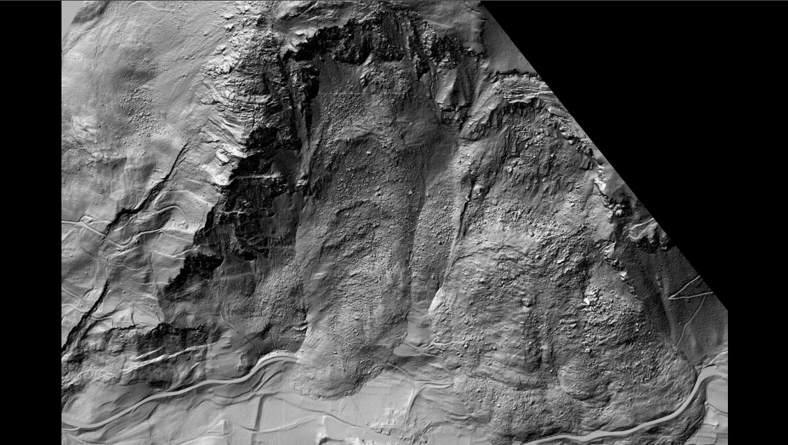
A post-failure Lidar image of the aftermath of the 15 June 2023 landslide at Brienz-Brinzauls in Switzerland. Image from a presentation posted to the website of Albula/Alvra.
.
Loyal reader Funkenbeachin has once again collated lidar and satellite data for the area, and has posted a film to Youtube to display it. This was an epic effort – creating the underlying dataset required extensive work, but the outcome is remarkle:-
.
Note that this video uses data collected before 15 January 2023, so that the recent landslide is not captured. Ken has marked the approximate outline of the landslide on the imagery. But look at what the Lidar image shows:-
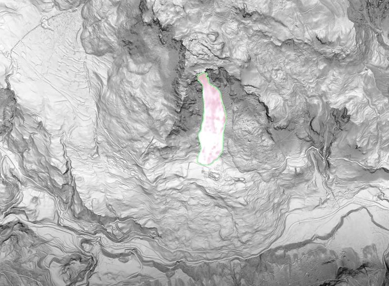
A pre-failure Lidar image of the aftermath of the 15 June 2023 landslide at Brienz-Brinzauls in Switzerland. The recent landslide is shown on the image. Still from a video posted to Youtube by Funkenbeachin.
.
That the events this month were part of a much larger landslide complex is not new, but the scale is breathtaking. The image above shows an ancient mega-landslide, with the most recent event being a much smaller failure from the rear scarp of the previous slide. The ancient landslide was sufficiently large to have reached the other side of the valley. To the east of the 15 June 2023 event is the deposit of another large landslide, also from the rear scarp of the mega-landslide. This appears to have been larger than the 15 June 2023 event.
And upslope of the rear scarp is an area of active deformation that is huge – this is the deep-seated gravitational deformation that has been described previously. Immediately above the rear scarp are a series of tension features, but the zone of deformation extends much further upslope:
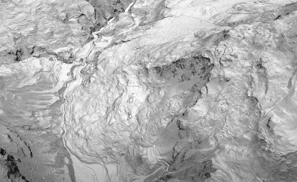
A pre-failure Lidar image of the aftermath of the 15 June 2023 landslide at Brienz-Brinzauls in Switzerland. Still from a video posted to Youtube by Funkenbeachin.
.
These types of very complex landslide systems are very common in high mountain areas, but this is a beautiful example.
 Dave Petley is the Vice-Chancellor of the University of Hull in the United Kingdom. His blog provides commentary and analysis of landslide events occurring worldwide, including the landslides themselves, latest research, and conferences and meetings.
Amazing! Thanks for posting.
The lidar video has been updated with the public information, post-slide lidar map:
https://youtu.be/LTGotVNQYT4
The video pan of lidar data has been updated to include pre-slide radar deformation mapping, the post-slide lidar map draped on the 2019 0.5-m lidar DEM and bibliography of recent geotechnical investigations:
https://youtu.be/0ra3JtJYn4Q