
16 May 2023
Planet images of the Lake Kivu landslides in the DRC
Posted by Dave Petley
Planet images of the Lake Kivu landslides in the DRC
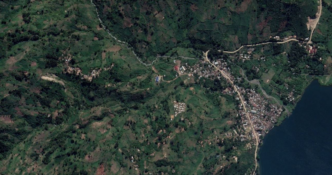
Planet has been able to collect a set of SkySat images of the Lake Kivu landslides in the Democratic Republic of Congo (DRC). This is an image of the area around Chabondo, which was hit by multiple channelised debris flows:-
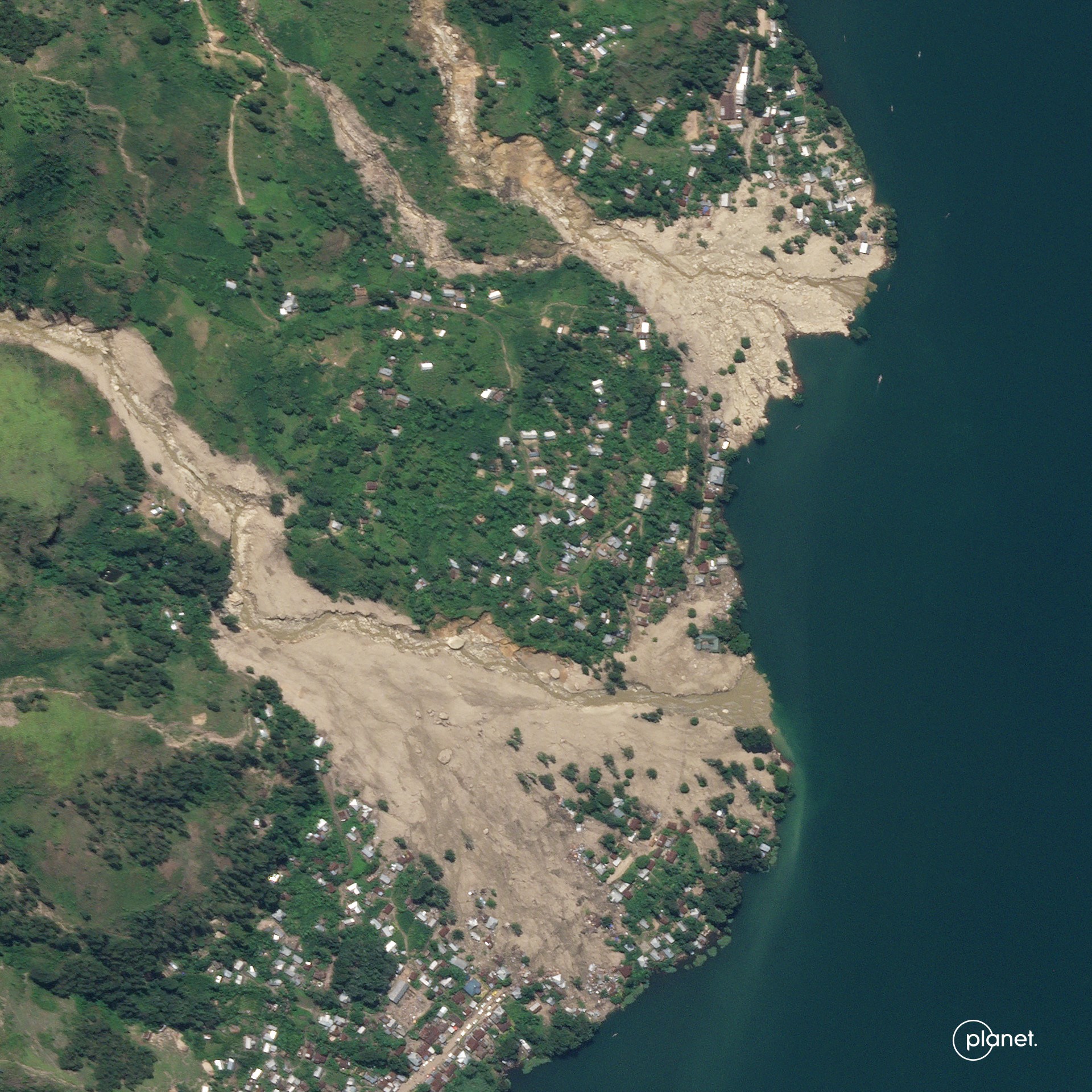
Planet SkySat image of the Lake Kivu landslides in the Democratic Republic of Congo. This image shows the area around Chabondo. Image copyright Planet, used with permission.
.
For reference, this is a Google Earth image of the same location, captured in 2019:-
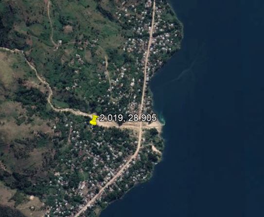
Google Earth image from 2019 showing the site of the Lake Kivu landslides at Chabondo.
.
This is a classic set of channelised debris flows that have flowed across the debris fan upon which the houses were built. The location was clearly high risk, and indeed there is an earlier debris flow track in the 2019 image. The Planet image shows that any building in the path of the landslides was destroyed.
The image below shows the track of these landslides, which have travelled several kilometres. The form is complex, with multiple sources and, in one case, connection between the major flows:
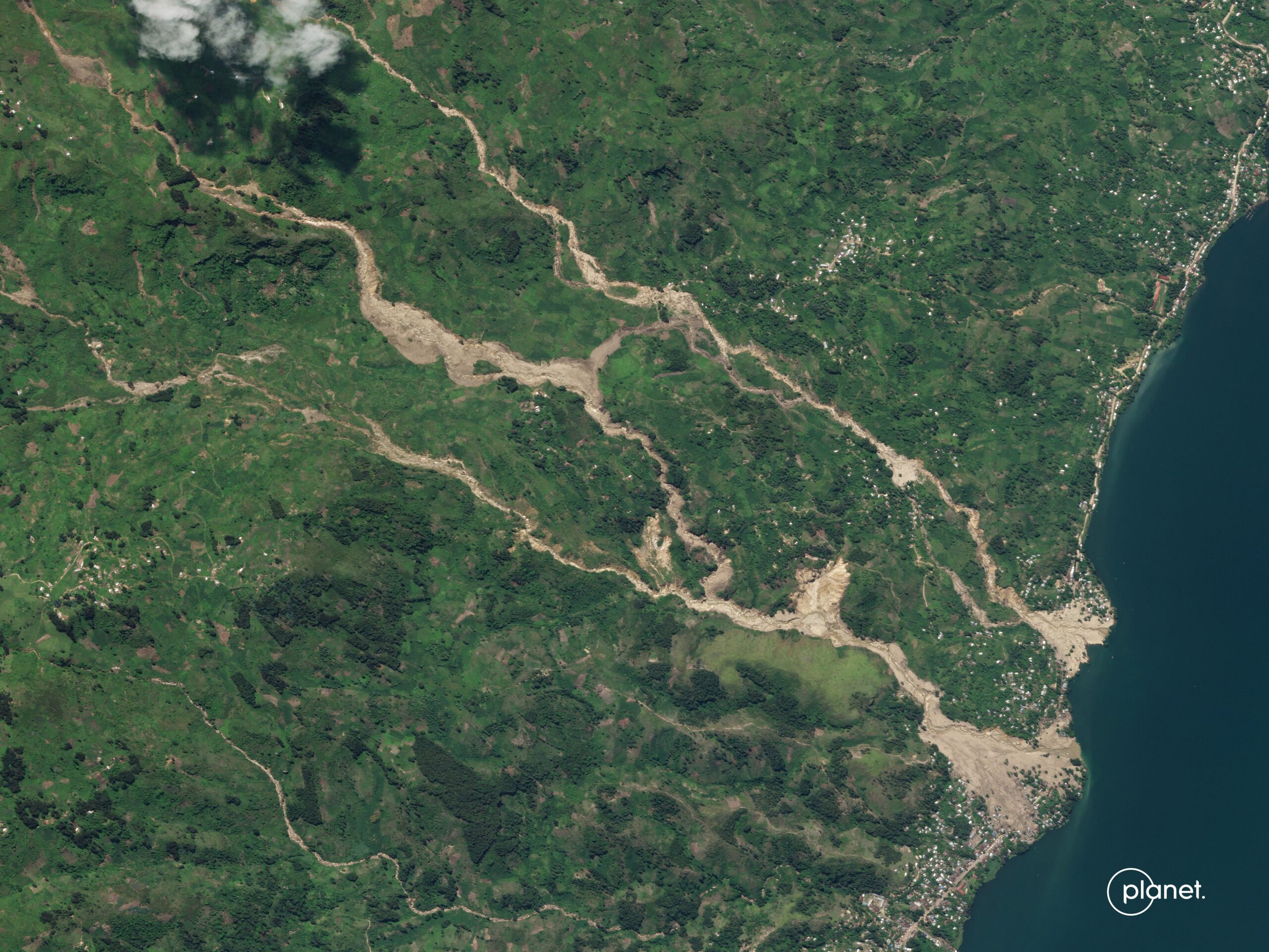
Planet SkySat image of the Lake Kivu landslides in the Democratic Republic of Congo. This image shows the area upstream of Chabondo. Image copyright Planet, used with permission.
.
The image illustrates the extreme power of the landslides.
Planet has also captured a high quality image of the landslides at Nyabibwe:-
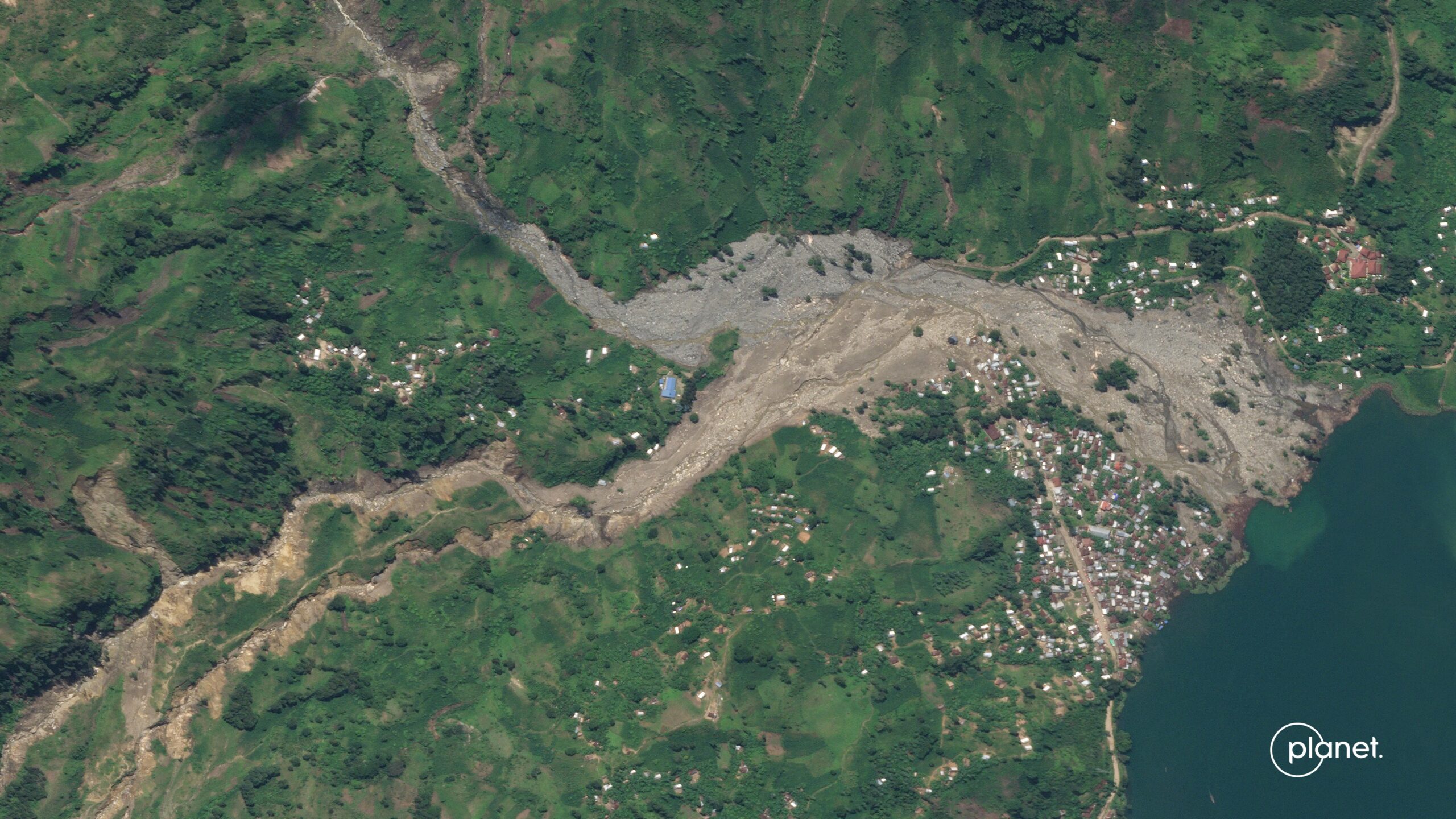
Planet SkySat image of the Lake Kivu landslides in the Democratic Republic of Congo. This image shows the area around Nyabibwe. Image copyright Planet, used with permission.
.
Once again, this is a Google Earth image for reference, from 2018:-
Google Earth image from 2019 showing the site of the Lake Kivu landslides at Nyabibwe.
.
The devastation to a large number of houses is painfully clear.
CNN reported on 11 May 2023 that the death toll from these events was at least 438 people, but that 1,000 more were missing. Other reports suggest a higher toll, but are unlikely to be correct. Meanwhile, a further landslide occurred at Vuveyi Lac in North Kivu on 9 May 2023, killing 10 people. There were also reports of a landslide at the Songambele mine, near Rubaya in North Kivu, killing at least six people. Some reports suggest that over 100 people may have been killed. Videos have posted to Twitter that allegedly show this event (I am unsure as to whether this is indeed the landslide), and the true picture remains very unclear:-
#URGENT: Quand l'inondation de Kalehe est en cours. Plusieurs sources locales à Bisunzu, près de Rubaya indiquent qu'un éboulement de terre a touché cette région ce lundi 08 mai. Le bilan n'est pas encore connu mais c'est près d'une dizaine de creuseurs artisanaux. #RDC pic.twitter.com/tmhdZXQ6bc
— Akilimali S. Chomachoma (@akilimalichoma_) May 8, 2023
.
Reference
Planet Team (2023). Planet Application Program Interface: In Space for Life on Earth. San Francisco, CA. https://www.planet.com/
 Dave Petley is the Vice-Chancellor of the University of Hull in the United Kingdom. His blog provides commentary and analysis of landslide events occurring worldwide, including the landslides themselves, latest research, and conferences and meetings.
….more death, and sadness….due to our uneasy and uninformed manner of habitation and awareness of nature…no observations can make real change happen, but allow for condolences for those lost, and sympathies for the missing and affected by nature’s fury….
Very interesting. Shows how good and important satellite imagery is.
Very interesting. Shows how good and important satellite imagery