
25 January 2023
The 30 August 2020 debris flow at Azijue village in Sichuan Province
Posted by Dave Petley
The 30 August 2020 debris flow at Azijue village in Sichuan Province
On 30 August 2020, a 3.2 million cubic metre debris flow struck Azijue in Sichuan province in China, killing three people and causing extensive damage to two communities, a school, the Chengdu–Kunming Railway (which was closed for 14 days) and three bridges. In a paper just published in the journal Landslides, Yan et al. (2023) have provided a comprehensive account of this interesting event.
The landslide can be clearly seen on Google Earth, located at 29.150, 102.870. This is an image from March 2016, showing the main channel and the substantial tributary down which the landslide flowed:-
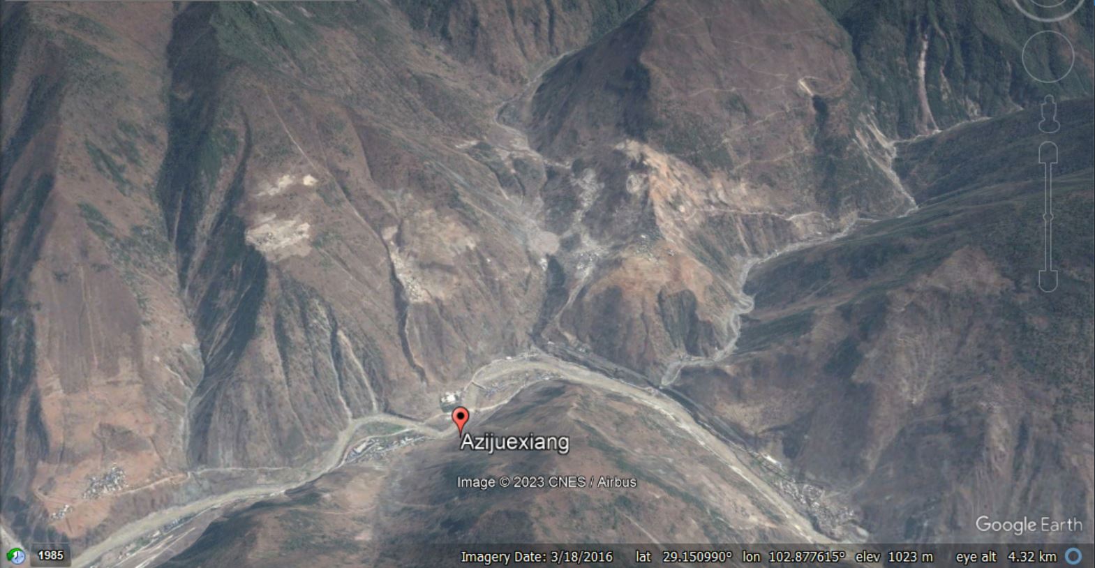
Google Earth image of the location of the Azijue debris flow, collected in March 2016.
.
Whilst this image shows the aftermath of the landslide, collected in November 2022:-
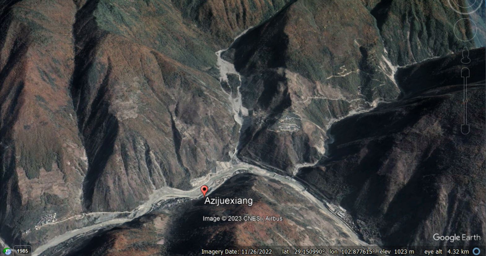
Google Earth image of the aftermath of the Azijue debris flow, collected in November 2022.
.
You should be able to compare the two images using the slider below:-
.
According to Yan et al. (2023), the landslide was triggered by about 90 mm of rainfall in a month that had already suffered abnormally high rainfall totals. But there is an unusual and interesting element to this landslide disaster. The debris flow initiated in the upper part of the catchment and travelled down the channel. En route it encountered two plateaus in the channel, which can be seen in the Google Earth image below:-
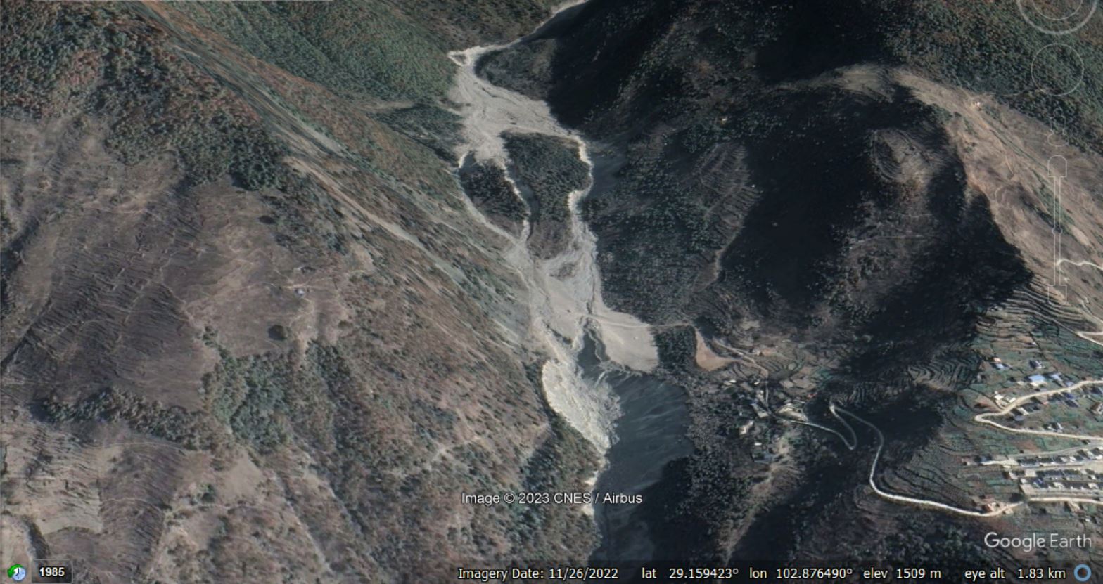
Google Earth image of the aftermath of the Azijue debris flow, showing the two plateaus in the channel, collected in November 2022.
.
These two plateaus consisted of deposits from previous flow events. The first plateau caused the flow to split into three components, which then merged again upon reaching the second plateau. But when the flow passed the downstream edge of the second plateau, a major secondary failure occurred in the channel bed, releasing a large volume of additional debris. The scar from this landslide can be seen in the lower centre part of the image above.
Yan et al. (2023) have produced a rather nice schematic diagram of the mechanism of this failure:-
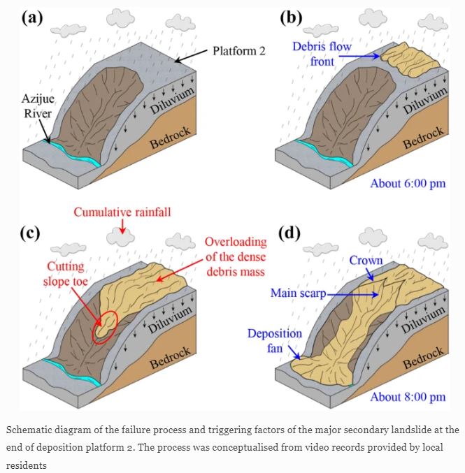
The mechanism of failure of the Azijue debris flow, from Yan et al. (2023).
.
Yan et al. (2022) attribute the damage and loss of life to this secondary landslide.
The impact of the Azijue debris flow was reduced by an effective early warning system. Yan et al. (2022) note that:
Most of the nearby residents were successfully evacuated due to a successful detection and early warning by the local government, which can be attributed to a specific microtopographic features of Heixiluo Gully. There were two wide and sub-horizontal platforms at the lower part of the gully that effectively reduced the kinetics of the debris mass before a major secondary landslide occurred at the end of the second platform over 2 h later. This 2-h interval gave enough time for most of the residents to escape from the final debris cascade.
This was a complex landslide event, most notably because of the in-channel secondary failure. Anticipating such processes is very challenging.
.
Reference
Yan, K., Wang, F., Fan, G. et al. 2023. The Azijue debris flow induced by rainfall on 30 August 2020 in Ganluo County, Sichuan Province, southwestern China. Landslides (2023). https://doi.org/10.1007/s10346-022-02022-2
 Dave Petley is the Vice-Chancellor of the University of Hull in the United Kingdom. His blog provides commentary and analysis of landslide events occurring worldwide, including the landslides themselves, latest research, and conferences and meetings.