3 November 2022
Pierreville: an interesting landslide in Quebec, Canada
Posted by Dave Petley
Pierreville: an interesting landslide in Quebec, Canada
On 1 November 2022 at about 3:30 am local time an interesting landslide occurred at Pierreville in Quebec, Canada. There is an excellent drone video of the aftermath of the landslide on Youtube:-
.
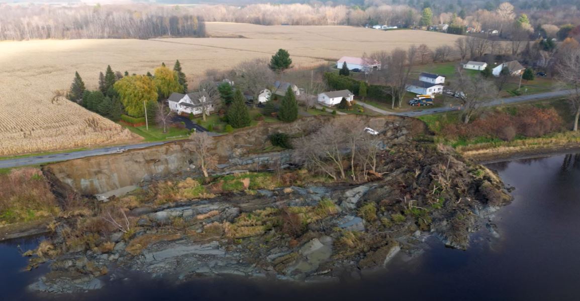
I think the location is 46.079, -72.846, although this needs to be confirmed. This image is from the video:-

The 1 November 2022 landslide at Pierreville, Canada. Still from a video posted to Youtube.
.
La Ronge Northerner has an article about the event (with what I take to be a surprising typo, if you can find it!). No-one was killed by the landslide, and the images indicate that the houses have not been damaged so far. A van driving along the road crashed into the landslide, the driver survived but was treated for shock.
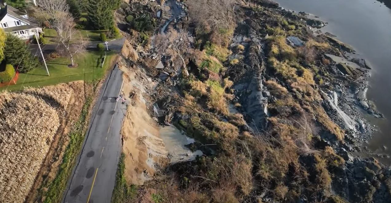
The landslide is a slump/spread, with some rotational component. This still from the video shows the rather complex form of the deposit:-

The aftermath of the 1 November 2022 landslide at Pierreville, Canada. Still from a video posted to Youtube.
.
Note the materials involved in the landslide, which are clearly fine-grained.
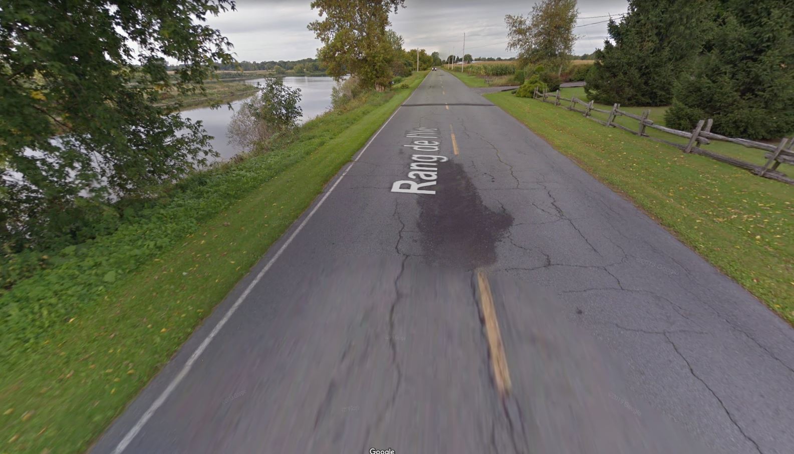
The timing of the failure is intriguing, as there had been no heavy rainfall and the river does not appear to be high or in flood. There is Google Street View imagery of the site from 2014 which shows a fair amount of cracking and some repairs to the road in the area that failed:-

Google Street View imagery from 2014 showing the site of the 1 November 2022 landslide at Pierreville, Canada.
.
This is not a smoking gun in isolation however – the cracking and repairs could have alternative explanations.
Geotechnical testing will now be needed to determine whether the houses affected will be safe to occupy in the long term, and to plan the remediation of the site to reopen the road. A key priority will be to identify the likelihood of retrogression of the headscarp.


 Dave Petley is the Vice-Chancellor of the University of Hull in the United Kingdom. His blog provides commentary and analysis of landslide events occurring worldwide, including the landslides themselves, latest research, and conferences and meetings.
Looks like a meander in river was nibbling at bank, too…
I speak Canadian French and English. I’m pretty sure this reporter’s first language is not English and some of his translations are… unfortunate. Here’s hoping the people he interviewed can’t read his article!
this grey clayey material looks bad…. after the last glaciation, there was the Champlain sea here, potential quick clay behavior ? Some landslides in the area are related to this quick clay pehnomenon : Nicolet landslide 1955 (under the bridge, you can still see the lobe) and Yamaska landslide 1974 (in front of the church apparently).
Just adding another comment :
– looks like some trees have been cut off on the river bank, on le left of the slide, some trunks dumped on the bank. Not sure how it could interact in the stability of the slope…
– an online article (https://ici.radio-canada.ca/nouvelle/1929438/centre-quebec-rang-ile-vanne-evacuation, in french) is saying that a pipe used for water supply has been severed during the slide. But if there was movement prior to the “big slide”, this pipe could habe been leaking for a while, possibly triggering it? drawning the timing of things is alaways difficult to telle afterward…!
Just my thoughts… thanks for the posts, as usual.
Surprising typo indeed!!!
the video that you shared shows the road not being created properly. Thank goodness, no disasters have occurred so far.