8 October 2021
Multiple landslides in Þingeyjarsveit and in Kinnarfjöll in Iceland
Posted by Dave Petley
Multiple landslides in Þingeyjarsveit and in Kinnarfjöll in Iceland
In recent days heavy rainfall has triggered multiple landslides in Iceland, at Þingeyjarsveit and in Kinnarfjöll. These are two settlements within 10 km of each other in the northern part of central Iceland. Fortunately there have been no casualties, but some houses needed to be evacuated to manage the risk.
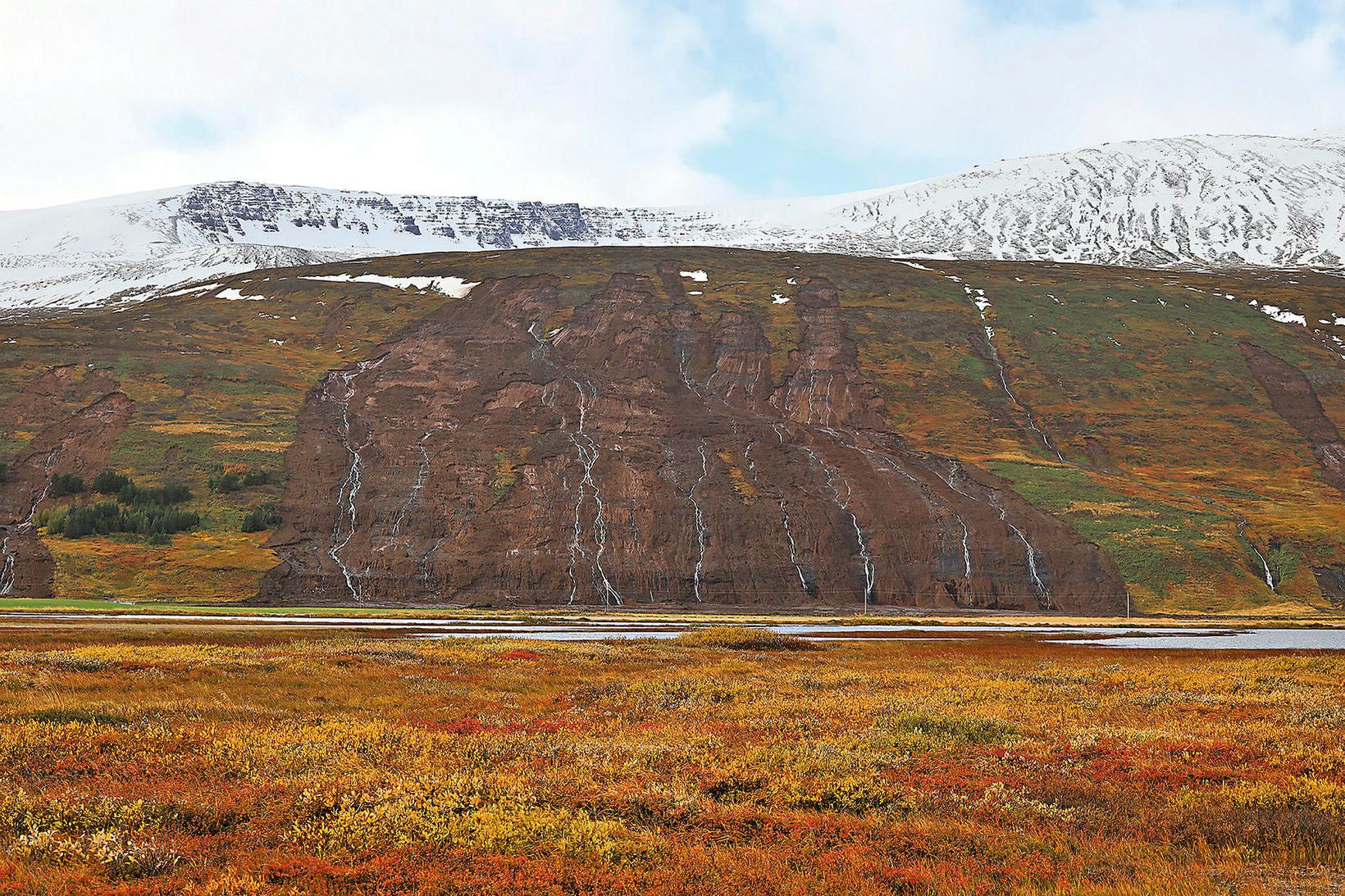
At Þingeyjarsveit, a series of large failures occurred. The best image that I have seem that illustrates these landslides was published on mbl.is:-

The coalescence of multiple shallow landslides at Þingeyjarsveit in Iceland. Image by mbl.is/Hafþór Hreiðarsson.
.
This is an interesting set of landslides, apparently resulting from multiple shallow slips high on the slope. These have combined to generate a large scale open hillslope flow in which there has been entrainment of material. Such landslides are usually caused by a loss of suction forces and / or high pore water pressures as a result of high intensity rainfall.
Note that this main complex is not the only landslide – there are further slips on each side of the image.
.
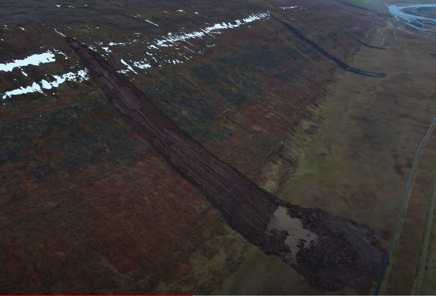
This landslide, from the video, is something of a classic:

One of the landslides at Þingeyjarsveit in Iceland. Image from a drone video uploaded to Youtube by Íslandsrásin.
.
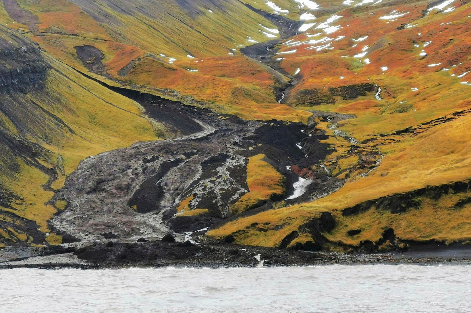
At Kinnarfjöll there were further multiple landslides. mbl.is has a rather spectacular image of these landslides as well:

Some of the landslides at Kinnarfjöll in Iceland. Image by Sverrir Yngvi Karlsson via mbl.is.
.
The two main landslides in this image appear to be channelised flows with a great deal of entrainment of material. The lower failure has flowed out of the channel. Note that the soil and debris is very black – this may indicate volcanic materials. There are other, different, landslides present too – for example, there is a shallow failure with a debris trail in the top left of the image and a disrupted translational slide in the middle right.
These landslides are worthy of a detailed investigation.


 Dave Petley is the Vice-Chancellor of the University of Hull in the United Kingdom. His blog provides commentary and analysis of landslide events occurring worldwide, including the landslides themselves, latest research, and conferences and meetings.
I assume you mean “Fortunately there have been NO casualties”
“Fortunately there have been casualties” gave me a chuckle.
I also note what appears to be a large slug of old slide debris or moraine-related morphology in the middle distance on the valley centerline. Beautiful image, in any case.
Excellent videos and images. It would be helpful for identification (specifically on Google Earth) if latitude/longitude in (4 places) decimal notation could be supplied by anyone who know the area. GE isn’t always helpful and theer is not enough detial to help with a GE search ‘on the ground. I have started some academic work looking at sediment connectivity and it woulkd be useful to develop the method. My indexing is for a point location, e.g. Þingeyjarsveit
as [65.7228,-17.3632] and a direction from that location (usually the fall-line for a flow) as {65.7228,-17.3632,180}.