8 June 2020
A further significant failure at the site of the Alta quick clay landslide
Posted by Dave Petley
A further significant failure at the site of the Alta quick clay landslide
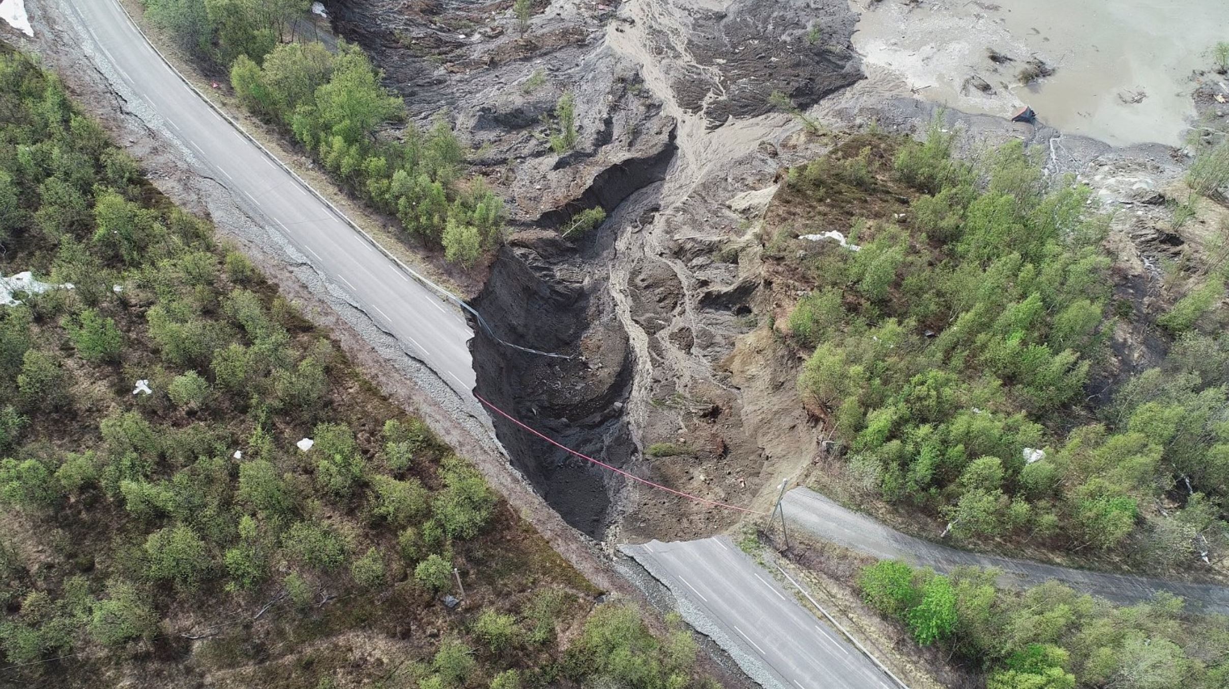
In Friday night a further significant failure occurred at the site of the Alta Quick Clay landslide. The best image that I have found of this new failure is on the nettavisen.no website:-

The new failure, on Friday 5 June 2020, at the site of the Alta Quick Clay landslide. Image from www.nettavisen.no, Photo: Anders Bjordal / NVE / NTB scanpix Foto: (NTB scanpix).
.
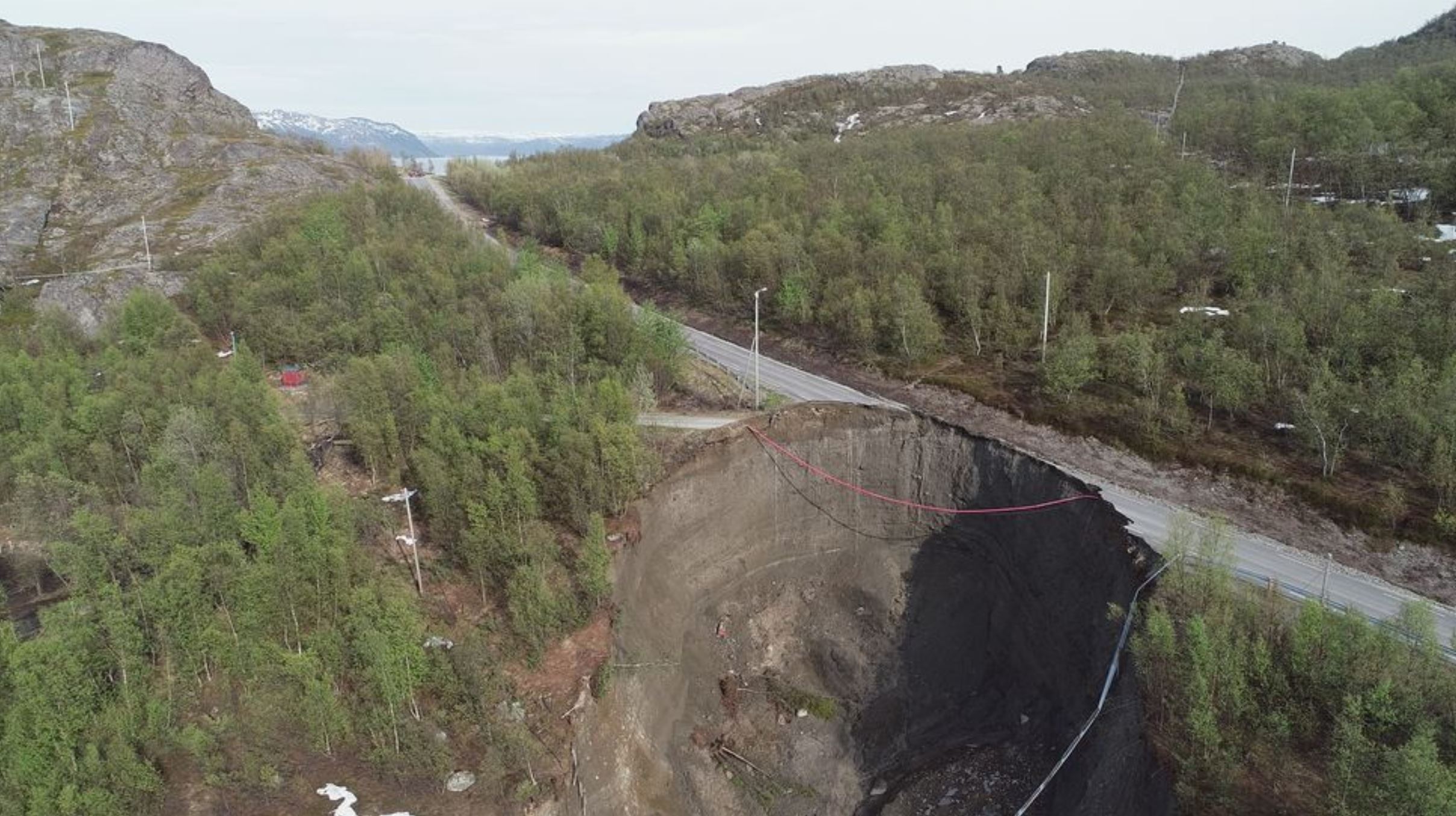
It appears that this is another major failure that is retrogressive from the events of Wednesday. This landslide is notable for the destruction of the road. Note that the landslide scar is almost completely evacuated – i.e. there is no landslide debris in sight – suggesting that this was once again a highly mobile event. The iTromso website has an image taken from a different angle:-

A view of the scar of the Friday 5 June 2020 Alta quick clay landslide. Image from iTromos, Photo: Anders Bjordal / NVE / NTB scanpix.
.
This image of the landslide scar shows the thick layer of marine silts and clays that is responsible for the high mobility of these landslides.
I suspect that the focus now will be on securing the road, which is clearly an important transport link for people living in this area. I hope that in due course some bathymetry work might be undertaken offshore from the landslide. It would be extremely interesting to understand the mobility of the landslide on the seabed.
.
On reflection 1: Heavy rainfall causes landslides in Hong Kong
Heavy rainfall yesterday caused landslides in the Sai Kung, Shatin, and Tai Po areas of Hong Kong yesterday. News reports indicate that 24 landslides have been observed.
.
On reflection 2: Coseismic landslides in Kamikochi, Japan
An ongoing swarm of small earthquakes is causing landslides and rockfalls in the Kamikochi area of Japan. The Asahi Shimbun has some good images.


 Dave Petley is the Vice-Chancellor of the University of Hull in the United Kingdom. His blog provides commentary and analysis of landslide events occurring worldwide, including the landslides themselves, latest research, and conferences and meetings.
The latest slide is on the old road; there’s a new tunnel shown on Google maps, so it shouldn’t affect transport.
I think the earth is melting
Aerial photographs available on norgeibilder.no (2005-2018) show a new road from the former national road (E6) down to the cabin in 2015. Also the cabin itself grew considerably in size between 2011-2018. On the other/eastern side of the ridge, a large rock landfill appears in 2015. The landfill is material from the 2.5 km long tunnel for the new E6 driven throught the mountain just 2.0-2.5 km south of the landslide (opened in Dec. 2016). Does this divert drainage from the valley Kråvikdalen towards the landslide in the west? Together with unusually high amounts of snow, little ground frost and the late, rapid snow melt, these construction activities might triggered the landslide. I leave the conclusions to the experts though.
If you look at Kraknesveien, Alta on Google earth you can see the indented bays where events like this have clearly happened in the past.