14 March 2018
Papua New Guinea earthquake – continued landslide impacts
Posted by Dave Petley
Papua New Guinea earthquake – continued landslide impacts
The continued scandalous response (or, more precisely, non-response) of the international community to the Papua New Guinea earthquake is highlighted in this article on the New Zealand website stuff.co.nz. The article includes this telling section:-
New Zealander Tony Stuart, Executive Director of UNICEF Australia, visited the Mt Hagen area last week and says while the locations are very different, the devastation is familiar. “It’s like Christchurch, but without the response.” People were walking around saying “why doesn’t the rest of the world want to come and help us?” he said. “Because so much of it is hilly terrain, houses just disappeared. But on the flat as well, solid brick buildings were completely flattened. It’s taken everything down.” “It’s clear that there are going to be far more fatalities”.
Meanwhile, I highlighted immediately after the earthquake that large numbers of landslides were likely, and subsequently that landslide dams pose a significant threat. That now looks all too prescient, sadly. On 13 March the local newspaper, the Post-Courier, reported that:-
Three villages have been completely wiped out in an avalanche of water and landslides last Wednesday. The villages, with a population of 47, are located at Jam Valley between Hela and Western provinces. Ten people have been confirmed dead and another 17 were seriously injured. Because of its remoteness, news of the disaster reached relief aid workers last weekend, four days after the disaster.
Hides PDL7 Special Purpose Authority chairman Andy Hamaga said that water in three mountain lakes had moved against the sides of the mountains, forcing them to collapse and emptying the lakes’ waters and mud into the unsuspecting villages. Mr Hamaga said these villages – Togayu, Oka and Sepitu – are situated within the Hides PDL 7 project area and come under the Kamia-Kera Block of the PNG LNG Project landowner group in Hela Province.
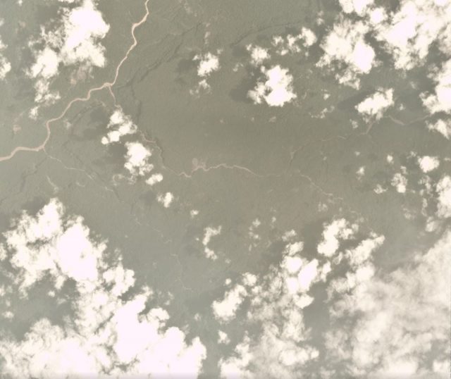
It continues to be really difficult to get decent satellite imagery of this area. But this is a Planet Labs image of a part of Mount Sia, taken on 26th Feb at 00:13 UTC, the day after the earthquake. The image is affected by haze and cloud, but the terrain is visible:-

Planet Labs satellite image of a part of the Mount Sisa area after the Papua New Guinea earthquake
.
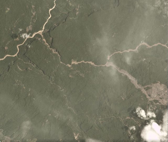
This is exactly the same area from a Planet Labs image dated 7 March 2018:-

Planet Labs image of the area affected by the Papua New Guinea earthquake. Image dated 7 March 2018.
.
Sadly the area upstream that has been affected by this event is covered in cloud. But there is no doubt that this area has been affected by a catastrophic event, most likely landslide related.
Reference
Planet Team (2017). Planet Application Program Interface: In Space for Life on Earth. San Francisco, CA. https://api.planet.com


 Dave Petley is the Vice-Chancellor of the University of Hull in the United Kingdom. His blog provides commentary and analysis of landslide events occurring worldwide, including the landslides themselves, latest research, and conferences and meetings.
thanks