2 March 2018
More detail on the Papua New Guinea landslide dams
Posted by Dave Petley
More detail on the Papua New Guinea landslide dams
Information remains sketchy about the Papua New Guinea landslide dams that I have highlighted over the last few days, not least because the area remains cloud-affected, which is rendering the collation of satellite imagery difficult. The best image that I have been able to track down is a Sentinel 2 image that was collected on 27th February 2018, and available via the EO Sentinel Viewer tool. This image does not capture the entirety of the earthquake affected area, so we remain unsure as to what might be lurking under the cloud. It does however capture a series of landslide dams in the epicentral area. This is an overview image of the sites that I describe below; I believe that this area covers the Tagari River, a tributary of the Heggio River [corrected 2nd March in light of comment below]:-
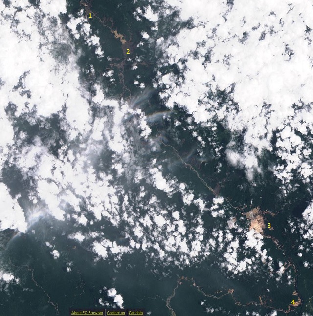
Overview image of the Papua New Guinea landslide dams. The numbers indicate the locations of the sites identified below. Sentinel 2 image collected on 27th February 2018, via ESA, viewed via the EO browser.
.
In terms of detail I shall work downstream.
1. The first dam that is apparent is the one shown below, located at -6.036, 142.899. This appears to be about 1 km in length (in terms of the amount of river that is blocked), and a lake has formed. This dam appears to have breached already, so should not accumulate much more water, but may be problematic in a flood:-
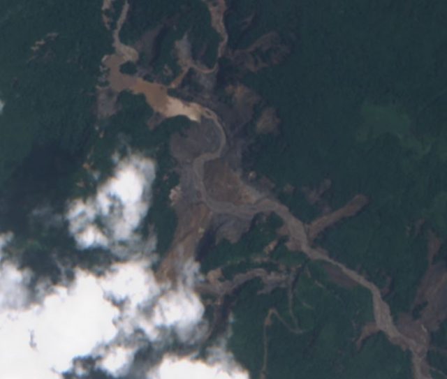
The first of the Papua New Guinea landslide dams. Sentinel 2 image collected on 27th February 2018, via ESA, viewed via the EO browser.
.
2. Immediately downstream (the distance is about 5 km) is a much larger and much more complex landslide dam, located at -6.074, 142.938. This appears to have blocked the river over a distance of over 2 km, although the height of the debris is hard to ascertain. On the images this looks like some sort of spread or flow type slide:-
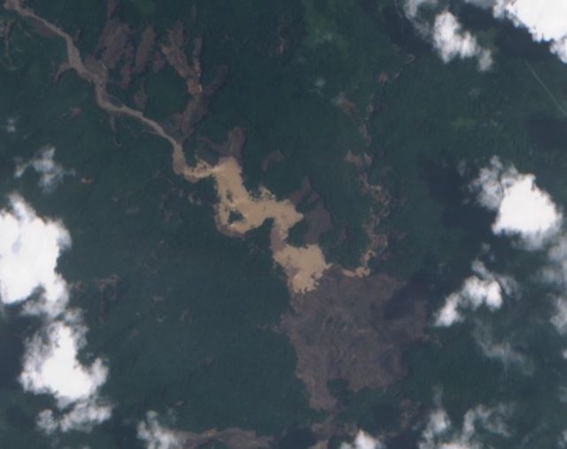
The second of the Papua New Guinea landslide dams. Sentinel 2 image collected on 27th February 2018, via ESA, viewed via the EO browser.
.
Note the very substantial lake that has already developed at this site. That lake appears to be about 1.5 km in length at the time that the image was collected. Downstream from this location is at least one further major slide that may have blocked the valley.
3. Further downstream the largest landslide complex appears to be the largest landslide in this area, located at -6.247, 143.066:-
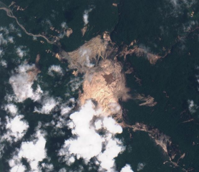
The largest of the Papua New Guinea landslide dams. Sentinel 2 image collected on 27th February 2018, via ESA, viewed via the EO browser.
.
Whilst much of this landslide is in cloud, it appears to be a giant rockslope failure. It has blocked the river over a distance of at least 2 km. I suspect that this may well be the dam that is visible in the videos by Bernard James McQueen, and now posted on Facebook. This is probably the most worrying of all of the dams. At present the volume of impounded water is small due to the blockages created upstream.
4. Finally, a few kilometres downstream are some other landslide dams of various scales, including this sequence, which is located at -6.327, 103.105. I suspect here the blockages are small, but nonetheless are of concern:-
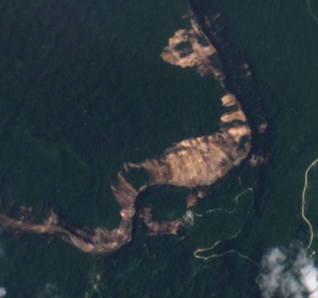
Sammler rockslides, part of the The largest of the Papua New Guinea landslide dams sequence. Sentinel 2 image collected on 27th February 2018, via ESA, viewed via the EO browser.
.
So, overall, there are at least four landslide dams on the Heggio River, some of which appear to be large. The level of hazard, and the vulnerability of people and other assets downstream, in unclear at present. But, the possibility of a sequential failure of these dams cannot be ruled out. In an area with metres of rainfall per year, these Papua New Guinea landslide dams need urgent attention.


 Dave Petley is the Vice-Chancellor of the University of Hull in the United Kingdom. His blog provides commentary and analysis of landslide events occurring worldwide, including the landslides themselves, latest research, and conferences and meetings.
Dave, I worked on the pipeline project and am pretty sure the drainage is the Tagari River, a tributary of the Heggio. I flew down the valley several times and there were numerous very large landslides on the canyon walls prior to the earthquake, including one labeled Landslide Mtn. on the 1:250k geologic map. The western slope is a dip slope limb of the Manada anticline in limestone. Some of the prior failures were translational along bedding planes but others are deep seated.
Dave, nice post! A news story posted by Bloomberg has shows a GeoEye-1 image taken on March 1 (https://www.bloomberg.com/news/articles/2018-03-02/satellites-images-show-damage-from-papua-new-guinea-earthquake). From that image, it appears that your landslide #2 has breached in two locations. However, the lake behind it is even larger than in the Sentinel 2 image you shared (Feb. 27).
Some before and after satellite images of two major landslide dams on the Tagari River.
https://www.bloomberg.com/news/articles/2018-03-02/satellites-images-show-damage-from-papua-new-guinea-earthquake
Did the earthquake trigger failures of waste dumps or other mining infrastructure in PNG?
Dave, an excellent post for our purposes and information of dams. Updated status of dams would be appreciated.