
14 January 2018
Villa Santa Lucia landslide in Chile – high resolution satellite images from Planet Labs
Posted by Dave Petley
Villa Santa Lucia landslide – high resolution satellite images
At last the clouds have cleared sufficiently above the area affected by the Villa Santa Lucia landslide in Chile , which killed 18 people on 16th December 2017, to become visible to optical satellites. Planet Labs captured a very high quality image of the area, including the full length of the landslide, on 11th January. Further images have been collected since. This is a 3 m resolution image of the whole of the landslide:-
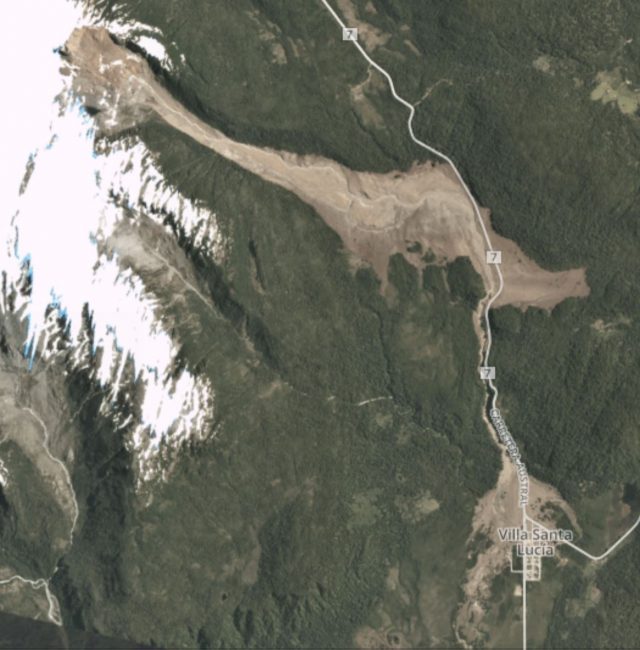
Planet Labs image of the Villa Santa Lucia landslide. 3 m resolution imagery collected on 11th January 2018
.
The landslide consists of three main sections – a rotational landslide in the scarp area, a flow type landslide that has deeply eroded the channel (and deposited material at the toe), and a smaller flow along the steep, narrow channel adjacent to Highway 7, which then spread across the fan to bury a part of the village of Villa Santa Lucia.
This is a Planet Labs image of the source of the landslide. Note the band of snow in the scarp area that marks the top of the slumped and rotated block. Much of this block is intact:-
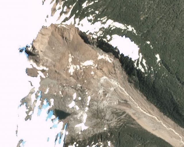
Planet Labs image of the source area of the Villa Santa Lucia landslide. 3 m resolution imagery collected on 11th January 2018. Note that the slide involved the more pink material towards the top of the image,. The duller grey rock in the bottom left side was not involved.
.
The main part of the track of the landslide appears to be a zone of intense erosion and entrainment, with deposition occurring on the margins and at the toe of the landslide:-
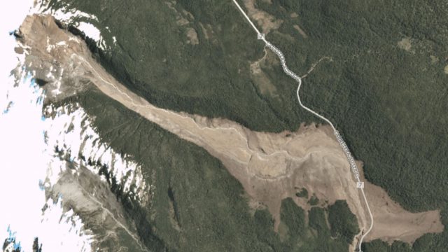
Planet Labs image of the main track of the Villa Santa Lucia landslide. 3 m resolution imagery collected on 11th January 2018.
.
A portion of the slide then turned 90 degrees and travelled down the narrow gully to Villa Santa Lucia. It spread across the fan to engulf the northern part of the village:-
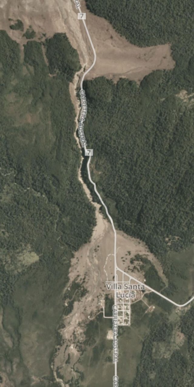
Planet Labs image of the portion of the Villa Santa Lucia landslide that struck the village. 3 m resolution imagery collected on 11th January 2018.
.
It is this lower portion of the landslide upstream of the town that was caught in the video that is now on Youtube:-
.
Reference
Planet Team (2017). Planet Application Program Interface: In Space for Life on Earth. San Francisco, CA. https://api.planet.com
 Dave Petley is the Vice-Chancellor of the University of Hull in the United Kingdom. His blog provides commentary and analysis of landslide events occurring worldwide, including the landslides themselves, latest research, and conferences and meetings.
The flow of the landslide occurred on December 16, fluctuated between 5.5 to 6.8 million cubic meters, “which corresponds, in comparison, to 3 Santa Lucia Hill, which is located in Santiago de Chile dow town, according with http://www.biobiochile.cl/noticias/nacional/region-de-los-lagos/2017/12/28/aluvion-en-villa-santa-lucia-equivale-a-3-veces-el-cerro-santa-lucia-de-santiago.shtml