
8 May 2017
The Mocoa landslides: new satellite images
Posted by Dave Petley
The Mocoa landslides: new satellite images
ReliefWeb has posted online a set of satellite images showing the Mocoa landslides of 1st April 2017 in Colombia. These images were collected by the RapidEye system and made available via Planet Labs Germany GmbH and DLR-RESA. The set consist of an image before the disaster, taken on 21st November 2013:
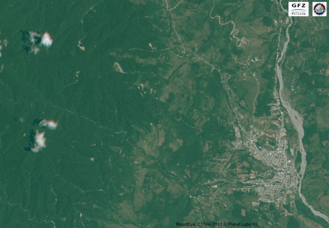
Before image of the area affected by the Mocoa landslides, via GFZ Potsdam and Planet Labs
.
An image showing the aftermath, collected on 10th April 2017:
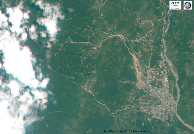
Image showing the aftermath of the Mocoa landslides, via GFZ Potsdam and Planet Labs
.
And an interpretative map that highlights the areas affected by the landslides and debris flows:
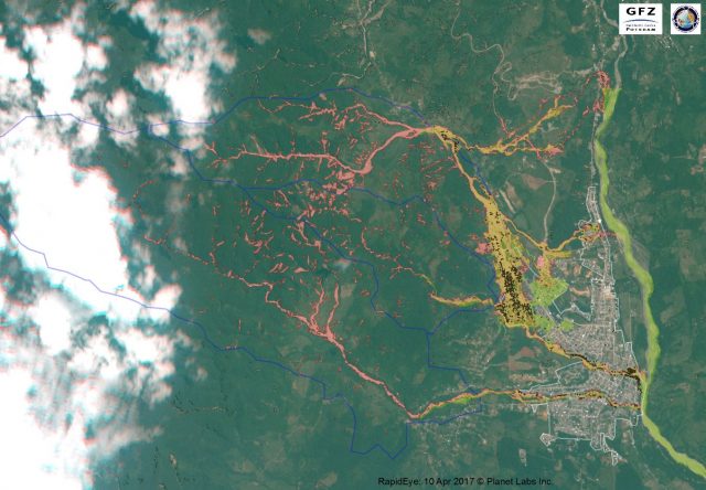
Interpretative map of the area affected by the Mocoa landslides, via GFZ Potsdam and Planet Labs
.
This work was undertaken by Dr Robert Behling in the Remote Sensing section of GFZ Potsdam. The maps are very interesting. The ReliefWeb article notes that the map depicts over 600 landslides and debris flows. These are widely dispersed across the landscape in a pattern that is commonly associated with a an extreme rainfall event. These landslides have then sent debris into the channels, where they have combined to generate a large volume, which has then entrained debris from within the channels to provide the enormous debris flows that struck the town. The vulnerability of the buildings in the channel of the Quebrada Tarnquita is very clear, and of course this is where the majority of the losses occurred.
Wikipedia now has a good article about the landslides, noting that about 130 mm of rainfall fell during the disaster, which killed 314 people and left a further 106 missing. In total about 45,000 people were reported to have been affected. Incidentally, this analysis also suggests that the interpretation of the Sentinel image of the Mocoa area, which was released in the immediate aftermath of the disaster, was not correct.
 Dave Petley is the Vice-Chancellor of the University of Hull in the United Kingdom. His blog provides commentary and analysis of landslide events occurring worldwide, including the landslides themselves, latest research, and conferences and meetings.