9 January 2016
The Farnley Haugh landslide in Northumberland, northern England
Posted by Dave Petley
The Farnley Haugh landslide in Northumberland, northern England
In the spell of extremely heavy rainfall that has affected the UK in the last few weeks, railway slopes have inevitably suffered. Perhaps the most interesting landslide is at Farnley Haugh in Northumberland on the line that connects Newcastle to Carlisle – this is an essentially east – west link across the Pennine hills that connects between the two main north-south railway lines. The Farnley Haugh landslide has closed the section of line between Prudhoe and Hexham. The closure is indefinite, [with Northern Rail saying:
Customers are being advised that the line between Hexham and Prudhoe will be closed for several weeks to allow the area to be safely assessed and restored.
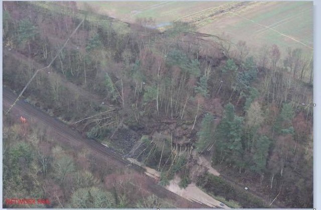
BGS Landslides retweeted an aerial image of the landslide:

Farnley Haugh landslide via a BGS Landslides retweet
.
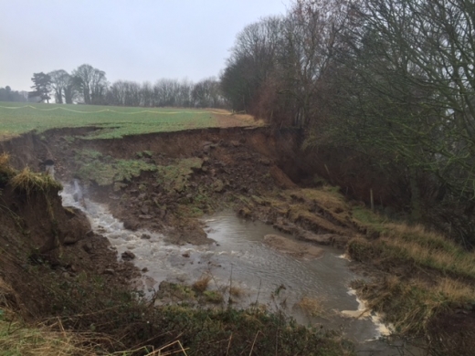
At present the portion of the landslide that has affected the line is a comparatively small more active section on the lower right side of the active slope, where the trees have fallen. The large amount of fine sediment on the track in this area is interesting – I wonder where the water that has transported this sediment has come from. But the landslide is larger than this, with major tension cracks extending into the field at the rear of the cutting. Note that there appears to be a ditch in the field close to this section. Northern Rail have released an image of this portion of the landslide complex:

The Farnley Haugh landslide via Northern Rail
.
Once again there is a huge amount of water flowing into the landslide, right in the area of the tension scarps. The image does not really show the source of this water, but there is a good chance that this is a significant factor in the landslide.
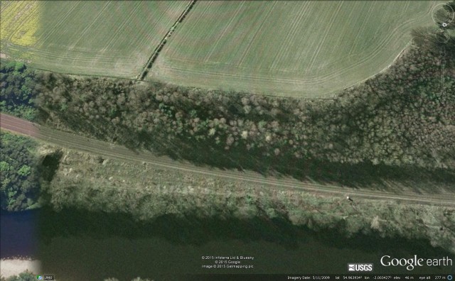
As far as I can tell this is the section of embankment that has failed (from Google Earth):
.
But as this image dates from 2009 it provides little more information. One thing to note is that the ditch does seem to be associated with a channel on the cutting, and there appears to be a culvert under the track.
Stabilising this slope is a large task, though completely within the capabilities of the engineers at Network Rail, and their contractors.


 Dave Petley is the Vice-Chancellor of the University of Hull in the United Kingdom. His blog provides commentary and analysis of landslide events occurring worldwide, including the landslides themselves, latest research, and conferences and meetings.
That broken culvert near the left lateral boundary (downhill view) in the photo didn’t help any. Probably a big factor in the higher mobility in that part of the slide.
As Jim has mentioned, there is a seemingly large bore land drain pouring into the slip at the top. It looks to be rather significant, maybe 6-8 inches and plastic, as opposed to the usual 1-2 inch older clay drains of the area. This would suggest that it’s quite a recent addition and the ‘break’ looks clean enough to be a joint failure. I’d love to get a closer look as it’s only a few miles away but I imagine it’ll be well fenced off by now.