
29 April 2015
Landslides in the Nepal earthquake: preliminary guidelines for relief and response activities
Posted by Dave Petley
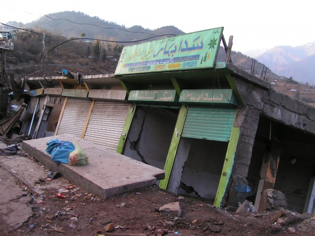
Pakistan 2005
Landslides in the Nepal earthquake: preliminary guidelines for relief and response activities
Alex Densmore, David Milledge, David Petley, Nick Rosser, and Katie Oven
Originally posted at the EWF Blog
The extent and effects of landsliding triggered by the 25 April 2015 Nepal earthquake remain unclear. However, since relief and response activities have already begun, and will accelerate in the coming days, we have assembled preliminary guidelines for relief and response workers and emergency planners in Nepal. They are informed by initial models of landslide likelihood, some fragmentary mapping of available satellite imagery, and experience in the 2005 Kashmir (Pakistan) and 2008 Wenchuan (China) earthquakes.
General pattern
Landslide susceptibility maps for the entire region have been posted at http://ewf.nerc.ac.uk/2015/04/25/nepal-earthquake-likely-areas-of-landsliding/ and https://blogs.agu.org/landslideblog/2015/04/26/nepal-earthquake-2/, along with some initial interpretations. These models are highly generalized and should not be used as predictions of the occurrence of individual landslides; instead, they give an idea of the areas where landslides are most likely. A brief summary interpretation of the key results:
- We expect many landslides in the high Himalaya of northern Nepal, where valley floor elevations exceed c. 800 m. These areas are particularly important because they have very long, steep slopes and narrow valleys, so that large landslides are likely to block valleys (see section on ‘Landslide dams’ below). The valleys of the Kali Gandaki, Marsyandi, Trisuli, and Sun Kosi rivers, and their major tributaries, are at greatest risk, but large valley-blocking landslides are also likely elsewhere. These areas also have little space for roads, so are likely to be cut off with overland access taking days (to weeks). Experience in Kashmir and Wenchuan suggests that some settlements will be completely disrupted or destroyed, with local death tolls in the hundreds to thousands.
- There is also a high chance of landsliding in the foothills – e.g., south of Kathmandu and the epicentral area, including the Siwalik Hills. These areas have shorter slopes (up to 1000 m relief) and broader valleys, so there is a lower chance of valley blocking. Preliminary reports are that roads across the Lesser Himalaya to the south of Kathmandu are open, but landslides and debris are hampering movements.
- Based on previous comparable EQs, it is highly likely that many relatively small landslides (1000s of m3 in volume), up to one if not more large valley-blocking landslide (> 1 million m3), will have occurred. Initial efforts should focus upon identifying the largest landslides, as they pose significant secondary risks if they dam rivers and subsequently fail (see ‘Landslide dams’ below).These models could be revised or run on more targeted areas if there is interest from stakeholders in specific areas, but they should NOT be used as predictions of landslide occurrence at particular sites. Our preliminary image mapping shows fewer landslides than the models anticipate, but imagery to date is patchy, with much cloud cover showing only the foothills. There is not yet any systematic information from the high Himalaya but mapping is ongoing. Experience in Wenchuan (China) shows that the earthquake will have weakened the hillslopes, so further landslides should be expected in the coming days to months – especially, but not only, during rainfall and aftershocks of M > 5. The locations affected by these post-earthquake landslides will be similar to those already affected most severely by the landslides. Wet landslides can be very rapid, and unpredictable in direction and runout.
Landslide dams
Most landslide dams fail within a few days of filling; thus, it is critical to establish where they are located and how rapidly they are filling. Periodic measurements of water level relative to dam crest are invaluable. In the absence of information to the contrary, it should be assumed that landslide dams have formed in all of the major river valleys or tributaries draining the area between the epicentre and Kathmandu. Key observations that a dam has formed upstream include: decreased river flow independent of any changes in rainfall, or changes in colour – especially a muddier-than-usual appearance. Flow gauges in Nepal, if still serviceable, should be monitored for rapid changes in flow on all rivers : http://hydrology.gov.np/
The effects of a landslide dam failure depend on the height of the dam and the volume of the lake behind it. As a general rule, valley floors and river channels should be avoided until it has been confirmed that no possible cause for flooding (via failed landslide or hydroelectric dams) exist upstream. Any temporary infrastructure in the valley floor should be sited as high as possible and as far as possible from the channel; a minimum elevation of AT LEAST 10 m above the active channel is recommended. Risk should also be minimised by positioning a spotter at the landslide dam with a comms link to all VDCs downstream and a clear protocol for communities to move to higher ground if there is a dam failure.
Operational guidance
Temporary infrastructure (temporary housing, hospitals, roads, etc.) should be sited to avoid further landslide hazards, flooding from potential landslide dams, inevitable increased river flow in the monsoon, and (over a period of weeks to months) river bed deposition from landslide sediment. Some general guidelines include:
- Site infrastructure in the widest possible part of the valley
- Avoid piles of large boulders or other signs of previous landsliding
- Stay at least 10 m above the active river channel, and as high as is practicable
- Stay away from steep hillslopes. Try to minimise the angle between a site and the local skyline. This angle should be <20 degrees if possible, although this may not be practical in many valleys
- If (re)cutting roads for access, minimise gradients, the number of switchbacks, and traverses across loose ground. Cut slopes that are just stable in dry conditions will be unstable in the monsoon.
Exposure
If further landslides occur, it is important that exposed field workers are briefed on what to do:
- In broad terms, follow the guidance for earthquakes. If you sense something happening or moving, ‘duck, cover, hold’, and importantly don’t run.
- Be aware of your surroundings. Unusual noises, tremors, or dust are all possible indicators of an earthquake OR a landslide. Landslides are surprisingly loud, especially in mountain valleys.
- A key component of risk is exposure, so minimising the time spent in areas that are apparently dangerous and susceptible to landsliding is essential.
- Landslides on steep hillslopes are often the source of more landslides over time. Don’t assume that because something has already failed, it will not continue to do so in the coming hours and days.
- Local communities will have a sound knowledge of where landslides have occurred prior to the earthquake. This information is invaluable and should be used wherever possible, as these slopes may be most susceptible. At the same time, be aware that the earthquake may have changed the landscape dramatically, so that other areas may also be at risk.
- Very generally, earthquakes trigger landslides on ridges, sending debris downslope. Many roads in the Himalaya follow the valley floors. It is therefore important to be aware of the terrain above, and the condition that it is in, even if you cannot see it. While shaking may be more violent on ridges, the chance of being struck by falling objects in valleys is much greater. When in doubt, move up, as ridges will be the safest parts of the landscape.
- Landslides can occur with no apparent trigger. Even if there is no rainfall or no further earthquake, a slope can still collapse. Keep away from steep slopes wherever possible.
- Mountain streams (large and small) will be choked with loose sediment and probably subject to debris flows, particularly in the monsoon. As a result, flows will be less predictable and more prone to flooding, even after moderate rainfall. Streams are also likely to change course unpredictably. Stay well away from river beds.
Next steps
We are currently compiling optical and radar satellite imagery to map large landslides and potential landslide dams across the affected area. We will update these guidelines as those maps become available.
Reference:
Alex Densmore, David Milledge, David Petley, Nick Rosser, and Katie Oven. 2015. Landslides in the Nepal earthquake: preliminary guidelines for relief and response activities. EWF Blog: http://ewf.nerc.ac.uk/2015/04/28/landslides-in-the-nepal-earthquake-preliminary-guidelines-for-relief-and-response-activities/
 Dave Petley is the Vice-Chancellor of the University of Hull in the United Kingdom. His blog provides commentary and analysis of landslide events occurring worldwide, including the landslides themselves, latest research, and conferences and meetings.