14 June 2012
Another very large landslide – this time on the Canada / Alaska border – can you help?
Posted by Dave Petley
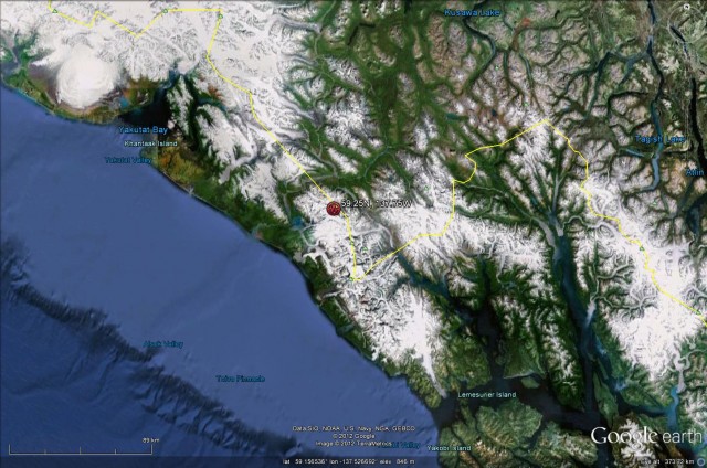
In the last few weeks I have highlighted two large landslides, one in Nepal and one in Alaska, that Colin Stark and Goran Ekstrom detected remotely using seismic instruments (there is a great summary of the Nepal work on the Earth Institute blog). On 11th June they detected another, this time in the area of the border between Alaska and Canada. This is the seismic event that was almost certainly a landslide – but note that for an event like this the location is not likely to be very precise, meaning that it occurred in either Alaska or in Canada. The event occurred at 22:23 UT, which was 14:23 local time, on 11th June 2012. The map below shows the approximate location of this large event:
 It would be really good to try to identify the location of this landslide. So, can anyone help to find it? This is quite a remote area, but at this time of year people will be travelling through, so if anyone has any contacts that might help us to find it then please drop me a line.


 Dave Petley is the Vice-Chancellor of the University of Hull in the United Kingdom. His blog provides commentary and analysis of landslide events occurring worldwide, including the landslides themselves, latest research, and conferences and meetings.