6 February 2012
First news of landslides from the earthquake in the Philippines this morning
Posted by Dave Petley
The Negros Oriental area of the Philippines suffered a M=6.7 earthquake this morning at 11:49 am local time. Although moderately deep (20 km ), this event appears to have caused some damage, with news reports suggesting that at least 52 people have been killed. The timing of the earthquake just a few hours before sunset probably means that the full picture won’t be available until the morning, but it is possible that the losses will rise. Interestingly, losses are more than the PAGER data would indicate.
Interestingly, at the moment it appears that a substantial number of these losses may be associated with landslides. For example, inquirer.net is reporting at several landslides. These seem to include:
- 29 people killed in a landslide in a landslide in Barangay Planas in Guihulngan City;
- 10 people killed in a landslide on Ten others died due to a landslide on the Guihulngan national road
- An unknown number of people trapped in the village of Solongon in La Libertad
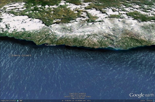
A quick look at the Google Earth image of the affected area hints at why the landslide losses may be high:
The coastal strip affected the earthquake (note the epicentre location in the sea on the left side) is both steep and inhabited.
The NDRRMC is posting updates here. This is likely to be the best source of information on losses by this time tomorrow.


 Dave Petley is the Vice-Chancellor of the University of Hull in the United Kingdom. His blog provides commentary and analysis of landslide events occurring worldwide, including the landslides themselves, latest research, and conferences and meetings.
[…] earthquake in the Philippines yesterday appears to have stirred barely a ripple in the global media, but in a comparatively small area of […]
I’m in Cebu and the quake was strongly felt in Cebu City, the second largest city in the Philippines. The earthquake was a jolting action, with sharp and quick shaking that lasted for about 30 seconds. Pretty scary actually, but no damage in Cebu.
This is an unexpected tragedy; there are many people who are victims of this tragedy. We hope and pray that they cannot happen again.