4 November 2011
Geological Survey of India report on landslide from the Sikkim earthquake
Posted by Dave Petley
Summary: A new Geological Survey of India report describes some of the landslides triggered by the September 2011 Sikkim earthquake in India and Nepal
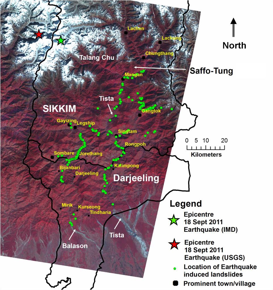
The Geological Survey of India has posted online a (2 MB) pdf document containing a report about landslides triggered by the Sikkim earthquake. The report is based upon a field reconnaissance visit undertaken by a group of geologists shortly after the event, and thus inevitably concentrates on those slides that were accessible (i.e. close to roads). In most cases these are the ones that affected the population, so that is not unhelpful.
In total, 210 landslides were noted along 12 road sections. These are mostly rockslides. Interestingly, most were first time failures – indeed the report notes that existing landslides were not reactivated in most cases. It is also interesting to note that “a large number of earthquake induced rockslides occur proximal to the crest portions of its steep ridges and in its westward higher slopes, which perhaps indicates the effect of the topographic amplification of earthquake induced ground motion in these steep rocky mountain faces.” This directionality effect is similar to my observation based on satellite imagery a month or so ago. As the report notes, it would be really interesting to map properly the landslide distribution from this earthquake using high resolution imagery. Now that the monsoon has ended it should be possible to gain a good image in the next few months.
It is interesting to note that there is almost no information about landslides triggered by the earthquake in Nepal.


 Dave Petley is the Vice-Chancellor of the University of Hull in the United Kingdom. His blog provides commentary and analysis of landslide events occurring worldwide, including the landslides themselves, latest research, and conferences and meetings.