17 August 2010
New pictures of Attabad
Posted by Dave Petley
Many thanks to David Butz, who is a Professor of Human Geography at Brock University in Canada, for sending to me a set of photographs of the situation at Attabad. David was there about eleven days ago, when the boat service was still running (it has now ceased due to a lack of fuel). David has kindly allowed me to post some pictures here – note however that he retains ownership and copyright of them.
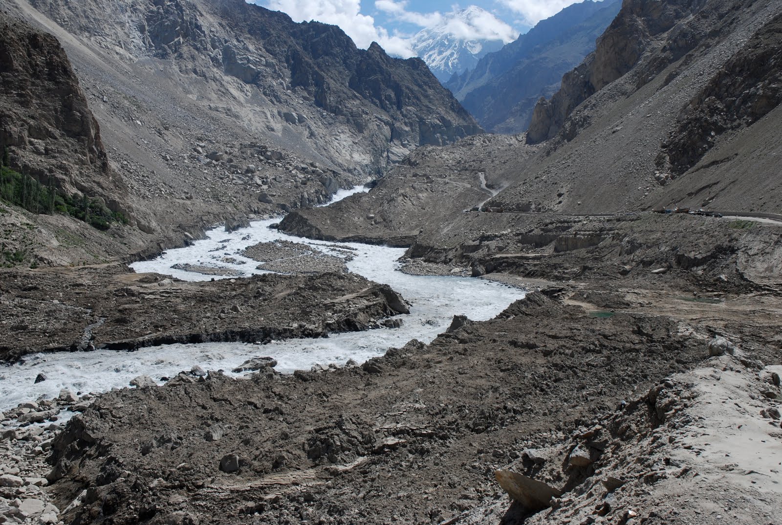
The dam from from downstream (click on “read more” to get the remainder of the post):
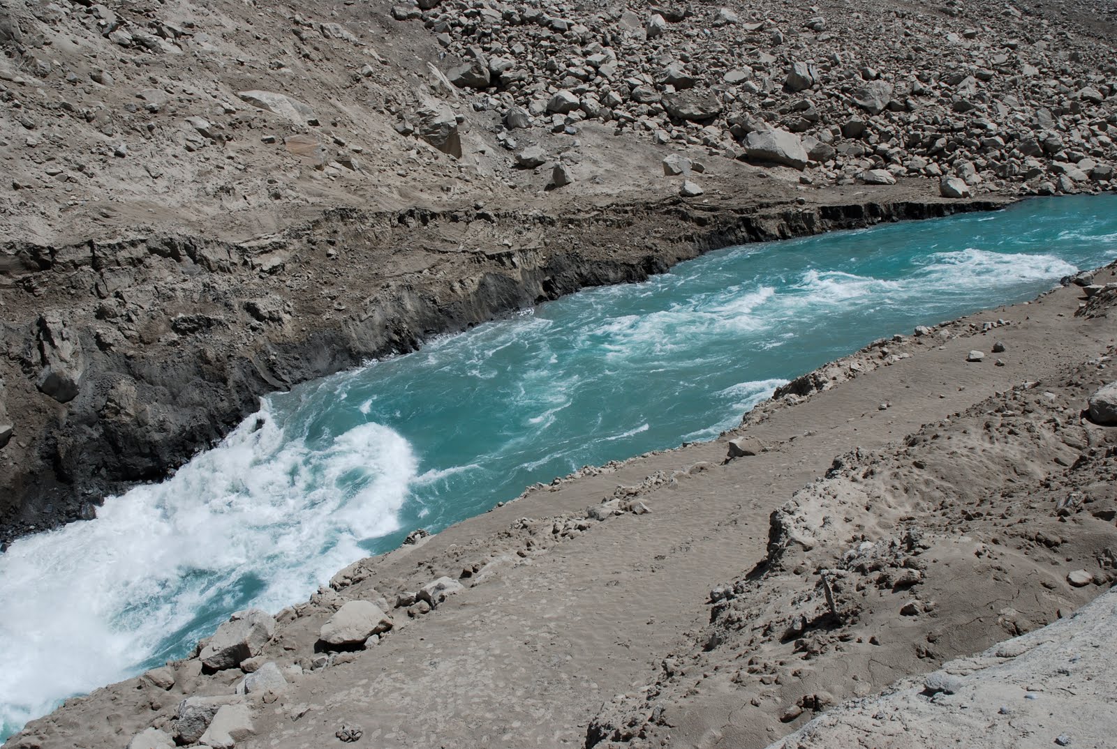
A close up of the downstream part of the spillway. Note the very large boulder:
The upper part of the spillway, the point at which the flow rate increases:
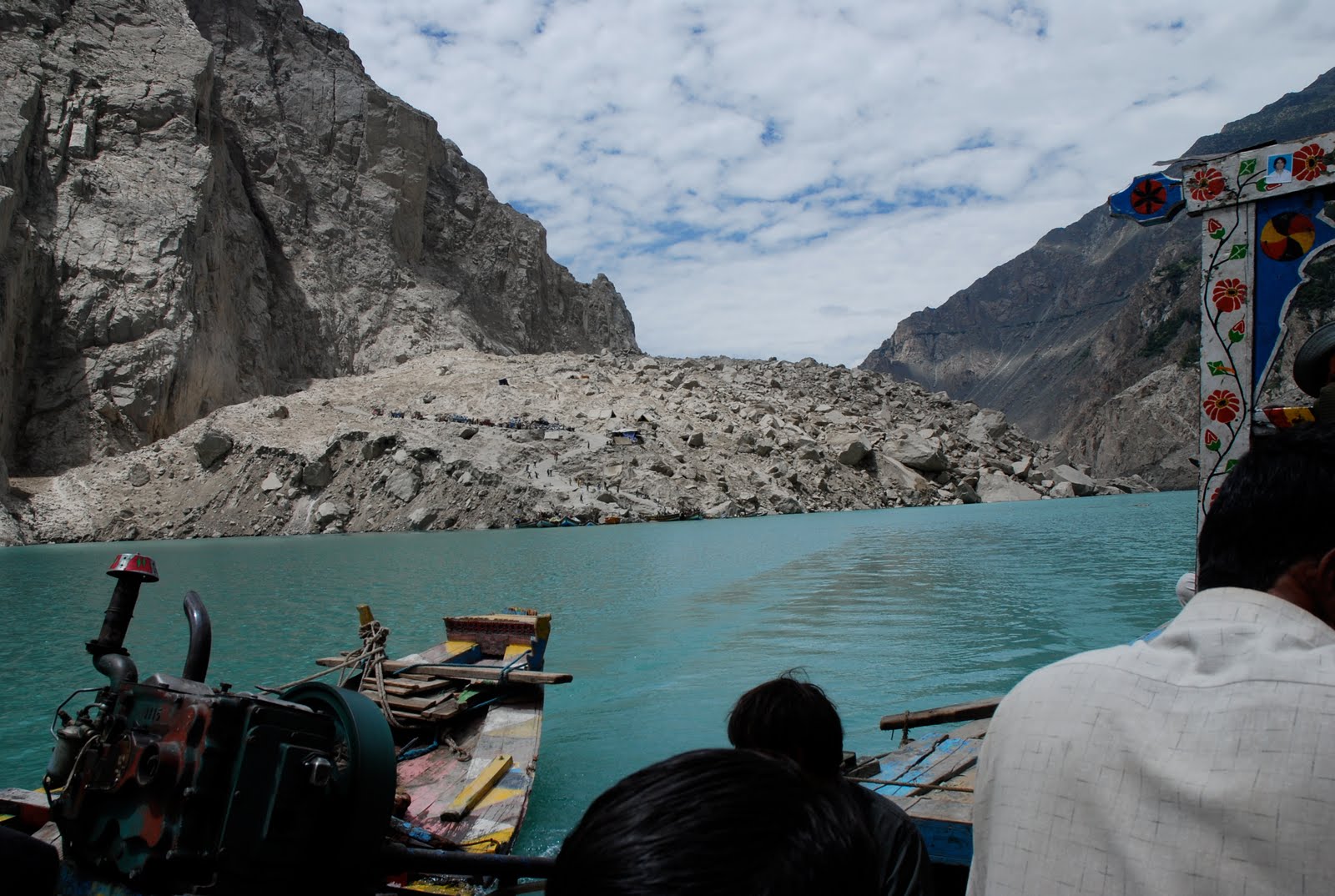
The landslide mass from the upstream side:
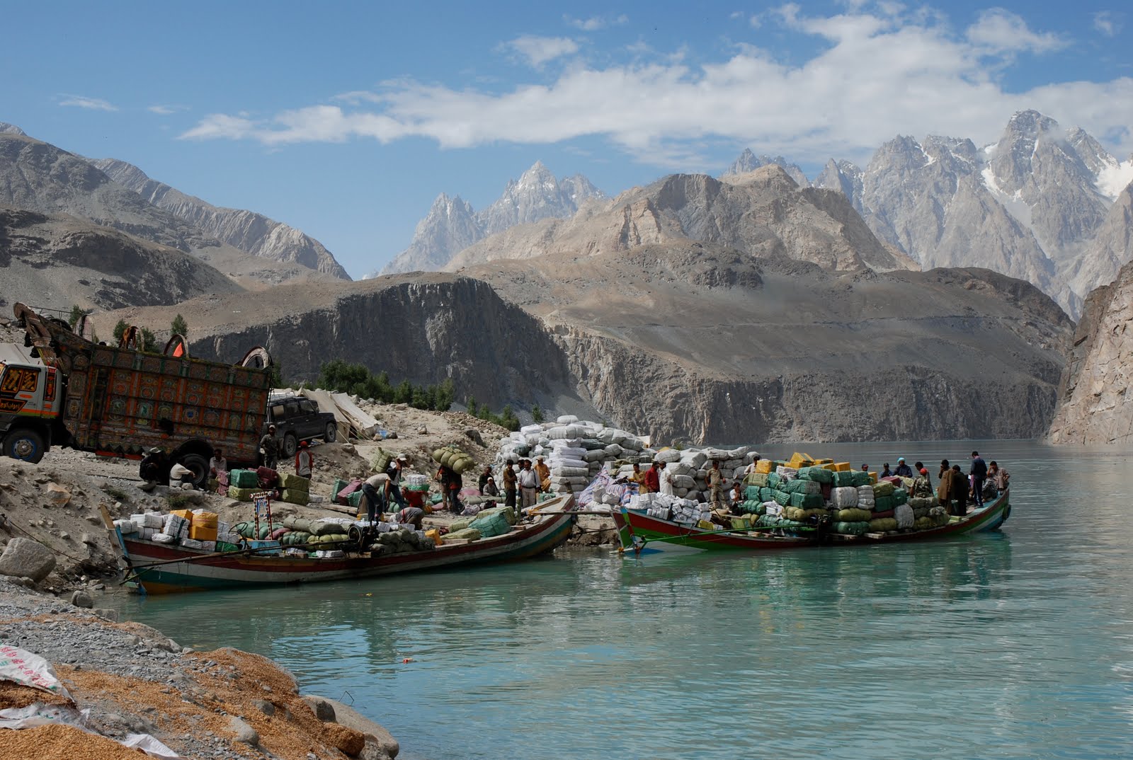
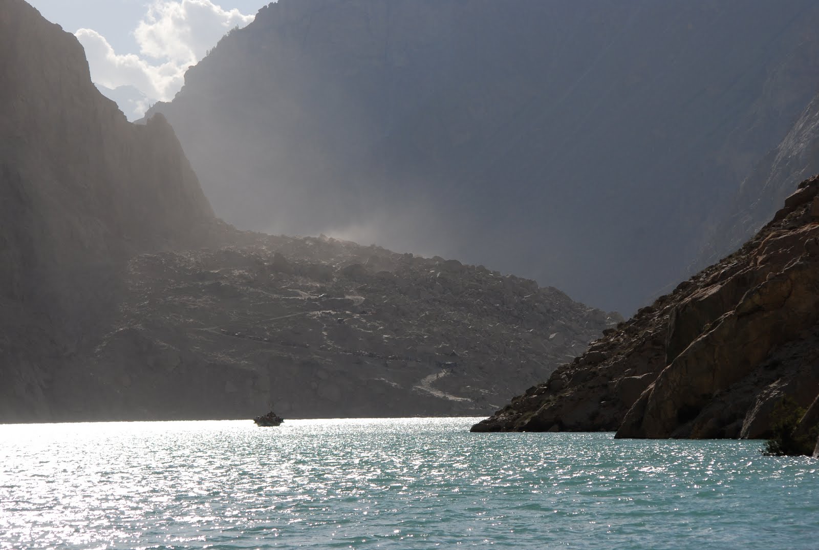
The towering landscape and the heavily overloaded boats that ply the lake:
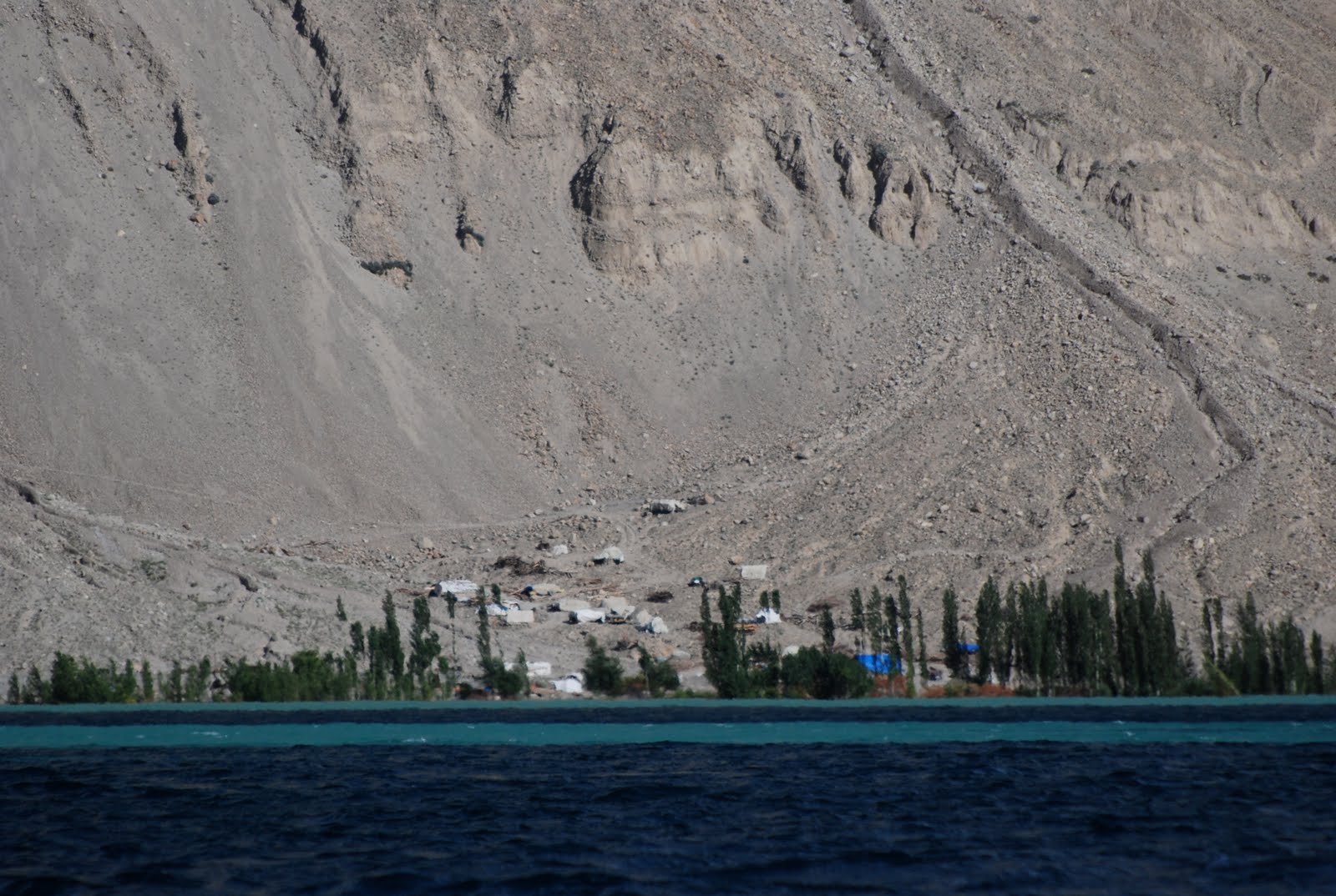
Many of the displaced people are still located in very hazardous locations:
And to finish, the best image that I have seen to date that is able to show the size of the landslide. Remember that the lake is 120 metres deep:



 Dave Petley is the Vice-Chancellor of the University of Hull in the United Kingdom. His blog provides commentary and analysis of landslide events occurring worldwide, including the landslides themselves, latest research, and conferences and meetings.
Finally some pictures… it seems the dam will not fail after all.. at least for another while at least
I stayed at Passu for a while last year. Hoping that the Lake will drain gradually and safely.Thanks for all the info and pictures in your blog.Gareth
Thanks David Butz for images; specially the last one.
If dam stays put….It could be a very valuable resource in Jan for Winter crop irrigation in the Punjab and Sindh. It shd now not be blasted at all. In any case….downstream can;t take in a drop of extra water and tarbela is full too. Interestingly, the attabad lake issue is dwarfed in light of severe flooding and displacement in rest of country. Now blasting the lake and displacing 27 villages downstream with sparse population appears like a joke.
None should be surprised at Feroze's comment. Punjab has always been irrigated at the cost of Pakistan and that's what can be done. Who cares about Gojal Valley. The valley, along with rest of GB, is even not part of the country! Hail Punjab!
I apologize if I have offended anyone. I love GB,Hunza etc. Punjab has the least of the problems. What I am sayhing is that when government had to make a decision on blasting the attabad dam, it was skeptical of the fate of the emptied out 27 villages downstream. And now punjab villages, hundreds of them, maybe even thousands of villages have been flooded and no people evacuated. Its a calamity worse than the worst case scenario of Attabad dam breach.But I am not creating any matches here. All I am saying is no good can come out of Attabad lake being blasted now. And the people in the area have already been displaced and moved elsewhere. There is 3.3 million cusecs of water stored which could be used in winters for irrigation. At that time inflow will be at a minimum too thus making the task easier since lake level might have reduced by then coz of inflow vs outflow + seepage. And that irrigation water will help crops in PUNJAB supplying food all over the country. So good for GB too.
I follow your blog with interest. Excellent coverage so far and some great new pictures. Thankyou. (Small note on picture # 3, the flow rate does not increase but rather the velocity)
The new pictures are fantastic and I follow this blog with great interest. My wife and I cycled through here from China in late 2008, staying in Passu, walking in Hussaini and moving on after a week or so down to Karimabad. We have very fond memories of the place and our hearts go out to the wonderful people of this area. Our thoughts are with you.
This story is getting very little coverage around the world. I was lucky enough to stumble upon some Youtube videos while researching the Pakistan monsoon floods. Some very powerful forces of nature are at work in Pakistan this year.
Where the blue water ends, there still seems to be the erect boulder near the right bank which can be identified by the black spot. There now seems to be less level ground adjacent to the upper right bank, but no bypass has been eroded to the side of the upper streambed slab.If it is not an artifact of the camera angle, it now seems that the gradient below the blue water is steeper than before; so possibly the retrogressive erosion has reached the downstream edge of the midstream slabs. The prominent boulder in the second photo is indicative of the size of the midstream slabs.Sadly we are seeing a regional disaster submerged into a national disaster of horrific proportions.George
Atabad was created due to neglect and now the wrath of God has struck the entire country.
Brig. Sahab,Attabad happen because to negligencedue to building of highway withoutany study of geology.Care is needed in Earthquake zone.It has nothing to do with God.Too bad you don't believe in Global Warming.or Dams which cause more floods due toblockage of silts. Even in US houses build on floodzones are prohibited even for 100 year floods.Global Warming is suppose to Dry Pakistanbut shift of Jet Stream created a perfect storm.There kinds of disaster will be common place in the future.This is just the beginning.
"…the point at which the flow rate increases:" (Photo)Dave- Isn't the flow rate constant the entire length of the spillway? Where is the extra water entering?Since the depth decreases, the velocity increases, but I don't see where there is any added flow.
Oh, and I guess I should add that by "depth decreasing" I really make the assumption that the width is fairly constant. It's the cross sectional area that's important.
"Many thanks to David Butz"Yes, thank you David Butz! And thank you for allowing Dr. Dave to post some of your wonderful images here.Again, I thank you.
Feroze's comments are very typical of the Punjabi mindset. The Panjabis have always used the rest of the provinces for the benefit of Punjab and their geopolitical games. If Gilgit/Baltistanis suffer, so what?
"Attabad happen because to negligence due to building of highway without any study of geology."Perhaps. Was there a highway on the south side? I thought the landslide brought the village to the KKH highway, across the Hunza, blocking both highway and river. And destroying Attabad.On the other hand, armed with photos, such as these perhaps, and a guide such as this one (page 41 on), can you see any incipient landslides in the Attabad landscape? When do you expect them to fail? How would you stop them? How would you avoid them? Meanwhile, you've an entire country beset by a large flood. What money, and whose, will you use to bring your plans to completion?________Dave, I notice in the first of these photos a horizontal trace extending up river. Is this in fact a fault?
"On the other hand, armed with photos, such as these perhaps, and a guide such as this one (page 41 on), can you see any incipient landslides in the Attabad landscape? When do you expect them to fail? How would you stop them? How would you avoid them?"This really, in my opinion, gets to a cost benefit of the KKH. There is no doubt that it's a major highway, since it is the only major road between China and Pakistan. With that in mind, we need to consider the construction costs of mitigating addition environmental factors versus avoidance, or accepting the risks on a cost-benefit basis.On an economic basis, it is my guess, without sufficient information, that this highway is not worth significantly more investment than the basic structure that existed, and when rebuilt, the economics do not justify significant improvements over the former design.That said, I fully recognize that the highway is probably not going to be rebuilt for at least a year, putting the total time at least 18 months.Rebuilding the KKH is a minor concern for Pakistan given the magnitude of the flooding.
Is there any official reaction happening from the Chinese side, who once built the KKH? They must be interested keeping that trade line safely running, but maybe they wait until all the recent Indus floods pass bye. Hope that the heavy rains in the region will not harm the structure of the dam in the Hunza valley, which seems to be stable at this point. If it will brake there will be a deluge…Andus
Thank you for the website and pictures. We follow the situation with great interest. Our family is a regular visitor to Hunza, our favourite destination in the world: 1995, 1998, 2001, 2005 and 2008. Each time, we renew many friendships with people from Gilgit to Pasu and beyond, many of whom have been affected by the landslide and lake, as well as more recent flooding in Gilgit and surrounds. Thank you for providing the means for us to monitor the situation.
Thank you for the website and pictures. We follow the situation with great interest. Our family is a regular visitor to Hunza, our favourite destination in the world: 1995, 1998, 2001, 2005 and 2008. Each time, we renew many friendships with people from Gilgit to Pasu and beyond, many of whom have been affected by the landslide and lake, as well as more recent flooding in Gilgit and surrounds. Thank you for providing the means for us to monitor the situation.
Thank you for the updates and photos.according to my local information, NDMA has requested USAID for help and they will be sending two experts on landslide dams in next weekThe decrease in depth of attabad lake in 24 hours is about 2 inches and discharge at Sarat bridge is 25500 cusecs.Chinese experts had also visited the Attabad 4 weeks ago and studied the situation.Hussain
Can anyone give a width for the spillway as there are no people or vehicles to compare?
DEAR DAVEThanks allot for the updates, your contribution is admirable. May God give you the rewards of your good deeds and kind help. I been through some comments and found Mr. Feroze a pro-Punjabi it's not new for us. If we talk about state within a state the best example is Punjab and they have their own mindset, because of this sick mindset we have lost much and will loose everything. I feel this man never been through such traumatic situation that's why such ideas comes out sitting in their luxurious apartments under the Air-conditioner hitting the keys of the laptop just to show their intellect acts nothing els. I am totally surprised while reading such comments; how come human being can be selfish to gain advantages from the miseries of others but it's true and happening in the so-called Islamic, and so-called Republic of Pakistan under the so called Puppets I mean Leadership.Being a native of Gojal I know the ground realities better then the Plastic intellectuals. if the water remains the same it will be really worse in winter when the temperature will drop down to freezing -20c. They boat service which is the only source of transportation will have to close.Then the locals will remain on the mercy of God. I feel so bad when look at the locals who became dependent in the hand of poor local administrators. The locals are so hardworking love to earn their livelihood with their own hand. their only vision, goal, objective is to educate their children nothing else that's why the literacy rate is 90%. The local administration is look like an Ostrich not like but truly acting as an Ostrich saying "All is Well". But we are optimistic and we believe that we will come out of all these it's not new for us, our forefathers had suffered with the same but they came out with the willpower like rocks.One thing more the Chinese are the source of hope for us and they are gonna reduce the height soon because KKH is strategically important for Pakistan and China.Dee JayGojal Hunza
I recently came accross your blog and have been reading along. I thought I would leave my first comment. I dont know what to say except that I have enjoyed reading. Nice blog. I will keep visiting this blog very often.
The Pamir Times has new Pictures of the dam site, posted on August 24th.You find them here: http://pamirtimes.net/2010/08/24/latest-images-from-the-dammed-hunza-river/Looks like the upper part of the spillway is still almost unchanged.Good luck Pakistan andbest regards from Germanyulsc
Just found also this, which shows that the gouvernment believes in the stability of the dam now:http://pamirtimes.net/2010/08/22/repatriation-of-hunza-lake-idps-will-complete-soon/
These photos are beautiful and informative. The last one, once viewed at maximum size, shows the size of the landslide with cars on the road for comparison.I read that before the monsoon flooding President Zardari went to China and signed a Memo of Understanding with his Chinese counterpart whereas a pipeline carrying petroleum from Karachi to China will be built, as well as a railroad, and the KKH of course will be widened and modernized.I tremble at the thought of an oil spill due to a variety of possible causes in the Hunza valley.Well, it will take a few years and a MOU is not set in stone.Brigitte
I crossed Attabad on 26th August. The boats are running regularly now, there is no diesel shortage for this crucial link.However travellers should be aware of a bridge which is down across the Hunza river about 10km south of Sost. Currently this is being crossed with a flying fox contraption.Carl (now in China)
So amazing. Thanks for sharing the photos. I travelled the Karakoram Highway in August 2007 before the landslide stayed a few nights in Karimabad. One of the things I remember while dining at a tourist restaurant called “Eagle’s Nest” overlooking the Hunza Valley were all the numerous landslide scars on the valley walls and sedimentary benches on the lower valley slopes from previous enormous landslide lakes. It became clear to me that the geography was extremely unstable. The region is most excellent to visit I felt quite safe as a lone traveller and met many other western solo adventure travellers on the scheduled public bus from Kashgar to Gilgit that was running back then including two Norwegian girls and a Belgian guy. Pakistan’s Hunza region really saw tourism really drop off after the 9/11 attacks so you can visit today without huge crowds of westerners snapping selfie photos at every lookout point. Easiest way to do it solo is to fly from Beijing to Kashgar then buy the bus ticket at the Kashgar “Long Distance Bus Station”. I took a Chinese run bus but there the Pakistanis also ran a daily bus at that time and I’ve heard it’s now (2018) running again since the highway was reconstructed. Absolutely stunning scenery.