1 June 2010
Attabad – further retrogressive erosion
Posted by Dave Petley
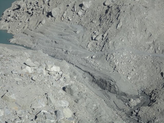
The latest photos from the site, taken late yesterday, show that the retrogressive erosion of the channel is continuing to develop rapidly. This image was taken at about 5 pm yesterday:
The lower part of the channel has widened and, more importantly, the steep section has moved up channel considerably. Bear in mind that this image is more than 15 hours old now. The best illustration of the way that this is developing is with this sequence of three images, which are taken about a day apart, starting on 29th May on the left and ending with 31st May on the right:
It seems to me that release of the water in the lake is now highly likely in the next few days. The most likely mode of failure looks to be this retrogressive erosion, which could lead to a rapid release event, but the initiation of erosion through downcutting cannot be ruled out. Downstream communities need to be prepared.
I have received no update on the state of flow in the channel – I will post again when some information becomes available.


 Dave Petley is the Vice-Chancellor of the University of Hull in the United Kingdom. His blog provides commentary and analysis of landslide events occurring worldwide, including the landslides themselves, latest research, and conferences and meetings.
Hello,Thanks for your interesting blog. Unfortunately I find it hard to put any scale into the pictures. How long is the channel? I guess it is longer than it seems on the various pictures.Thanks for your answer in advance.Regards, Daniel
Where is the water going to ?
DanielYou can get some sense of the scale in the first, biggest picture – see the access track on the right hand side leading to the area where the spoil was dumped at the base of the slope? That track is wide enough to accomodate JCBs/Caterpillar tracked excavators.
Is it possible the retrogressive erosion is fast at the moment because the water is cutting through the spoil from the spillway digging which is presumable very soft ? Once this has eroded then this erosion could slow down when cutting through the more compact undisturbed post landslip material ….Gavin
What I have beleiev that the water topping will increase gradually with the increase in water level at upstream and widening of the spillway, subsequently any different picture will fix, but it will take certain days.Engr. Farman Dubai
Here is an image, back from Jan 04, 2010.
There is a boulder that with shadow appears to be a tetrahedron near the top centre of the second photo which can be used as a common reference point in the photos. In the second photo, the first slump in the channel appears minor compared to the one below it — which in the third photo has expanded up to the upper slump. If the retrograde erosion holds at this point, the release may remain controlled for some time yet. I'd keep an eye on this spot.George