7 October 2009
More images of the earthquake-triggered landslides in Sumatra
Posted by Dave Petley
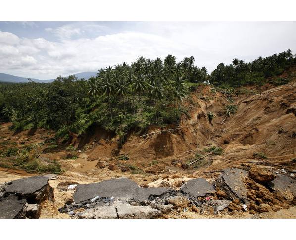
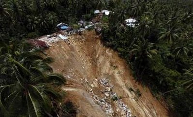
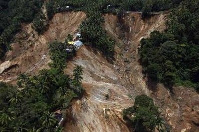
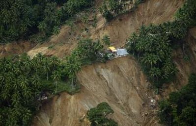
I thought it would be useful to provide a compilation of images of the landslides triggered by the Sumatra earthquake. ReliefWeb is reporting that over 1000 landslides were triggered: “Landslides have hindered relief efforts in some areas. The West Sumatra Satkorlak reported at least 1,000 landslide spots in Gunung Tigo highlands, located between Padang Pariaman and Agam districts. Six helicopters carrying food and medical supplies were dispatched to the highlands as landslides blocked roads.” Interestingly, the landslides appear to be highly mobile, (comparatively but not very) shallow flows in deeply weathered soils. They have run out over quite large distances and in some of the images there appears to be large amounts of water present.
From here, “A highway is severely damaged by a landslide after an earthquake occured near the Padang Alai village area in Pariaman, West Sumatra province” From Reuters, “A motorbike is covered in mud after it was unearthed in the earthquake ravaged village of Tandikat, Indonesia’s West Sumatra province October 6, 2009”.

From Reuters, “An aerial view of a village hit by a landslide which occurred when an earthquake hit the area in Pariaman district, West Sumatra province October 6, 2009.”

From Reuters, “An aerial view of villages hit by a landslide which occurred when an earthquake hit the area in Pariaman district, West Sumatra province October 6, 2009.”

From Reuters, “An aerial view of villages hit by a landslide which occurred when an earthquake hit the area in Pariaman district, West Sumatra province October 6, 2009.”
 From Reuters, “Indonesian soldiers and police search victims buried after a quake-triggered landslide in Jumanak in Padang Pariaman district, Indonesia, Monday, Oct. 5, 2009.”
 From Reuters, “An aerial view of the damage after a landslide caused by a powerful earthquake in Limo Koto Timur village in Padang , Indonesia’s West Sumatra province, October 4, 2009.”


 Dave Petley is the Vice-Chancellor of the University of Hull in the United Kingdom. His blog provides commentary and analysis of landslide events occurring worldwide, including the landslides themselves, latest research, and conferences and meetings.