
18 May 2011
City Lights and Economics
Posted by Dan Satterfield
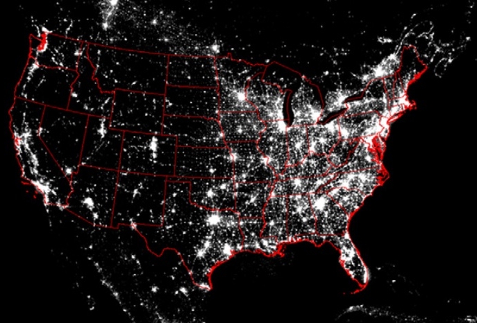 I posted an image a couple of weeks ago from the Air Force Defense Meteorological Satellites (DMSP) showing the lack of city lights over North Alabama after the massive tornado outbreak of April 27th. Many people are at least a little familiar with these images using a special sensor on the DMSP spacecraft and they are worth more than an illustration of why most humans today have no real concept of the beauty of the night sky. A good case in point, is in the most recent edition of the Proceedings of the National Academies of Science (PNAS).
In many countries, good and reliable economic data on GDP is hard to come by, but two Yale economists may have struck on a way to improve economic data using just these images! They measured the brightness of cities in areas with good data, and then compared it to lights in areas where the data is poor. They point out that you have to take numerous factors into account, and use Las Vegas as a good example. Salt Lake City residents are just as productive but guess which city is brighter?? There are measurement errors in using this method, and the authors conclude that it can only be used for countries with the poorest economic data quality.
Remote sensing from space has not only changed weather forecasting, but it’s changing almost every aspect of science.
Any science.
Think about that the next time you hear about budget cuts for NSA or the NSF. The state of our remote sensing for weather and climate is in a bad way right now, with Europe taking more and more of the lead. This just points out the value of studying our planet from above. It’s been said that if weather satellites saw nothing but hurricanes, they would still be worth their cost 1000 times over.
Note: The paper is free on the link above at PNAS.
 Dan Satterfield has worked as an on air meteorologist for 32 years in Oklahoma, Florida and Alabama. Forecasting weather is Dan's job, but all of Earth Science is his passion. This journal is where Dan writes about things he has too little time for on air. Dan blogs about peer-reviewed Earth science for Junior High level audiences and up.