14 August 2015
Paleoslump features and fluvial incision in the Conemaugh Group, West Virginia
Posted by Callan Bentley
For the past two days, I’ve been asking readers to think about some interesting rocks exposed along a newly-opened stretch of Corridor H in West Virginia.
Here’s the scene.
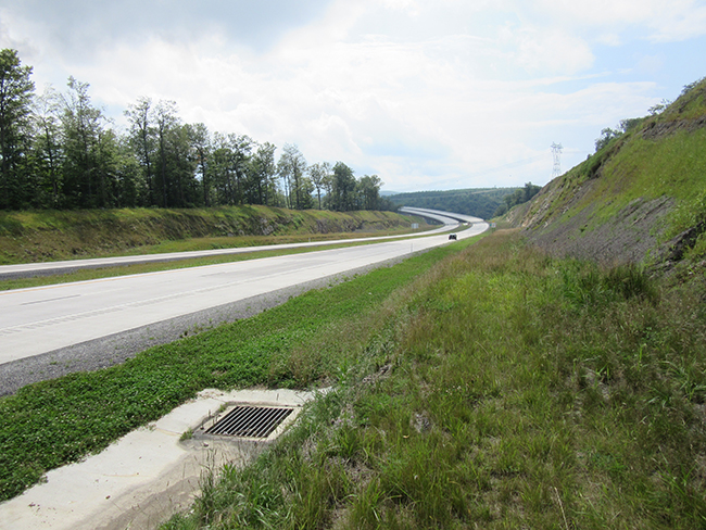
I visited the site twice last week – once with Dan Doctor (USGS), Mitch Blake (West Virginia survey), and Alan Pitts (University of Camerino), and then again with Jeffrey Rollins (Old Dominion University & Team GEODE) and Alan Pitts again.
We are talking about these rocks:
 Click to enlarge
 Click to enlarge
Today is the big reveal – a detailed look at this site. But the images I showed you above were only a taste. The real action is across the street:
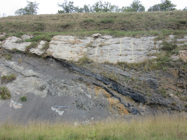
Whoa! That looks like an angular unconformity, right? Check it out in these GigaPans:
link [GigaPan by Marissa Dudek]
link [GigaPan by me]
But here it is in broader context:
link [GigaPan by Jeffrey Rollins]
link [GigaPan by Alan Pitts]
A detail of the central area showing coal seams in crazy orientations (Mitch Blake christened this site “The Dragon’s Tongue”):
link [GigaPan by me]
I hope at this point you have noticed all the different angles at which bedding appears in these roadcuts, and the various truncating relationships between key marker beds. Perhaps, you are wondering what’s going on here.
These strata are Pennsylvanian in age (later Carboniferous). They are part of the Conemaugh Group.
These strata are sandstone, siltstone, shale, and coal. The coal is the black stuff:
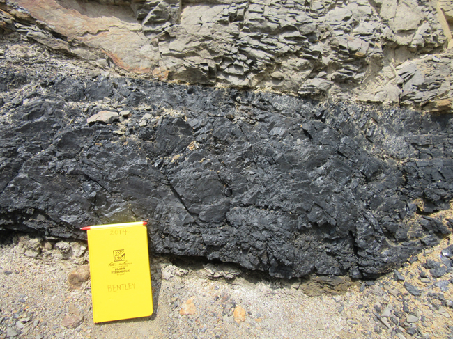
Here are two coal seams, at a ~20º angle to each other:
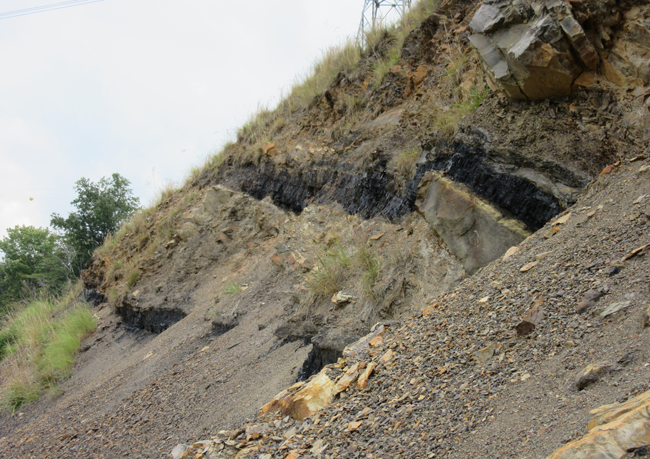
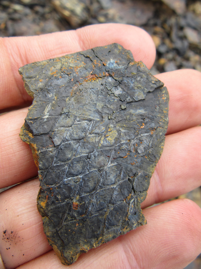
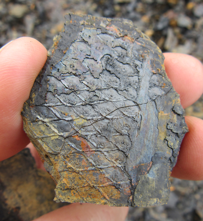
As you might expect with all that coal, there are lots of plant fossils in these rocks:
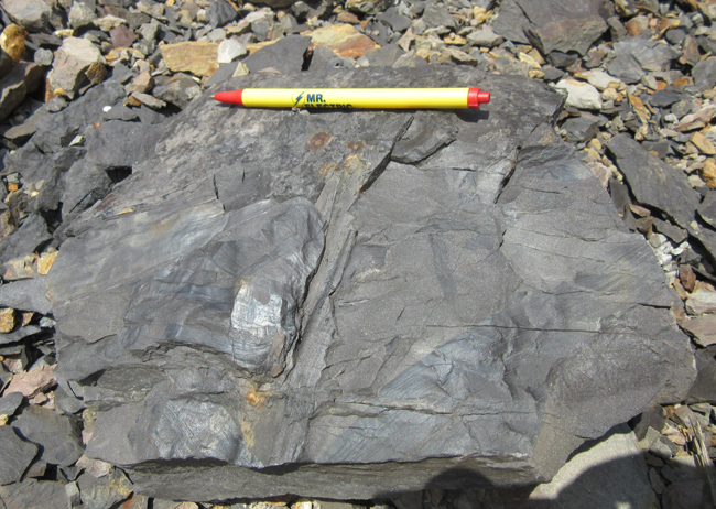
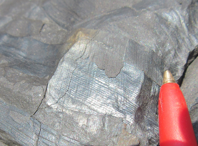
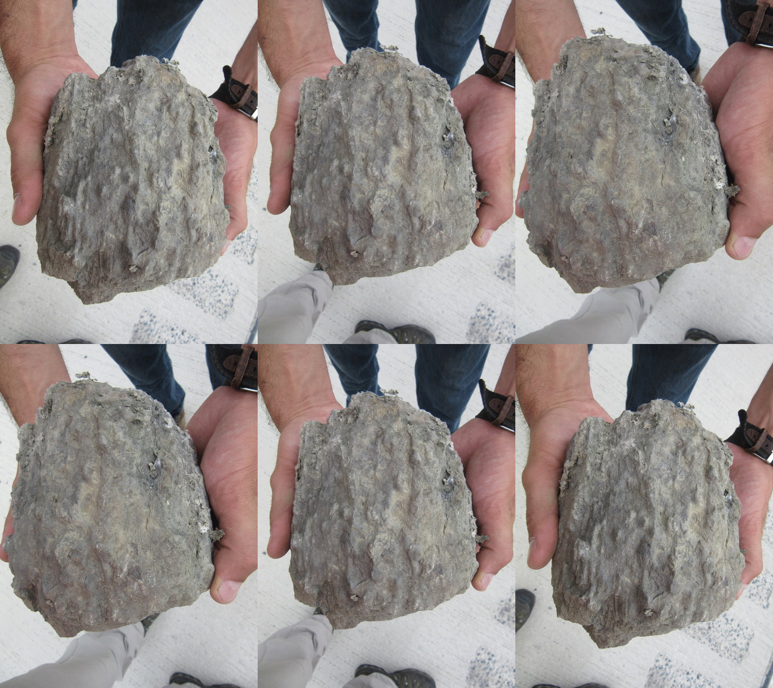
Here are two samples of the distinctive diamond-shaped pattern seen in lycopsid bark:
Here’s a section of stump/branch/log/root that Jeff found:
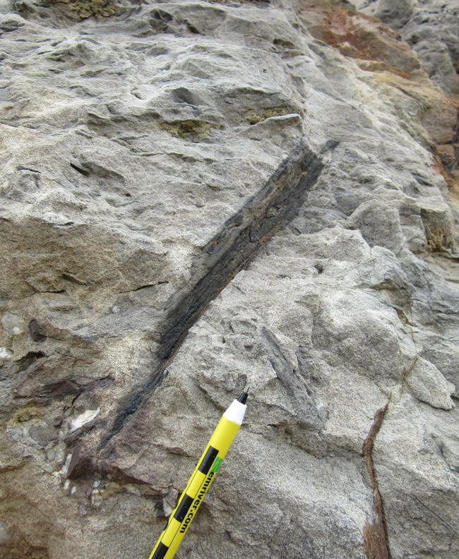
A stem in one of the white sandstones:
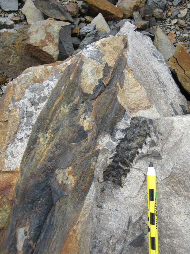
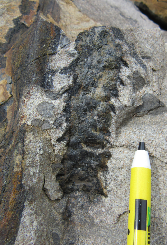
And another example of big pieces of coalified wood in the coarse, white sandstone:
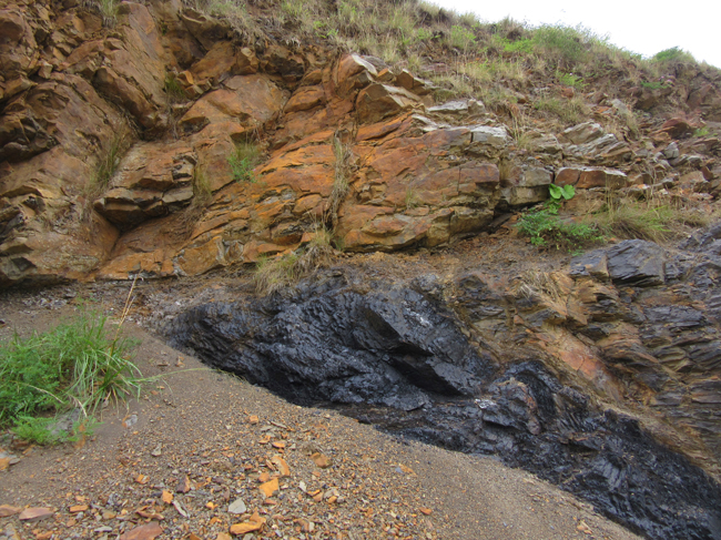
So, what’s going on here? Another example of a truncated coal, ending abruptly (and at an angle) relative to an overlying sandstone (here, stained orange from rust):
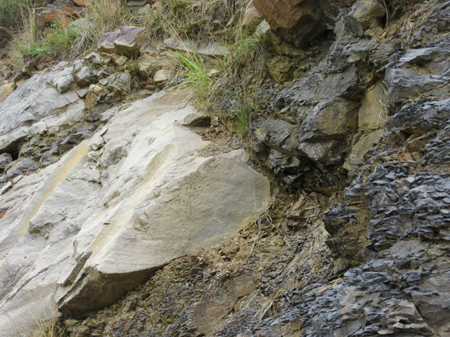
The bottom of this same sandstone shows features that look strongly like “ball and pillow” (soft sediment deformation due to density inversion):
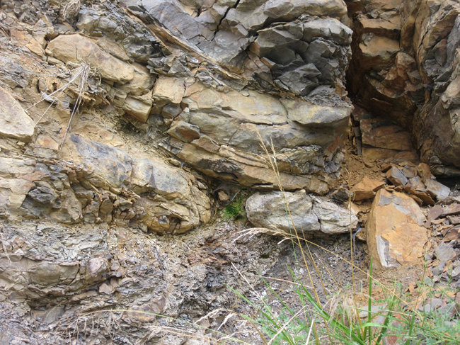
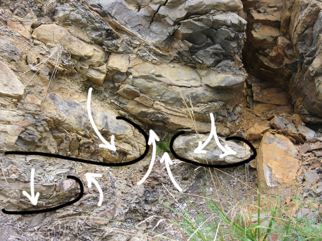
So maybe these relationships are sedimentary, depositional.
But… the angles of bedding are all over the place! Look at this:
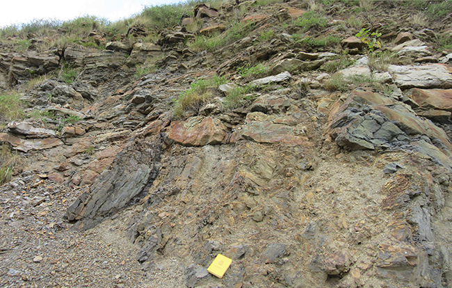
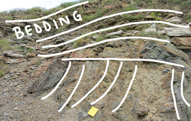
Could these layers be juxtaposted through tectonic deformation instead? Could these abrupt truncations be thrust faults? Certainly that was a common theme in the guesses offered by readers.
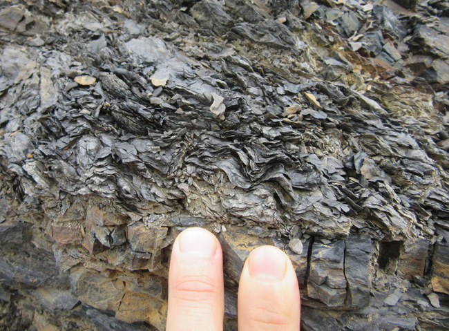
There is some smaller-scale structure to be observed, such as this batch of small crinkles in on of the shale units:
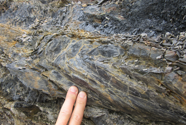
…or these recumbent folds in siltstone layers, a few inches away:
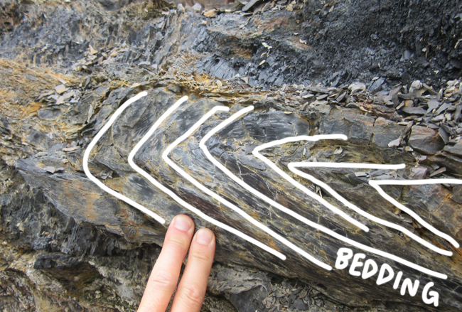
In one of the highly tilted sandstones, there is internal folding, too:
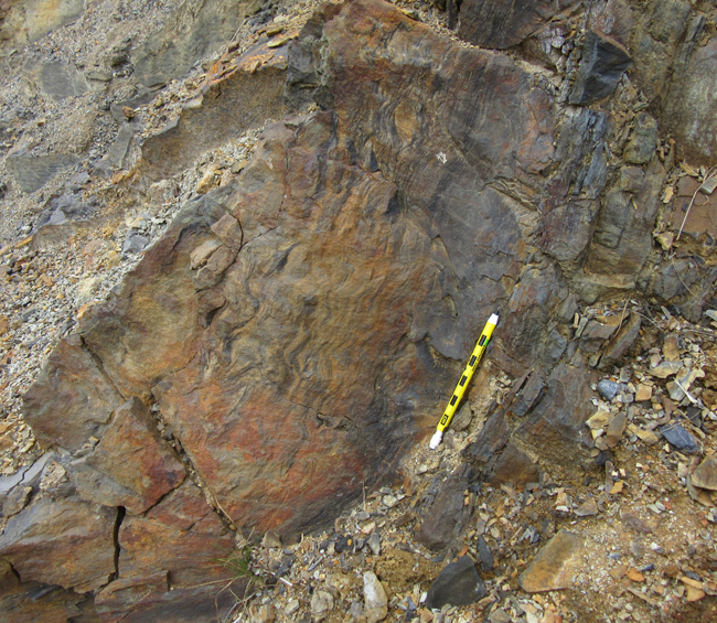
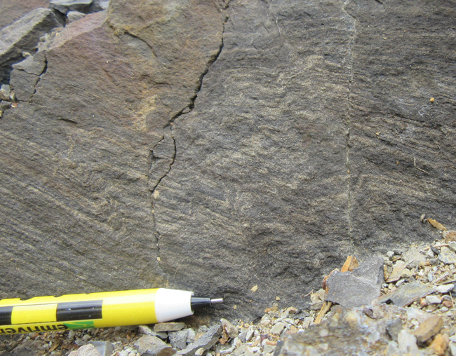
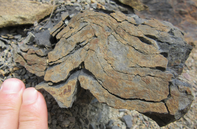
Here, the trace of bedding can be followed around the left and lower edges of this block weathered out from the outcrop, apparently overprinted by a weak crenulation lineation:
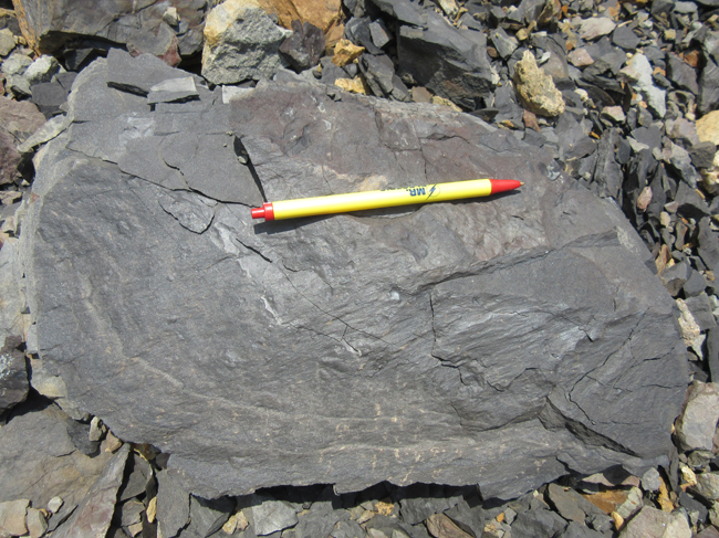
Look at this truncating relationship:
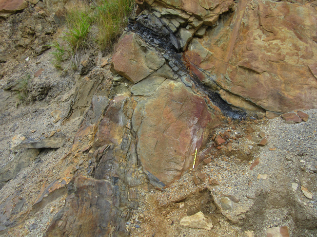
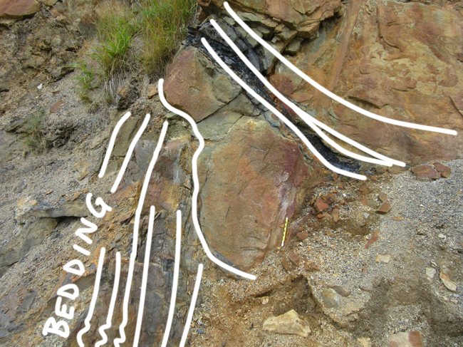
Jeff examines this site (same site; photographer’s perspective has shifted a few meters to the left):
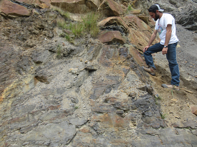
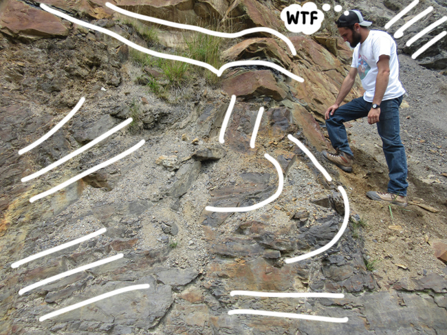
Elsewhere, there are odd “lozenges” of coal in the sandstone:
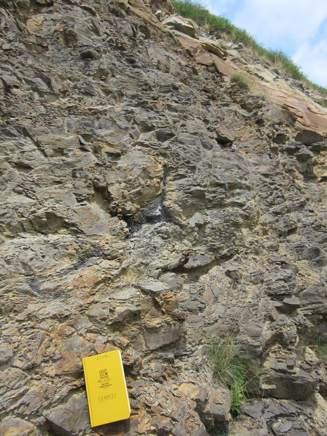
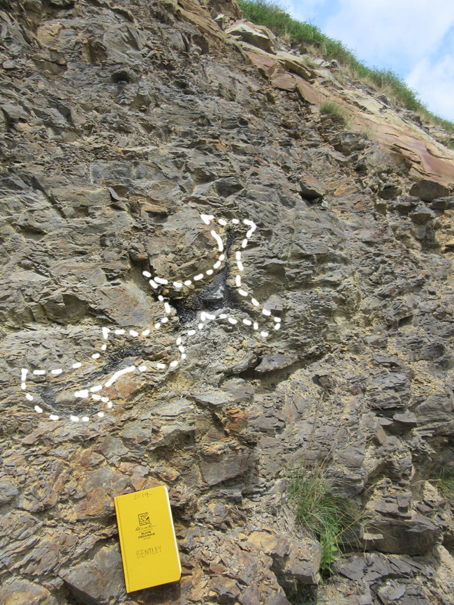
Is that a coalified branch? Is it a bleb of former peat that got torqued and twisted during deformation? Was the deformation pre-lithification (and coalification), or post-?
One idea on how to interpret these rocks is that there these discontinuities represent tectonic (Alleghanian) faulting, but when we looked for slickensides, fault breccia, etc., we didn’t find it. Instead, we think the best way to interpret this outcrop is a series of paleo-slump-blocks that were then incised by rivers, removing some portion of the slump blocks and depositing coarse channel sandstones.
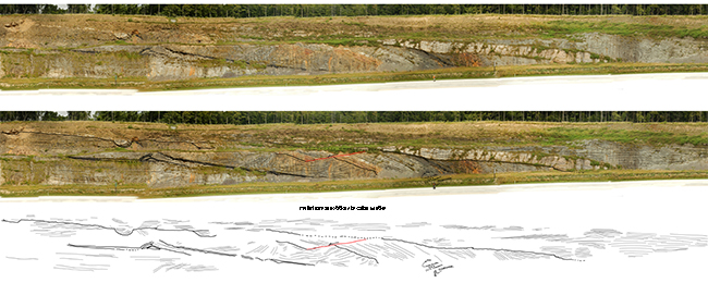
Here’s Alan Pitts’s annotation of the outcrop, based on a hand-held panorama (one of the GigaPans embedded above) and condensed a bit by me in order to economize on space:
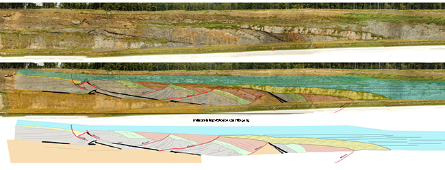 Click to enlarge
This I think, is instructive on two levels: (1) Alan is a talented graphic artist, and (2) this sort of annotating a high-res image is a useful method of developing hypotheses about an outcrop. You can see, for instance, that Alan has outlined the prominent white sandstone blob in the upper left with two faults. Here’s a close up of that site from the upper bench:
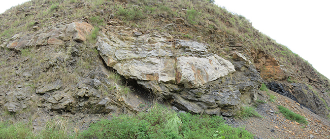
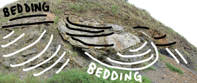
It didn’t look like it was fault-bound to me; it looked to me like a channel incising into (slump-) tilted strata, and then filled in two separate episodes (earlier dark gray and medium-grained sand, later white and coarse-grained sand). In other words, in my mind, the arcuate bottom to that protrusion is primary, a depositional feature, not a later tectonic imposition.
So here’s my attempt at annotating Alan’s GigaPan (i.e. same base imagery as above, but different a geologist making the lines and interpretations, using a stylus on a Wacom Cintiq):
I did that solo, without reference to Alan’s annotations, to minimize his influence on my thinking, and see what I would come up with on my own. He may have missed some stuff I caught, and I may have missed some of the stuff he caught. Caveat emptor: Both Alan’s sketch and mine are preliminary – a method of practicing looking at the outcrop. Nothing here should be taken as conclusive. I share them here in their unpolished state to reveal the way we approached this problem, and how the imagery was a catalyst to our thinking.
I interpret these rocks as paleoslump blocks – layers of clastic sediment and peat laid down, perhaps during eustatic highstands, then incised during the regression accompanying a late Paleozoic glaciation. These incisions likely oversteepened the slopes of these soggy sediments, and they sloughed into the resultant valleys. This rotated the strata, and exposed the leading edge to erosion at the river’s cut bank. The slump blocks, as Alan pointed out, would have a “normal” sense of offset on their trailing edge, but a compressional (and potentially even “reverse”) sense of kinematics on their noses.
Later, transgression accompanied deglacation, and fluvial deposition laid down the coarse white cross-bedded sandstone (with channel lags of gravel and big branches of plants included). Then another cyclothemic cycle went into force, and the pattern repeated. That, to me, is the most economical way to explain what I see at these outcrops. But I’m open to being convinced otherwise: You now have the same data we do. Take a crack at it – and once, again, Tell Me What You See Here….


 Callan Bentley is Associate Professor of Geology at Piedmont Virginia Community College in Charlottesville, Virginia. He is a Fellow of the Geological Society of America. For his work on this blog, the National Association of Geoscience Teachers recognized him with the James Shea Award. He has also won the Outstanding Faculty Award from the State Council on Higher Education in Virginia, and the Biggs Award for Excellence in Geoscience Teaching from the Geoscience Education Division of the Geological Society of America. In previous years, Callan served as a contributing editor at EARTH magazine, President of the Geological Society of Washington and President the Geo2YC division of NAGT.