
6 August 2010
Update on the Pakistan floods: 6th August 2010
Posted by Dave Petley
The flood wave in Pakistan continues to travel down the Indus River and is now approaching Sukkur. The authorities are responding with a large-scale evacuation of low-lying communities – The Nation reports that 500,000 people are being relocated but that 1.5 million people are likely to be affected.
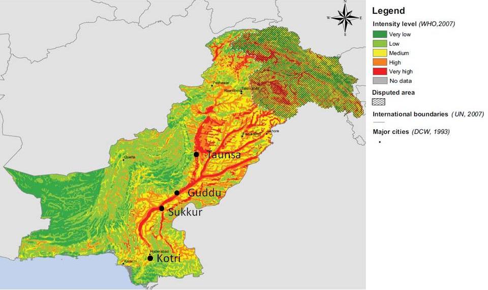
The latest FFD hydrographs depict the situation very clearly. The locations of the gauging stations are shown on this annotated 2007 OCHA map of national flood potential for Pakistan:
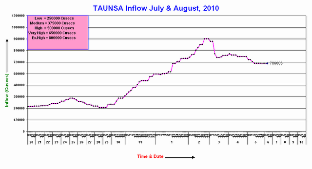
At Taunsa the FFD hydrograph is now on the falling limb, but the discharge is declining slowly:
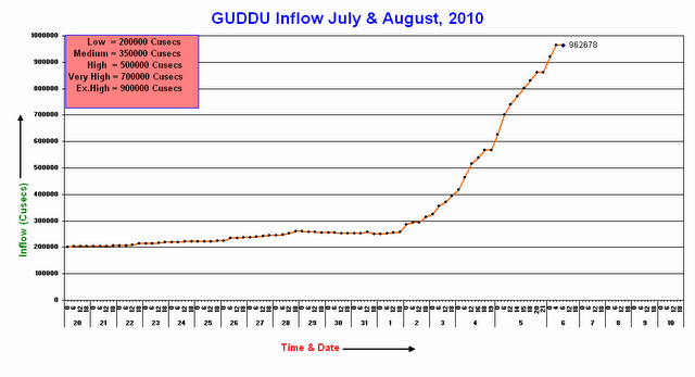
Meanwhile, as expected the water level at Guddu is continuing to rise towards the million cubic feet per second level, and is now substantially above the extremely high flood level:
The low-lying telief around Guddu is clear in this Google Earth image of the area:
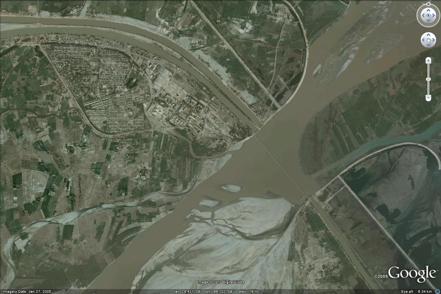
The barrage evident in the image above is deigned to direct flow into the channels on either side of the river, which then provide irrigation to about 12,000 square kilometers of land. Clearly, damage to this structure would have a substantial impact, but the reported capacity is 1.25 million cubic feet per second.
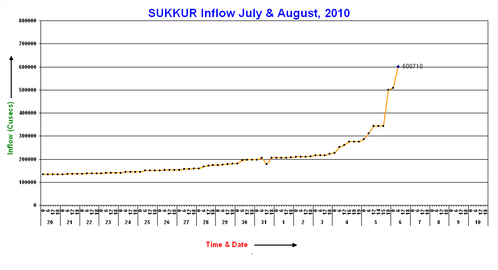
The next key location downstream is Sukkur, where the hydrograph is now showing rapid increases in discharge:
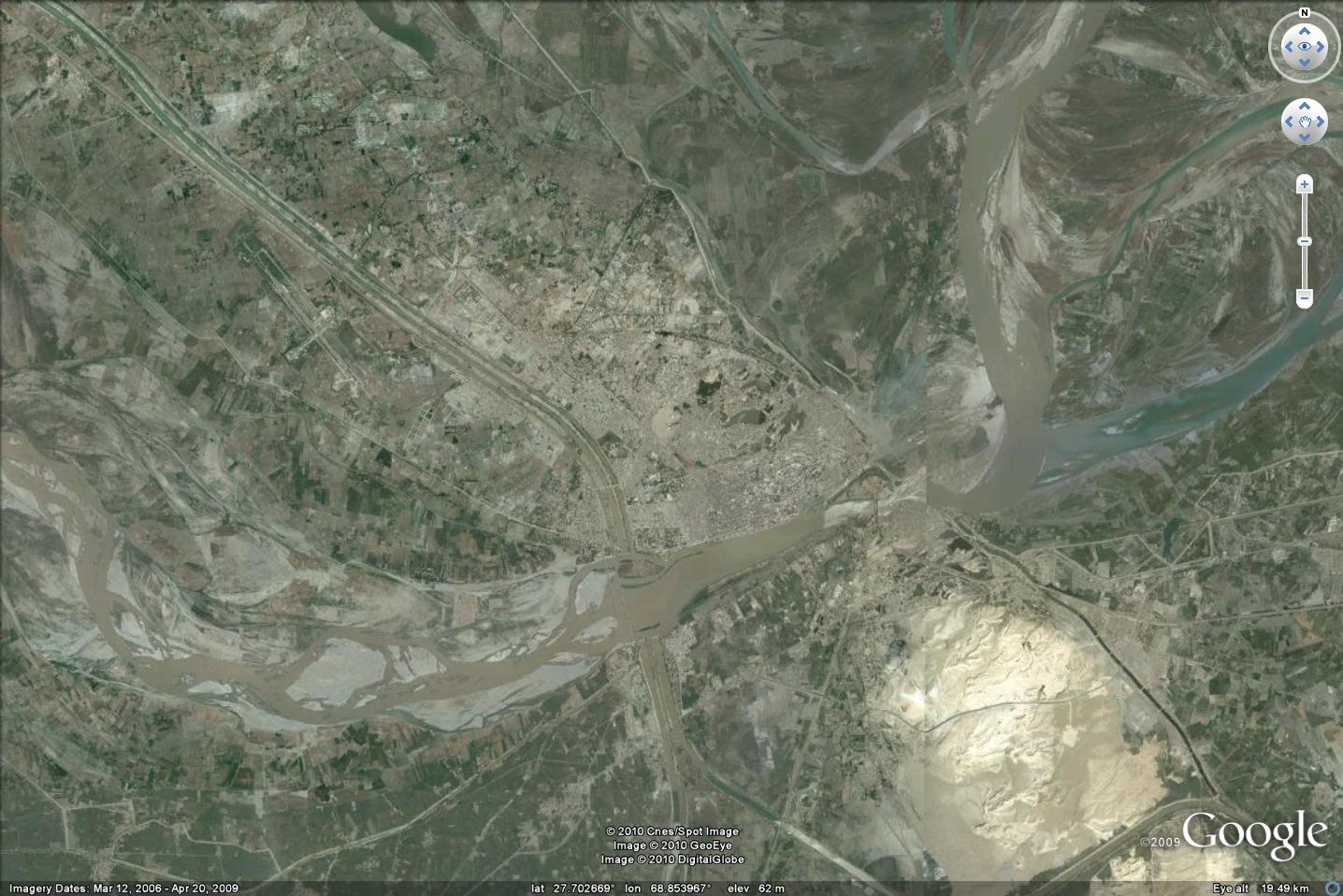
The Google Earth image of Sukkur shows that it is a much larger settlement:
Sukkur also has a barrage, as shown on this Panoramio image:

This barrage provides irrigation to 20,000 square kilometres of land. Damage to the structure would be serious. The reported capacity is 900,000 cubic feet per second, so it should survive.
Finally, downstream is Kotri, where the discharge is also now starting to increase:
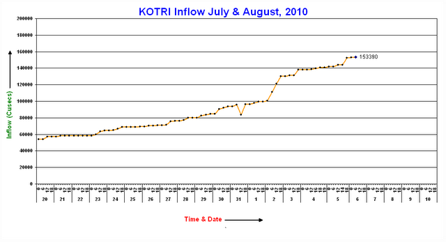
It will be a few more days before the main flood reaches this point.
Meanwhile, the Pamir Times has published another set of images of the state of the Karakoram Highway, of which this is the best:
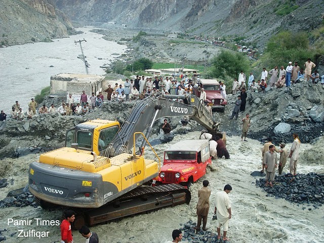
Two things to note here. The obvious one is the huge amount of material deposited on the road by this debris flow. The other is the huge queue of trucks in the background. These trucks are trying to travel southwards out of the mountains.
 Dave Petley is the Vice-Chancellor of the University of Hull in the United Kingdom. His blog provides commentary and analysis of landslide events occurring worldwide, including the landslides themselves, latest research, and conferences and meetings.
Thank you Dr Dave for the excellent update.Things in Pakistan are quite bad,there has been massive damage to infrastructure in KP province,GB province and in Punjab and flood wave has enetered Sind today.There are reports in some local newspapers that NDMA has wound up it's programme in Attabad of re-habilitation etc and left it to Chinese.http://dailybaadeshimal.com/popup.php?r_date=08-06-2010&img;=08-06-2010page-1-12The newspaper is in Urdu language.FOCUS still has very strong presence in Attabad (according to my friend in Hunza) and is also very active in providing flood relief in other areas.Hussain.
Hi Dr. Dave,Thank you for the update. I agree with Hussain, things look pretty bad in Pakistan. I am really hoping that they will recover soon. And with posts like this one I'm sure more and more people will be aware of what's really going on in this earth and hopefully this awareness will prompt them into action.Keep it up Dr. Dave!Drew Kesler
Is there a link somewhere to download the actual gage data rather than just the provided graphs?Keep up the good work Dr. Dave.
dear dr.dave, your landslide blog was awesome.