22 March 2022
Scud Glacier: images of the 2020 rock avalanche in British Columbia
Posted by Dave Petley
Scud Glacier: images of the 2020 rock avalanche in British Columbia
Loyal reader Brian Rottenfusser has very kindly sent me two images of a rock avalanche that occurred on the Scud Glacier near to Telegraph Creek in British Columbia in Canada. The images were taken by Bob MacDonald, who has given permission for me to publish them. The images were taken on 16 September 2020, although the landslide probably occurred some months earlier.
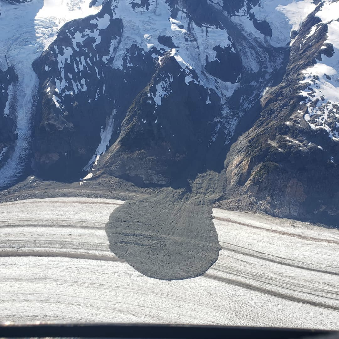
The first shows a rather beautiful rock avalanche deposit on the surface of the Scud Glacier:-

The 2020 rock avalanche onto the Scud Glacier in British Columbia. Image by Bob MacDonald, used with permission.
.
Note the symmetric shape of the deposit, with some enhanced mobility on the debris bands (this might be topographically driven). The track of the rock avalanche is visible down the gully.
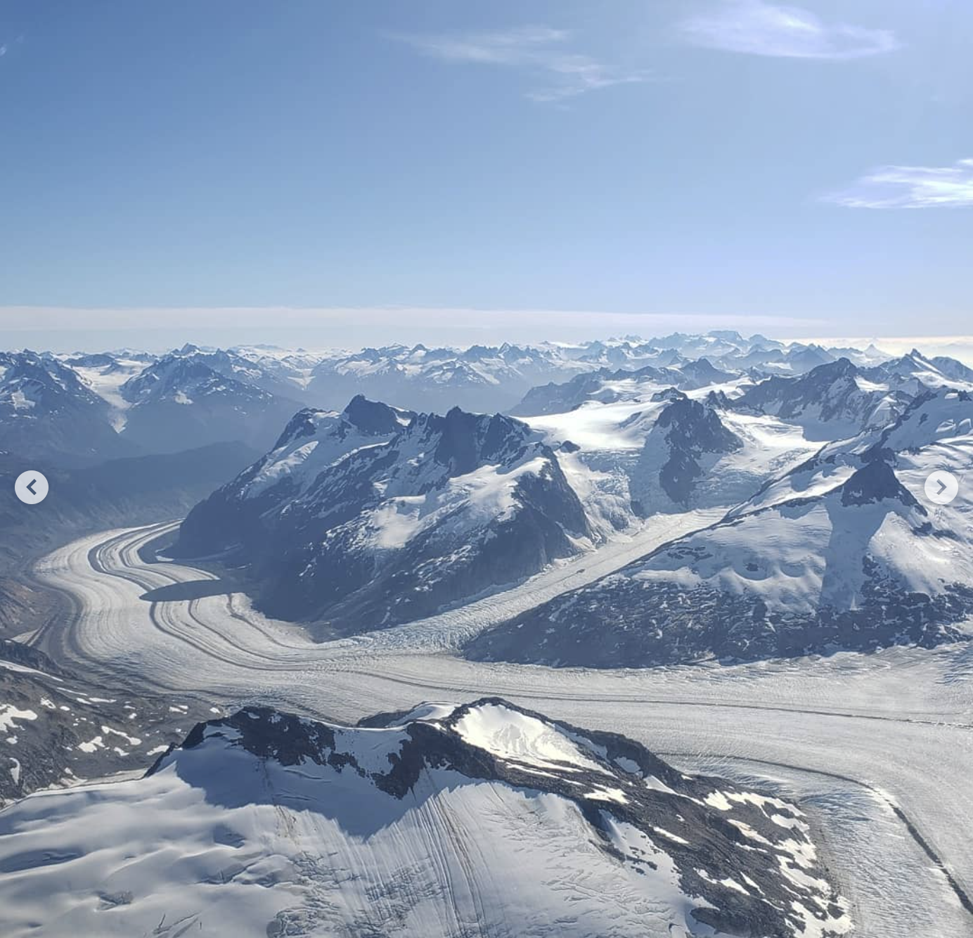
The second image provides a perspective view from a greater distance:-

A more distant view of the 2020 rock avalanche onto the Scud Glacier in British Columbia. Image by Bob MacDonald, used with permission.
.
Whilst I haven’t heard much about this event, Alexandre Bevington tweeted some satellite images of it in June of last year.


 Dave Petley is the Vice-Chancellor of the University of Hull in the United Kingdom. His blog provides commentary and analysis of landslide events occurring worldwide, including the landslides themselves, latest research, and conferences and meetings.
Absolutely gorgeous. Going to be interesting watching it move with the glacier on satellite images over the coming years. Not much motion visible as of just prior to this season’s snowfall:
https://soar.earth/satellites/sentinel?pos=57.345864562706154%2C-131.3993918493114%2C12&bbox=-131.4952932550824%2C57.265002358629815%2C-131.30349044354045%2C57.42654908178586&time=2021-08-31&layerKey=TRUE_COLOR
wow.. terrific pictures.. many questions.. such as why it came down and when. I have seen a similar slide a few years ago in that vicinity from a jet, but never figured out where it was located. Tar and Martin mapped many of these. I would not want to be below that slide when it came down. I wonder if there are any precursors or a seismic record showing when it came down.
It looks like the small flows to the right are up glacier, caused by the buildup behind the larger debris/ ce ridges on the glacier?
After June 14 but before June 17 2020
https://soar.earth/satellites/sentinel?pos=57.35745227369265%2C-131.38064341145915%2C12&bbox=-131.4952932550824%2C57.265002358629815%2C-131.30349044354045%2C57.42654908178586&time=2020-06-17&layerKey=TRUE_COLOR
Thank you for that wonderful image. I am starting to ‘collect’ examples of rock avalanches (etc) onto glaciers to see what, in time, happens to modifications of the glacier concerned. This is related to reduction in ablation under the debris and behaviour of the glacier and is also linked to work on rock glaciers as part of mountain landsystems. Using decimal Lat Long (dLL) I am identifying these in the form [57.3822,-131.3738] which is the approximate centre of this example and also {57.3818,-131.3848,080,@2020} which is the approximate origin and its flow direction bearing and date.
I’d be interested in hearing about any other examples, throughout the world,not just in BC.
Incidentally, on looking at the Sentinel imagery of Scud Glacier, (snow-covered on curent G Earth) there appears to be a considerbale event (or series of events, seismically triggered?) covering part of the lower left side of the glacier. Thus [57.3366,-131.3394] identifies the furthest position towards the centre of the glacier. Further information on this welcome.
Brian Whalley [email protected]