22 March 2021
The preferred route corridor for the A83 at Rest and Be Thankful
Posted by Dave Petley
The preferred route corridor for the A83 at Rest and Be Thankful
In terms of disruption and economic cost, the most serious landslide problem in the UK at the moment is the alignment of the A83 at Rest and Be Thankful in Scotland. This key road, which provides access to an important area of Argyll and Bute, has suffered repeated landslide problems over more than a decade. There is strong evidence that these problems are becoming worse with time.
Work has been underway to identify a route that avoids this problematic stretch of the landscape in Glen Croe. In a rugged, protected landscape there is no simple solution.
Late last week the Scottish Government announced their preferred option, which was based on the so-called Glen Croe Corridor Option 1. Transport Scotland has now provided a really excellent Story Map that provides details of the options in play and the detailed processes used to assess their viability. This proposal will retain the alignment within Glen Croe, but there is then a range of possible alignments within the valley:-

The potential alignment options for the A83 at Rest and Be Thankful.
.

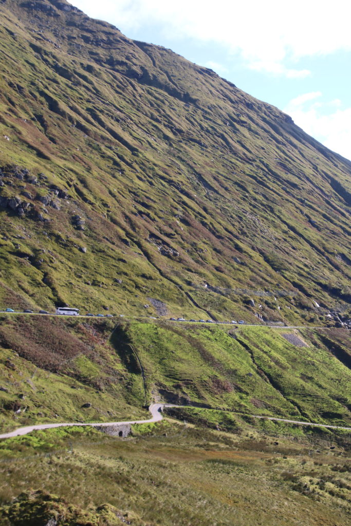
A part of the problematic slope at Rest and Be Thankful.
The options are:
The brown option closely follows the alignment of the current A83 Trunk Road and includes construction of a debris flow shelter around 1.3 km in length over the existing road, as well as a length of viaduct of approximately 0.3 km to improve road alignment on the approach to the Rest and Be Thankful car park.
The yellow option would see a new single carriageway road constructed approximately 2.1km in length, positioned between the existing A83 Trunk Road and Old Military Road. This would include a length of new carriageway on a viaduct around 1.8 km long from Croe Water to the Rest and Be Thankful car park.
The green option would involve the construction of a new single carriageway road around 4.3 km long on the opposite side of the valley from the current A83 Trunk Road, crossing the valley floor and Croe Water over a viaduct 0.2 km in length. Landslide mitigation works such as debris flow shelters, fencing and viaducts, would also likely be required to protect the proposed road from future landslide events.
The purple option provides a new length of single carriageway around 3.2 km in length, positioned within the Glen Croe valley floor and tying into the existing A83 Trunk Road south of the Croe Water.
The pink option would involve construction of a new length of single carriageway approximately 4.1km long, of which around 2.9 km would be within a tunnel. The tunnel would pass under the Croe Water and the A83 Trunk Road.
Transport Scotland is inviting views on these options, whilst starting the process of assessing in detail their viability. A Strategic Environmental Assessment (SEA) Environmental Report will be published next month.
In the meantime works continue to try to protect the existing alignment – completing the new road will take several years at best. I hope to pay another visit once the current ban on travel in the UK comes to an end.


 Dave Petley is the Vice-Chancellor of the University of Hull in the United Kingdom. His blog provides commentary and analysis of landslide events occurring worldwide, including the landslides themselves, latest research, and conferences and meetings.
No easy answers !!
IIRC, took three decades to figure an acceptable fix for grossly unstable stretch of A82 near Pulpit Rock, on North-West shore of Loch Lomond…
https://www.transport.gov.scot/projects/a82-pulpit-rock/a82-pulpit-rock/
https://www.mclh.co.uk/our-projects/a82-pulpit-rock-loch-lomond/
https://tonygee.com/a82-pulpit-rock/
The MCLH report aptly describes work as ‘bridge building’…
https://www.newcivilengineer.com/latest/announcement-on-scheme-for-scotlands-landslide-prone-a83-expected-within-weeks-23-05-2023/
Quote:
Announcement on scheme for Scotland’s landslide-prone A83 expected within weeks
23 MAY, 2023 BY NICK MYALL
Transport Scotland is set to confirm the preferred scheme to remedy a landslip-prone section of the A83 road in the western Scottish Highlands “in the coming weeks”.
Transport Scotland director major projects Lawrence Shackman told NCE that details of the selected long term solution for the Rest and Be Thankful section of the A83, which will be chosen from five proposed schemes, would be released in the coming weeks, along with a construction schedule and estimated completion date. Schackman revealed the timeline to NCE following his presentation at NCE’s UK Roads conference last week on the project.
/
There’s a lot more detail plus geological considerations etc…
My wife and I used to holiday in Glen Nevis / Ft William every Autumn, which gave us a sorta time-lapse of eg the Loch Lomond and Glencoe and Mallaig upgrades, successive A83 road alignments. These were, um, thought-provoking…
They’ve gone for the avalanche shelter, almost a mile of it…
https://www.bbc.co.uk/news/uk-scotland-glasgow-west-65781089
quote from linked site:
The Brown Option is generally located on the existing A83. To protect the road users from debris flows and landslides, a structure known as a debris flow shelter is required to cover part of the road considered to be at higher risk.
The form of the Brown Option has evolved to include a catch pit on the uphill side of the flow shelter structure. The purpose of the catch pit is to channel landslip material, allowing it to be removed safely and efficiently, without adversely impacting the road user or the downstream slope.
The Brown Option is 2.4km long, with the flow shelter and catch pit extending to 1.37km. The catch pit and protection wall extends a further 180m to further protect road users below the Beinn Luibhean slope and area of highest vulnerability.
/