2 January 2021
Mount Silberhorn – a large rockslide in New Zealand
Posted by Dave Petley
Mount Silberhorn – a large rockslide in New Zealand
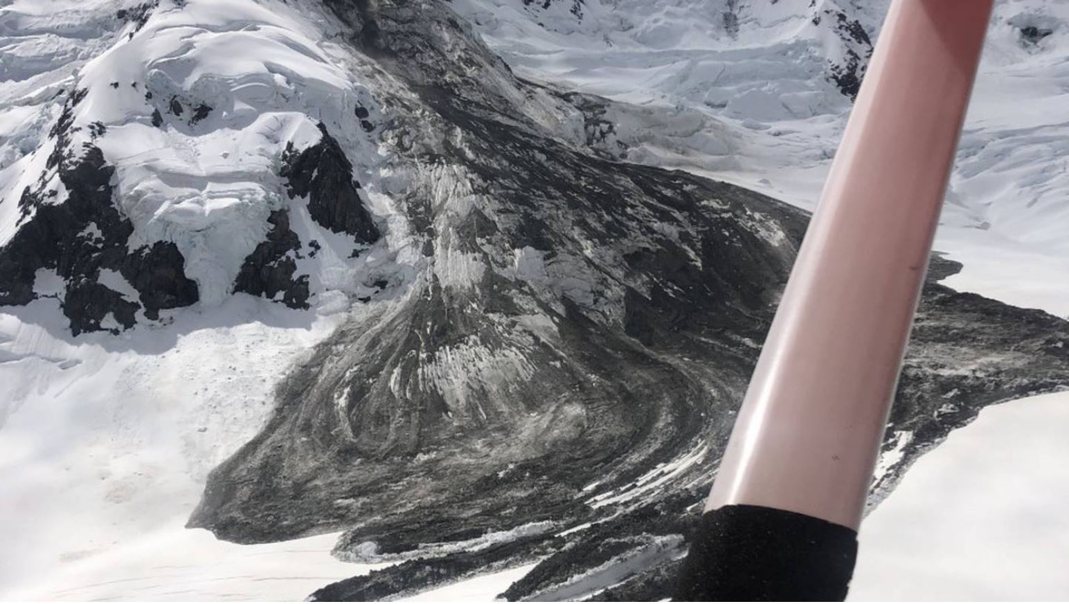
On 31 December 2020 pilots from Mount Cook Ski Planes & Helicopters in New Zealand noted the aftermath of a large rockslide from Mount Silberhorn in New Zealand. Mount Silberhorn, with an elevation of 3303 m, in the fifth highest peak in New Zealand. It is located near to Aoraki/Mt Cook in the Southern Alps.
Mount Cook Ski Planes & Helicopters have released the image below of the landslide, and there is a gallery of images on their Facebook page:-

The Mount Silberhorn rockslide in the Southern Alps of New Zealand. Image collected by Mount Cook Ski Planes and helicopters.
.
There is also a short video on the New Zealand Herald website.
This appears to be a rockslope failure on a steep ridge, which has transitioned into a rock avalanche and then a slide across the frozen surface. Note the lobate structure on the margins of the landslide, which might indicate late stage creep. The mechanism looks very similar to the Mount Dixon rock avalanche (also known as the Mount Haast rock avalanche), which was so memorably caught on video.
Unfortunately there is no satellite imagery of this landslide that I can find at present.
This landslide has occurred in the first half of the summer, which is a period in which we have seen increased levels of large rockslides elsewhere. The timing is likely to be linked to degradation of frozen ground in the early part of the annual thaw, probably exacerbated by the increasing temperatures associated with global heating.


 Dave Petley is the Vice-Chancellor of the University of Hull in the United Kingdom. His blog provides commentary and analysis of landslide events occurring worldwide, including the landslides themselves, latest research, and conferences and meetings.
It seems the landslide had not yet happened on 30 December 17:39 GMT: https://www.sentinelvision.eu/hyperlook/52a49888e354496e804d0c05545cd412