3 December 2020
High resolution satellite images of the Guinobatan lahar
Posted by Dave Petley
High resolution satellite images of the Guinobatan lahar
A month ago, Typhoon Goni (known locally as Rolly) brought heavy rainfall to the Philippines, causing extensive damage. One of the most serious events triggered by the typhoon was the Guinobatan lahar, which flowed down the flanks of Mount Mayon, an active stratovolcano.
Plant Labs have very kindly collected and processed high resolution satellite imagery of the aftermath of the lahar. Once again I thank them for their support and for making this amazing imagery available – it is transformative in our understanding of these events.
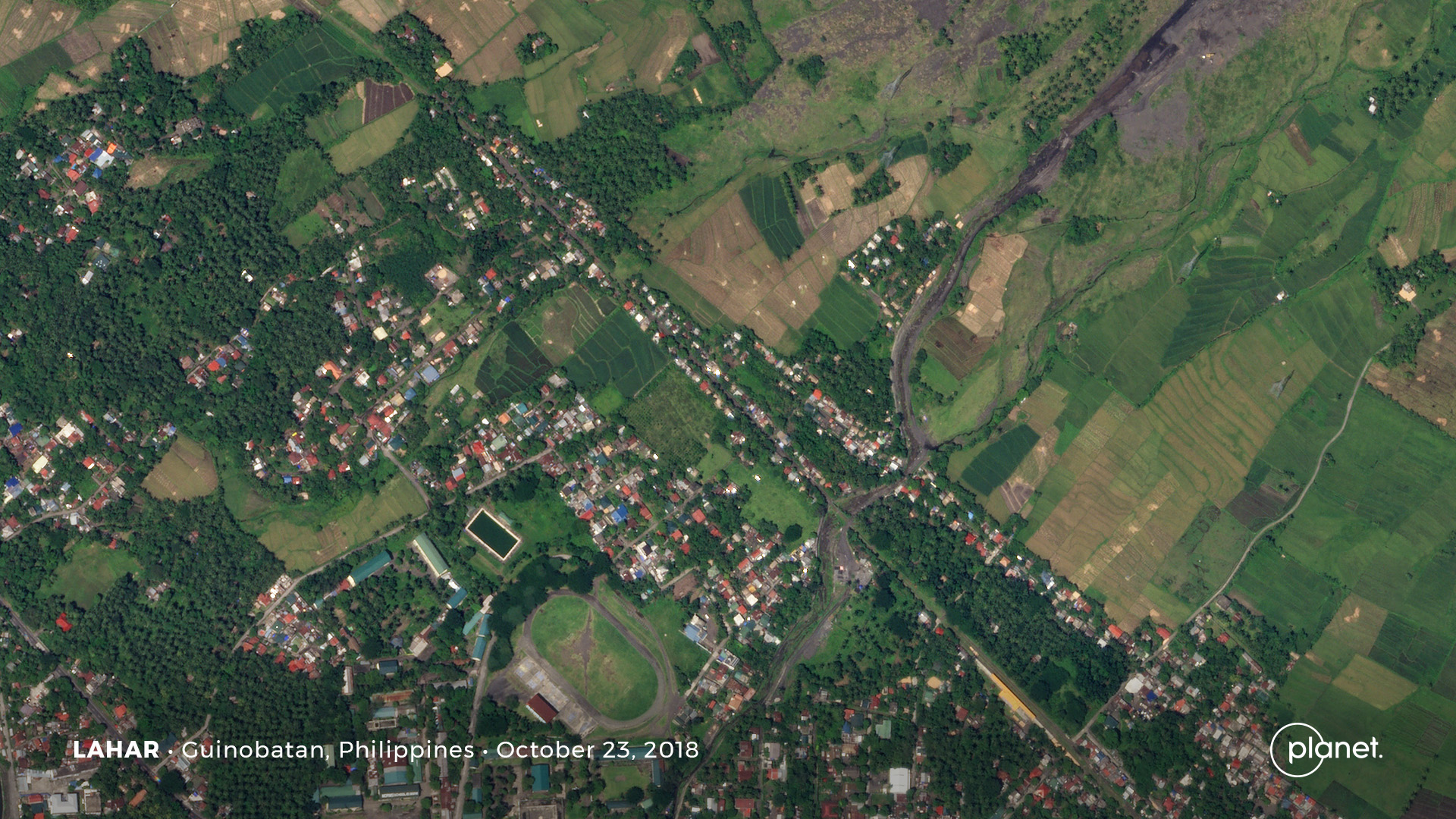
This is an image of the area affected by the lahar, collected on 23 October 2018:

The area affected by the Guinobatan lahar before the event. Planet Labs SkySat image, copyright Planet Labs, used with permission.
.
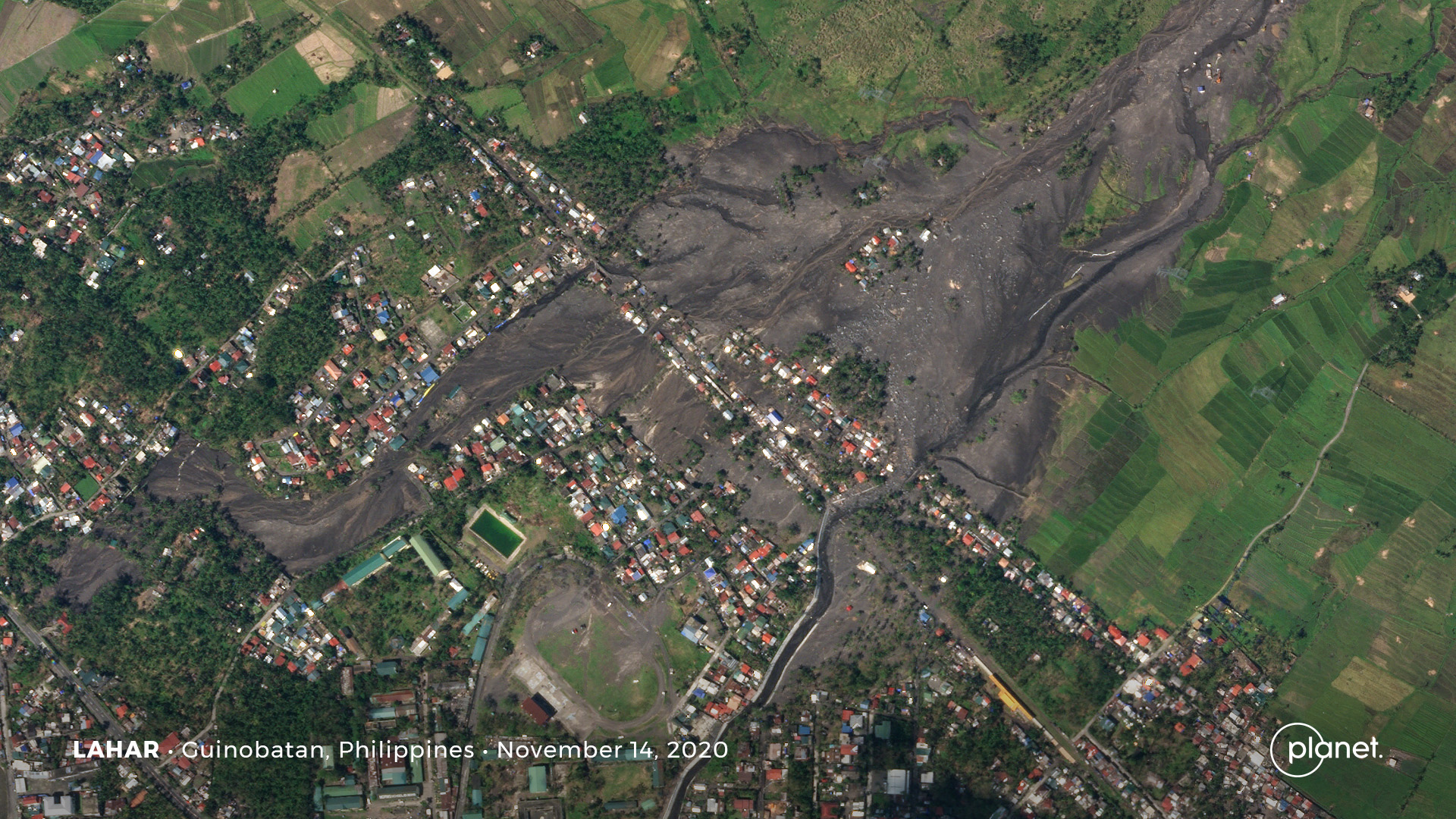
And in contrast, this is an image of the aftermath of the lahar, collected on 14 November 2020:-

The aftermath of the Guinobatan lahar. Planet Labs SkySat image, copyright Planet Labs, used with permission.
.
I have used Juxtapose to create a slider that allows comparison of the images.
In the image before the lahar the existing channel cuts through the settlement. There is a hint that lahars have affected a much wider area, especially in the upper central part of the image where there considerable areas of sparse vegetation.
In the second image it is clear that the Guinobatan lahar overflowed the channel upstream of the houses, spreading over a large area. Indeed the main flow appears to have followed a different path altogether, penetrating a long distance into the settlement. There are a large number of houses affected.
Interestingly, the lahar has reoccupied some abandoned channels, especially on the eastern side. There are other abandoned channels that this event has not reoccupied.
These images serve to highlight the hazards posed by lahars, the vulnerability of settlements to them and the repeat nature of these events.
.
Reference and acknowledgement
Planet Team (2020). Planet Application Program Interface: In Space for Life on Earth. San Francisco, CA. https://www.planet.com/


 Dave Petley is the Vice-Chancellor of the University of Hull in the United Kingdom. His blog provides commentary and analysis of landslide events occurring worldwide, including the landslides themselves, latest research, and conferences and meetings.
Interesting that, other that at the top in the middle, there are very few buidings on the path of the landslide. Could this have happened before?