10 November 2020
The Queja landslide at San Cristobal Verapaz: drone footage of the aftermath
Posted by Dave Petley
The Queja landslide at San Cristobal Verapaz: drone footage of the aftermath
Over the last 24 hours further information has emerged about the Queja landslide at San Cristobal Verapaz in Guatemala. The search for the victims continues, but with little success, primarily because the debris is an estimated 15 metres deep. There seems to be a growing recognition that recovery will be impossible in the circumstances. Reuters has a report of the impact of the landslide on local Mayan families, for whom the Queja landslide is a catastrophe at every level.
Meanwhile, improved images and some high quality drone footage have been posted about the landslide. Drone footage of both the source area and the debris track and deposit were posted to Twitter:
https://twitter.com/RBCNoticiasGT/status/1325484169628184577
.
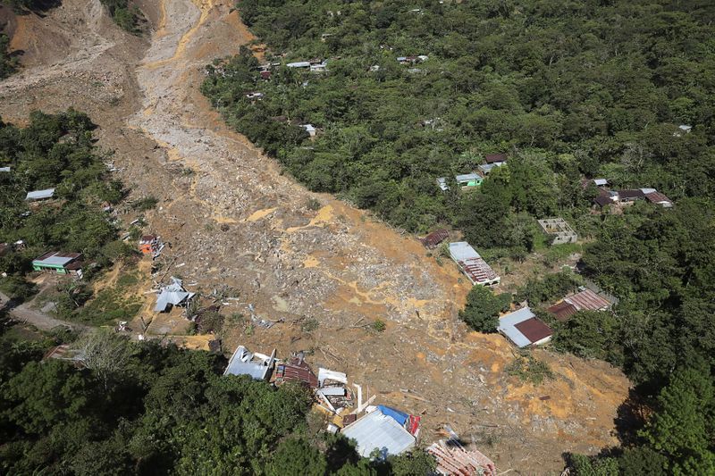
This footage has caused me to slightly change my interpretation of the event from yesterday. As I noted, it does appear that there are two main portions to the landslide, but the main impact on the communities seems to have come from the right hand, rather than the left hand, portion. The image below, posted by Yahoo News, shows this more mobile portion of the landslide:-

The lower portion of the Queja landslide. REUTERS/Luis Echeverria, posted by Yahoo News.
.
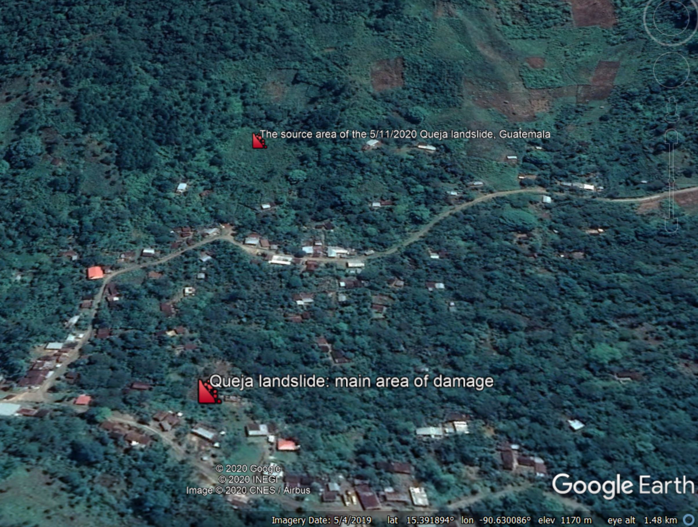
These images have made it possible to track down the source area of the Queja landslide on Google Earth, which is in the vicinity of the coordinates I posted yesterday (15.391, -90.632). The image below highlights the approximate source area of the landslide and the main damage track. Note the distinctive house with a brown and grey roof on the edge of the landslide on the image above – this can also be seen in the Google Earth image below:-

Google Earth imagery of the site of the Queja landslide.
.
Quickslide 1: Landslide induced pipeline ruptures in Ecuador prove to be extremely expensive
Reuters reports that Ecuador expects its crude oil production to miss its expected annual totals in part because of the impact of a pipeline rupture induced by a landslide:
Ecuador declared force majeure on oil exports in April after the state-run SOTE pipeline and privately held OCP pipeline burst due to a landslide in the Amazon region, forcing a temporary cut to crude production.
.
Quickslide 2: A rainfall induced landslide in Napier, New Zealand
Torrential rainfall in Napier, New Zealand yesterday triggered a landslide that destroyed a house. The occupants were lucky to survive.


 Dave Petley is the Vice-Chancellor of the University of Hull in the United Kingdom. His blog provides commentary and analysis of landslide events occurring worldwide, including the landslides themselves, latest research, and conferences and meetings.