
9 November 2020
San Cristobal Verapaz: the deadly landslide in Guatemala triggered by Hurricane Eta
Posted by Dave Petley
San Cristobal Verapaz: the deadly landslide in Guatemala triggered by Hurricane Eta
Over the weekend more information has emerged about the large, deadly landslide that struck San Cristobal Verapaz in Guatemala last week. The landslide, in an area that is remote and steep, destroyed a number of houses in the village of Queja. Unfortunately the area continues to be affected by heavy rainfall, and further landslides are occurring, disrupting the rescue and putting further lives at risk.
In terms of understanding this landslide, the two best images that I have found to date are below. The first, published on CP24, provides a good oversight of the source area of the landslide:-
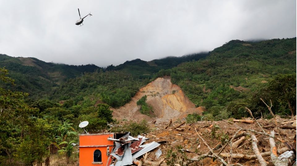
The landslide at San Cristobal Verapaz in Guatemala. Image by Esteban Biba/Pool Photo via AP, published by CP24.
.
On first inspection this appears to be a complex landslide, possibly occurring in two parts (note the stand of trees in the centre left of the landslide scar). In both elements there is possible a degree of rotational failure, but the upper portion appears to have transitioned into a slide or flow that has passed to the left of the trees (I’m using left in this case as shown in the image).
The second image is the one below, published by France 24:-
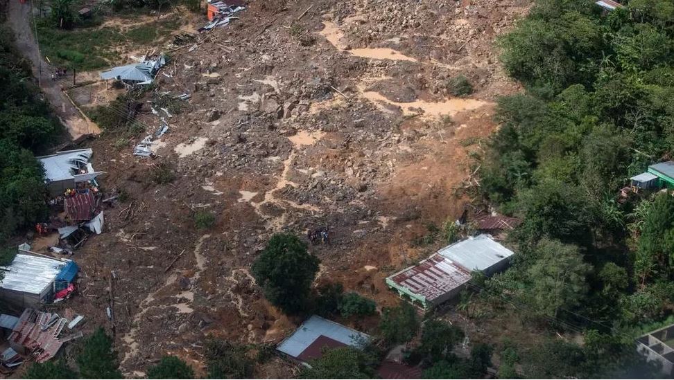
The lower portion of the landslide at San Cristobal Verapaz in Guatemala. Image by Esteban Biba/Pool Photo via AP, published by France 24.
.
This is the lower portion of the landslide; I suspect from other images that this has derived from the upper failure shown in the first image. Here the landslide appears to be a rockslide or possibly even a flow. Note the amount of standing water on the surface, but also the large boulders. The damage to the structures is clear; any building in the direct path would have been destroyed.
The number of people killed at San Cristobal Verapaz is not yet clear – to date only three victims have been recovered. However, on Friday President Alejandro Giammattei indicated up to 150 people might have been buried in the landslide. One woman has reportedly lost 22 family members in the disaster:-
“All her family is gone, she’s the only survivor. Her dad, mom, siblings, aunts and uncles, grandparents, they’re all gone. Twenty-two family members and it’s just her alive”. It is hard to imagine this level of loss.
A search for the location of Queja in San Cristobal Verapaz yields a location of: 15.391, -90.632 on the Geonames database. At present the satellite imagery is too cloudy to verify this as the correct site.
 Dave Petley is the Vice-Chancellor of the University of Hull in the United Kingdom. His blog provides commentary and analysis of landslide events occurring worldwide, including the landslides themselves, latest research, and conferences and meetings.
What a horrible way to go. Thanks to you Dave and all you other professionals for what you are doing to mitigate this sort of thing. Sadly as you often say Dave, we will see so much more of it with climate heating. Keep sounding the alarm all you scientists. Maybe the powers that be may stay listening properly.
Please tell me whether “9:03 AM. Nov 8. 2020” was the exact time of the land slide.
[No, the landslide was on 5 November 2020 I believe. D.]
Thank you for showing the date. Could you please also show the exact time?
[I don’t know the time. D.]
Thank you for showing the date. Could you please tell me the exact time?
[I don’t know the time. D.]