9 March 2020
Downstream impacts of the Salkantay rock avalanche and debris flow
Posted by Dave Petley
Downstream impacts of the Salkantay rock avalanche and debris flow
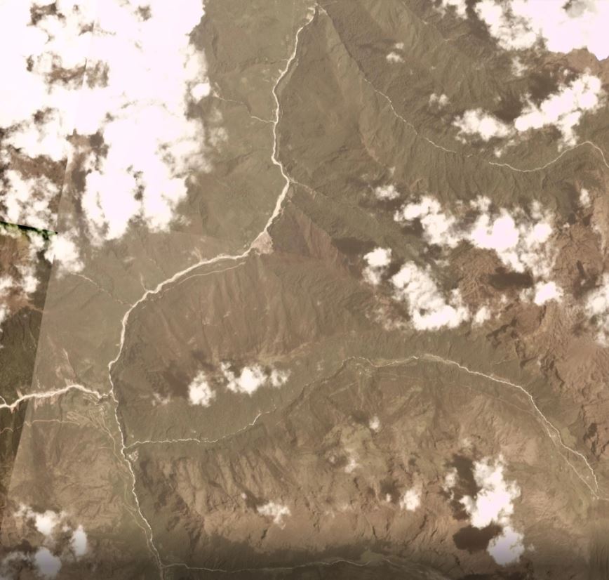
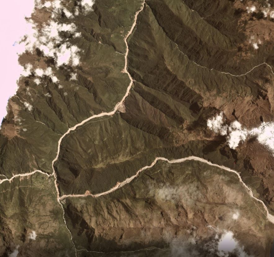
On 8 March 2020 Planet Labs captured an image showing the downstream impacts of the Salkantay rock avalanche and debris flow. Cloud-free days are rare in this part of the world are rare, so this is a good catch. Unfortunately the area of the actual failure is just off the edge of the image, but the downstream effects of the debris flow are clear.
This is an image of the area captured before the landslide on 7 January 2020 with the Planet Labs Planetscope system:

Planet Labs image prior to the Salkantay rock avalanche and debris flow. Planetscope image collected 7 January 2020. Copyright Planet Labs, used with permission.
.
This is an image collected with the same system on 8 March 2020 showing the aftermath of the debris flow:-

Planet Labs image after the Salkantay rock avalanche and debris flow. Planetscope image collected 8 March 2020. Copyright Planet Labs, used with permission.
.
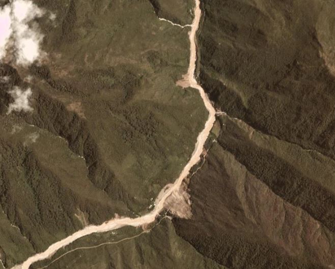
The impact of the landslide is clear. On the east side of the image a small proportion of what is presumably the landslide deposit can be see, before the channelisation occurred. The debris flow has eroded the channel flowing initially towards the west, and then towards the north. In some places erosion of the banks appears to have triggered failures on the hillsides. In this example, a new landslide has been triggered, and an existing one has been reactivated. In the latter case, a road across the landslide appears to have been destroyed:-

Planet Labs image after the Salkantay landslide. Planetscope image collected 8 March 2020. Copyright Planet Labs, used with permission.
.
Hopefully images will be captured in the next few days showing the failure itself, although this is of course dependent on cloud cover.
Reference
Planet Team (2020). Planet Application Program Interface: In Space for Life on Earth. San Francisco, CA. https://www.planet.com/


 Dave Petley is the Vice-Chancellor of the University of Hull in the United Kingdom. His blog provides commentary and analysis of landslide events occurring worldwide, including the landslides themselves, latest research, and conferences and meetings.
Through geo surveys, it is easier to maintain a good control over the issues like landslides. A little carelessness in the surveys can make things worse. So, good techniques should be used by the people to make sure that the outcomes of the survey are true. Thanks for sharing!
Geomembrane water survey