21 March 2019
Planet Labs imagery of landslides in Chimanimani National Park, Zimbabwe, triggered by Cyclone Idai
Posted by Dave Petley
Planet Labs imagery of landslides in Chimanimani National Park, Zimbabwe, triggered by Cyclone Idai
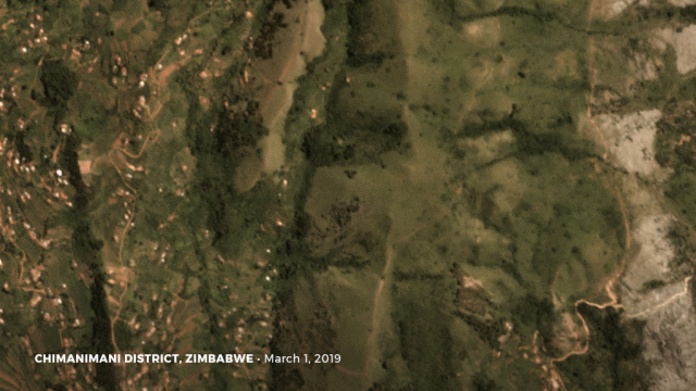
Yesterday Planet Labs captured high resolution satellite imagery of some of the landslides triggered by Cyclone Idai in Chimanimani National Park, Zimbabwe. There is increasing evidence that these landslides have caused substantial loss of life. This image is a SkySat image of the area, collected on 1st March 2019:-

Planet Labs Skysat image of part of the area affected of Chimanimani by landslides triggered by Cyclone Idai. Planet Labs Skysat image, 1st March 2019, used with permission.
.
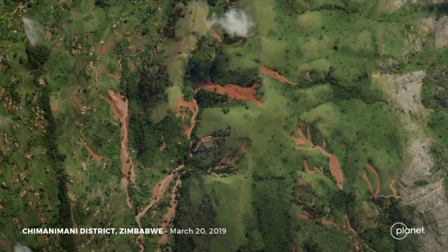
This is an image of the same area, collected yesterday, showing some of the landslides:-

Planet Labs Skysat image of part of the area affected of Chimanimani by landslides triggered by Cyclone Idai. Planet Labs Skysat image, 20th March 2019, used with permission.
.
So, the images show that there are multiple landslides across the landscape. The red colour of the landslide scars indicates deeply weathered soils, which are prone to failure in intense rainfall events. The initial slips, generally high on the slope, have triggered failure downslope, allowing the volume of the landslide to increase. That debris has combined in the channels to form the debris flows that have caused the losses downstream. Note that this area has been extensively deforested, which may explain the high incidence of landslides on this occasion.
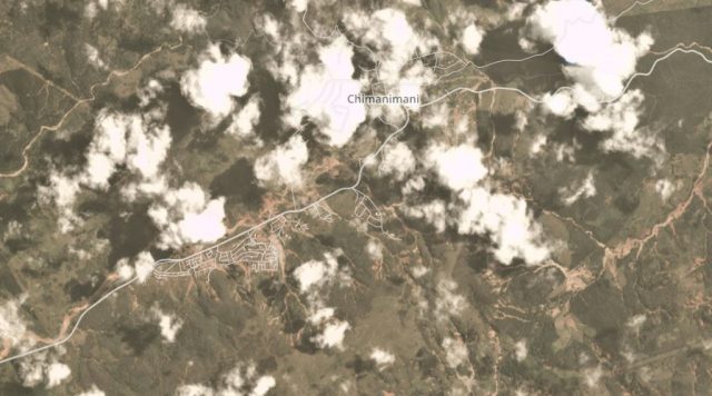
Planet Labs also captured a lower (3 m) resolution PlanetScope image of the Chimanimani area yesterday (20th March 2019). Whilst it is affected by some cloud, this appears to show very extensive landslides and debris flows of the types shown above, many of which have impacted upon the villages:-

Planet Labs PlanetScope image of part of the area affected of Chimanimani by landslides triggered by Cyclone Idai. Planet Labs PlanetScope image, 20th March 2019, used with permission.
.
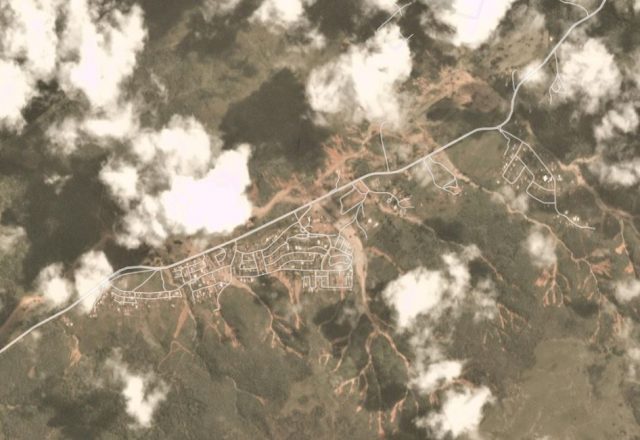
The village of Ngangu, southwest of Chimanimani, appears to have been particularly badly affected:-

Planet Labs PlanetScope image of the landslides in the area of Ngangu in Zimbabwe. Planet Labs PlanetScope image, 20th March 2019, used with permission.
.
It is likely that the level of loss, and destruction of houses, in this area are very high.
Reference
Planet Team (2019). Planet Application Program Interface: In Space for Life on Earth. San Francisco, CA.


 Dave Petley is the Vice-Chancellor of the University of Hull in the United Kingdom. His blog provides commentary and analysis of landslide events occurring worldwide, including the landslides themselves, latest research, and conferences and meetings.