20 January 2019
Landslides on the White Bluffs in Hanford Reach National Monument
Posted by Dave Petley
Landslides on the White Bluffs in Hanford Reach National Monument
Geologist Bruce Bjornstad has posted a really interesting video onto Youtube showing the development of landslides on the White Bluffs in Hanford Reach National Monument in Washington State. The video, which should be visible below, combines beautifully shot drone footage with a commentary on how these landslides have developed.
.
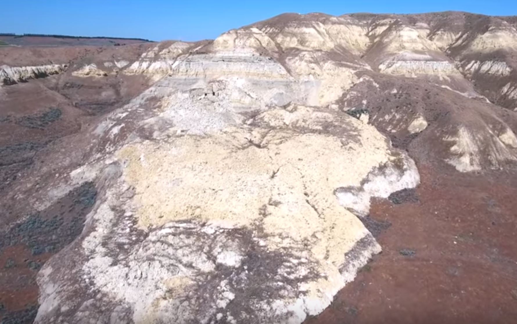
The image below provides a still from the video – these are very spectacular features:-

Landslides on the White Bluffs River in Hanford Reach National Monument in Washington State. Still from a Youtube video by Bruce Bjornstad.
.
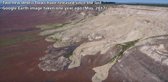
In the video Bruce explains the landslide mechanism, in which irrigation water moves down through the soil before hitting an impermeable layer and spreading laterally. This moves to the bluffs on the edge of the river, driving up pore water pressure and thus triggering failure. The resultant landslides have been developing with time. The locations in which water is exiting the slope can be seen in the Google Earth imagery in the video as vegetation growth has been enabled.
The resulting landslides are causing a serious change in the morphology of the bluffs in this protected area, as the still below shows:-

Landslide on the White Bluffs River in Hanford Reach National Monument in Washington State. Still from a Youtube video by Bruce Bjornstad.
.
This is a beautiful example of the ways in which poor water management can inadvertently trigger slope problems away from the location in which the irrigation is being applied. Of course the long-term implications are damage to the bluffs (which may well have implications for the ecosystem in this location), increased sediment supply to the river (which may have downstream implications) and of course loss of land at the top of the slope. Providing excess irrigation is presumably inefficient as well, so this is an unfortunate situation.
Acknowlegement
Thanks to Bruce Bjornstad for putting together the video and for highlighting it to me.


 Dave Petley is the Vice-Chancellor of the University of Hull in the United Kingdom. His blog provides commentary and analysis of landslide events occurring worldwide, including the landslides themselves, latest research, and conferences and meetings.
It is the irrigation conveyance systems that are inefficient and leads to water percolation laterally above clay layers. The efficiency of applications of irrigation water on farms has improved dramatically through the use of pivot systems, under-tree drip and solid set irrigation, and rill irrigation has been phased out.
Secondly, the souls deposited above the clay layers are colloidal and when liquification occurs, vertical forces are shifted laterally until slippage occurs. Those soils were collapsing along White Bluffs long before irrigation was introduced to the Columbia Basin.
Swallows drill nesting cavities into the face of pure clay cliff stratas and when they become too numerous, the face collapses and the cycle begins again.
Lastly, few account for the numerous tremors counted each year in fault areas that lead to cliff instability.
But, it is quite convenient to accuse farmers for the probelems. They didn’t construct the ditch and canal delivery systems – the Bureau of Reclamation did.
The idea of limiting irrigation water to only enough to support the crop is a good one, I think. But then, I’m not a geologist. I’m a 66 yr old woman who has brother-in-law who IS! (Jack Powell) I wasn’t too interested in geology till I married Javk’s younger brother. Now I’m hooked! I hope that this situation can be controlled, or at least contained. The implications of troubles caused by these landslides later i time, qnd the impact on the Xolumbia River are something everyone needs to be awate of! Thanks for all the info,you’ve posted on FB and YouTube!
Farmers know that if they are not using all the water they are allotted they will what they are not using.