19 December 2018
Revisiting the landslides from the Mw=7.5 earthquake in Papua New Guinea on 25th February 2018
Posted by Dave Petley
Revisiting the landslides from the Mw=7.5 earthquake in Papua New Guinea on 25th February 2018
Back in the early part of 2018 I posted on a number of occasions about the significant landslides triggered by the 25th February Mw=7.5 earthquake in Papua New Guinea. That event was efficient at generating landslides, and it is likely that a substantial proportion of the fatalities from the earthquake were related to the multiple slope failures. The response of the international community to this disaster has been disappointing, which has meant that it has been difficult to ascertain the true landslide impacts.
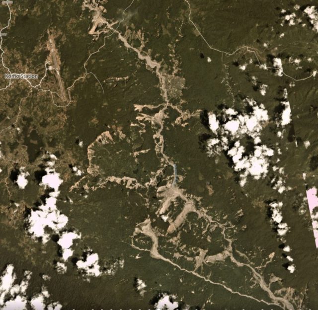
At the time it was difficult to piece together the overall effects of the landslides because satellite imagery was marred by the extensive cloud cover. In the months since it has been possible to get a better impression. This is a Planet Labs image of the river affected by landslides near to Komo Station, collected on 12th November 2018:-

Landslides triggered by the 2018 earthquake in Papua New Guinea. Planet Labs image, collected on 12 November 2018. Copyright Planet Labs, used with permission.
.
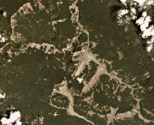
It is worth looking at just a part of this image in more detail:-

Detail of some of the landslides triggered by the 2018 earthquake in Papua New Guinea. Planet Labs image, collected on 12 November 2018. Copyright Planet Labs, used with permission.
.
The extensive failure of the steep scarp in the northeast of the image is interesting – I guess this illustrates the strong role that slope gradient plays in determining slope failure, plus there may be an element of topographic amplification here too. The large flow failure on the southern part of the image is also notable this is over 2.5 km in length. Along the river there is a series of significant failures, several of which are over 1 km long. And of course there are multiple smaller failures too.
Reference
Planet Team (2018). Planet Application Program Interface: In Space for Life on Earth. San Francisco, CA. https://www.planet.com/.


 Dave Petley is the Vice-Chancellor of the University of Hull in the United Kingdom. His blog provides commentary and analysis of landslide events occurring worldwide, including the landslides themselves, latest research, and conferences and meetings.