12 July 2018
Images of the disastrous landslides in Japan this week
Posted by Dave Petley
Images of the disastrous landslides in Japan this week
Over the last few days Japan has suffered from record levels of rainfall, triggering large numbers of landslides. In total at least 200 people have been killed in flood and landslide events.
To give an idea of the scale of this event, Planet Labs have published a before an after image pair of just one part of the affected area. This is the “after” image, showing the landslides around Yasuuracho Chuo, near to Hiroshima:-
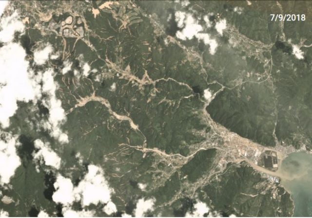
Planet Labs imagery of the aftermath of the landslides at Yasuuracho Chuo, near to Hiroshima, in Japan.
.
The image above shows multiple shallow slides, many of which appear to have transitioned into high mobility channelised debris flows. These are highly dangerous. Japanese news agencies have been publishing images that illustrate the scale of these landslides. The image below, published in The Mainichi, shows shallow slides at Uwajima in Ehime Prefecture. It may be no coincidence that the landslides have occurred in areas that have had heavy modification of their vegetation:
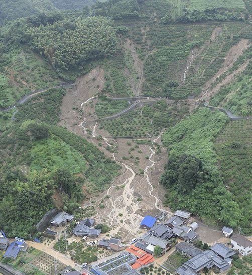
Landslides at Uwajima in Ehime Prefecture, Japan. Image via The Mainichi
.
Another image, also from The Mainichi, shows the impact of channelised flows in structures:-
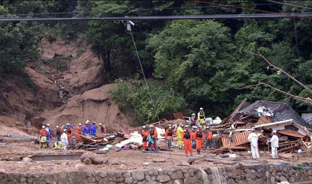
The aftermath of a channelised debris flow at Kure in Hiroshima Prefecture, Japan. Image via The Mainichi.
.
Meanwhile, the image below, published by Kyodo (via The Mainichi) shows a shallow slide in a very steep, deeply weather slope in Kitakyushu, southwestern Japan:-
.
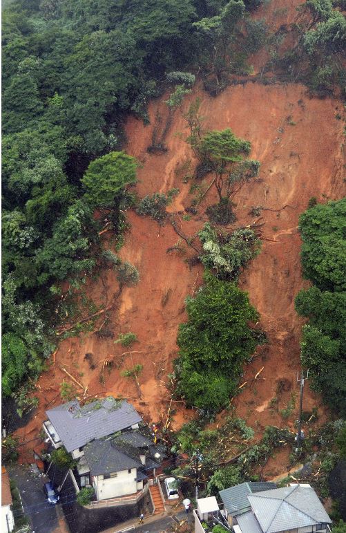
A shallow slide on a deeply weathered slope at Kitakyushu, southwestern Japan. Image from Kyodo.
.
The Japan Times has this spectacular image of the failure of a slope above a highway. Note that this is an engineered slope; the displaced slope reinforcement can be seen in the landslide debris. As such this is a failure of design:-
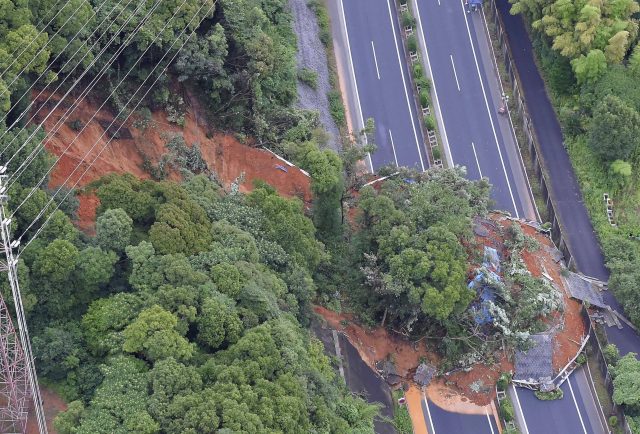
The failure of an engineered slope on the Kyushu Expressway in Kitakyushu, Fukuoka Prefecture in Japan. Image via the Japan Times.
.
And the image below shows the impact of two flow type landslides on a highway in Otoyo in Kochi Prefecture:-
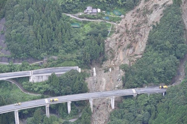
The impact of a landslide on a highway at Otoyo in Kochi Prefecture, Japan. Image via The Mainichi
.
At least 47 sections of expressway have been damaged by the landslides.
This is without doubt the most significant landslide event of 2018 to date. I’m sure more information will emerge in due course. The landslide research community in Japan is very large, and they are assiduous in documenting large landslide events. Japan is of course no stranger to massive landslide events , caused by both exceptional rainfall and earthquakes.
Reference
Planet Team (2017). Planet Application Program Interface: In Space for Life on Earth. San Francisco, CA. https://api.planet.com


 Dave Petley is the Vice-Chancellor of the University of Hull in the United Kingdom. His blog provides commentary and analysis of landslide events occurring worldwide, including the landslides themselves, latest research, and conferences and meetings.
Hi Dave,
About the Kyushu Expressway landslide, (the location is 33.861453°, 130.941452°), I can see on google earth that there had been some additional slope engineering between 2012 and 2014 (shotcrete probably?) above the previous retaining wall (brick-like wall?) that failed, at that exact place the landslide happened. Moreover, if you closely to the slope on google street view (zoom in), you can see some drain pipes in the concrete (shotcrete) retaining wall and on the brick-like wall nearby along the road, but absolutely none on the wall that failed… don’t know if it would have been much different if added, but it’s still a drainage fail for such a retainig wall… And as usual, lack of vegetation and invasive species are a big issue for soil stabilisation (so many examples here in Tahiti…).
As always, thanks for the post.