2 May 2018
The 3 km long Ultar Glacier rock and ice avalanche – first satellite images
Posted by Dave Petley
The 3 km long Ultar Glacier rock and ice avalanche – first satellite images
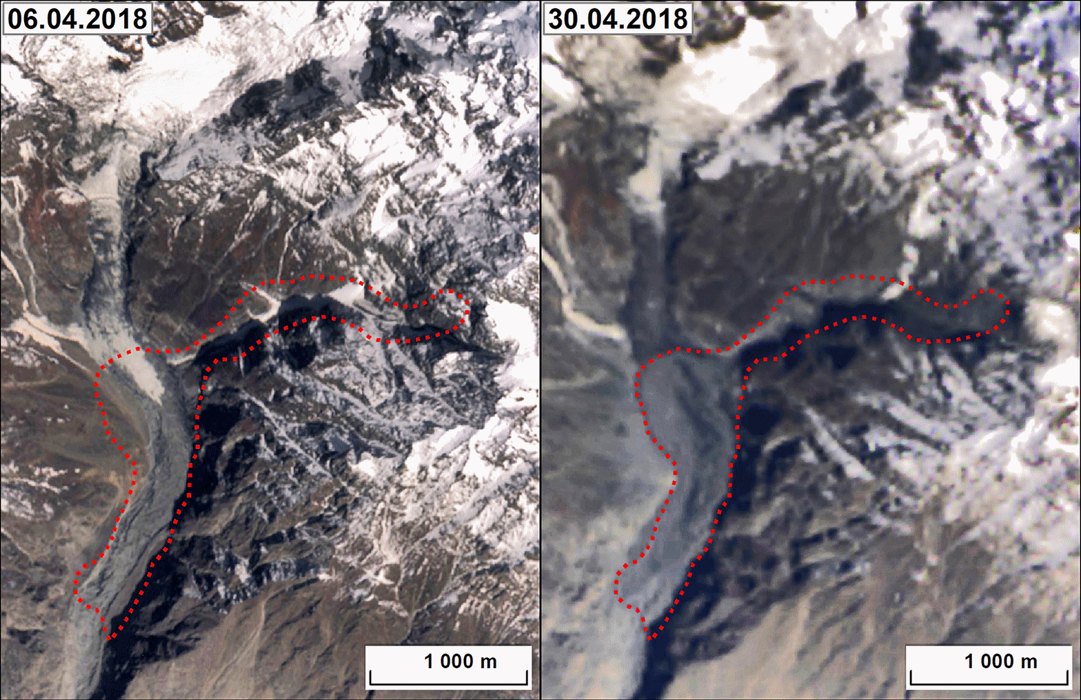
Last month I highlighted the large Ultar Glacier rock and ice avalanche that struck a valley close to the town of Karimabad in northern Pakistan. This event, which was caught on video, sadly killed three people who were trekking in the valley at the time. Frustratingly, until now cloud has prevented capture of decent images, but yesterday my friend Mikhail Dokukin pointed out to me that imagery is now available. He very kindly put together this before and after GIF based upon Landsat and Sentinel data:

Before and after imagery of the Ultar Glacier rock and ice avalanche. Image from Landsat and sentinel data, compiled by Mikhail Dokukin.
.
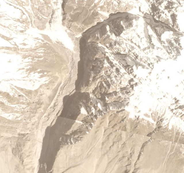
That inspired me to take a look at the Planet Labs imagery for the area, and it turns out that there is a now a good before and after image pair available. This is an image taken on 5th April 2018:-

Planet Labs image of the site of the Ultar Glacier rock and ice avalanche. Images collected by Planet Labs on 1st April 2018, used with permission.
.
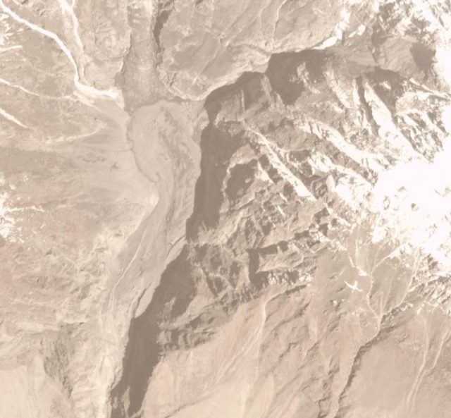
And this is the same site, also captured by Planet Labs on 30th April 2018, after the rock and ice avalanche:-

Planet Labs image of the site of the Ultar Glacier rock and ice avalanche. Images collected by Planet Labs on 30th April 2018, used with permission.
.
From this image it appears that the Ultar Glacier rock and ice avalanche started with a significant rockslope failure at the very top of the glacier, in the very northeast corner of the image. This appears to have entrained debris as it traveled towards the west across the surface of the glacier. After the slide turned to the south it started to deposit a very volume of material. Mikhail has estimated that the travel distance was about 3 km, making it the largest landslide of the year to date.
Reference
Planet Team (2017). Planet Application Program Interface: In Space for Life on Earth. San Francisco, CA. https://api.planet.com


 Dave Petley is the Vice-Chancellor of the University of Hull in the United Kingdom. His blog provides commentary and analysis of landslide events occurring worldwide, including the landslides themselves, latest research, and conferences and meetings.