17 September 2017
Landslides from the Kaikoura Earthquake part 3: the Leader 220 landslide
Posted by Dave Petley
Landslides from the Kaikoura Earthquake part 3: the Leader 220 landslide
The Leader 220 landslide, located on the Leader Rover close to Woodchester (the location is -42.585, 173.215 if you want to take a look on Google Earth), is another large valley blocking landslide triggered by the Kaikoura Earthquake in New Zealand. This is one of the most spectacular and photogenic of all of the landslides:
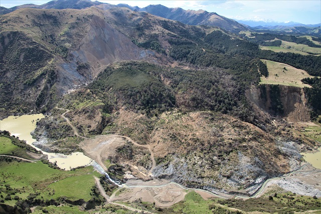
The Leader 220 landslide triggered by the Kaikoura earthquake
.
This is a large slump with a near planar, steep back scarp. The landslide has moved as a single block, but has extensively deformed as it transitioned from the steep back scarp to the near horizontal valley floor. The landslide has pushed the river across the valley floor such that it is now flowing over old terrace surfaces:
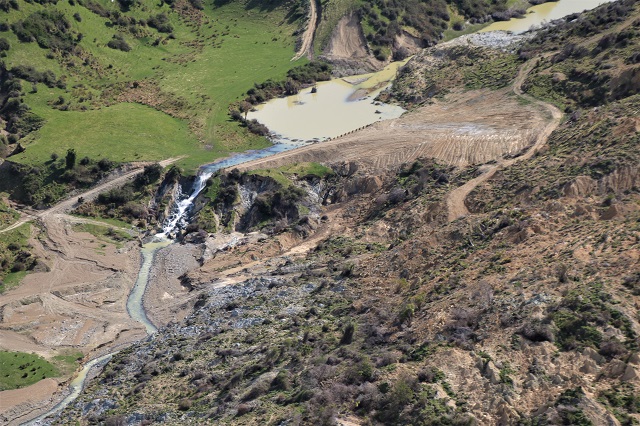
The aftermath of the Leader 220 landslide
.
The landslide dam has now breached but the lake remains partially intact. This has caused some properties to be inundated:
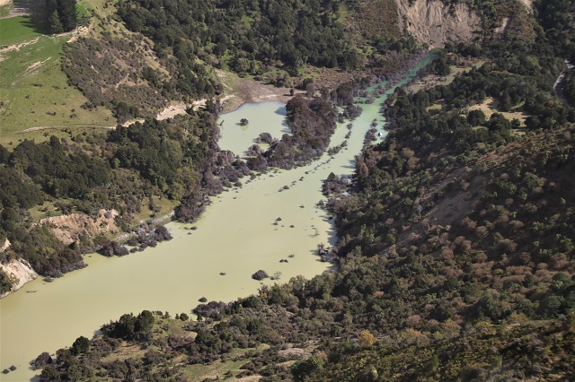
A property flooded by the Leader 220 landslide lake.
.
This is a slope that is undergoing considerable post-earthquake landslide activity. This image shows the foot of the main scarp, and the multiple flow type failures that have occurred:
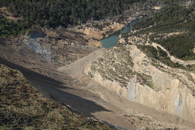
Post seismic flows that have occurred at the site of the Leader 220 landslide, triggered by the Kaikoura Earthquake.
.
The image above also shows some interesting deformation occurring at the trailing edge of the displaced block – in effect this is a landslide within a landslide as the edge of the block slumps back into the scarp depression. The image below shows this from a wider perspective – it is not an insubstantial landslide in its own right:
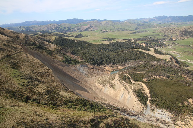
An overview from the scarp of the Leader 220 landslide, showing deformation in the displaced block.
.
Monitoring how this deformed mass behaves in the next few years will be fascinating. It appears that considerable post-seismic landscape evolution will occur before conditions each a new equilibrium. GNS Science have a newly funded MBIE Endeavour project for the next few years to monitor the evolution of the landscape after the earthquake.
Landslides from the Kaikoura Earthquake
The earlier posts in this series are as follows:
- Landslides from the Kaikoura earthquake part 1: the Seafront landslide
- Landslides from the Kaikoura Earthquake part 2: the Hapuku landslide


 Dave Petley is the Vice-Chancellor of the University of Hull in the United Kingdom. His blog provides commentary and analysis of landslide events occurring worldwide, including the landslides themselves, latest research, and conferences and meetings.
Note the dark colour of the planar surface. Is it a slickenslide? Or, it is the colour of the minerals in the rock?. For sure there would be tremendous heat generated in the movement at the shear surface I am going to assume that the original non weathered (parent) rock) was greywacke. This landslide needs a forensic back analysis of the acceleration. That is a research project.
Note the planting of the forest trees and it is assumed they are pinus radiata, or similar. Most of the trees have a free ride under gravity and have remained vertical. Recall the three dairy cows on the previous posted landslide.
Professor Paul Finlay
Holy Name University